

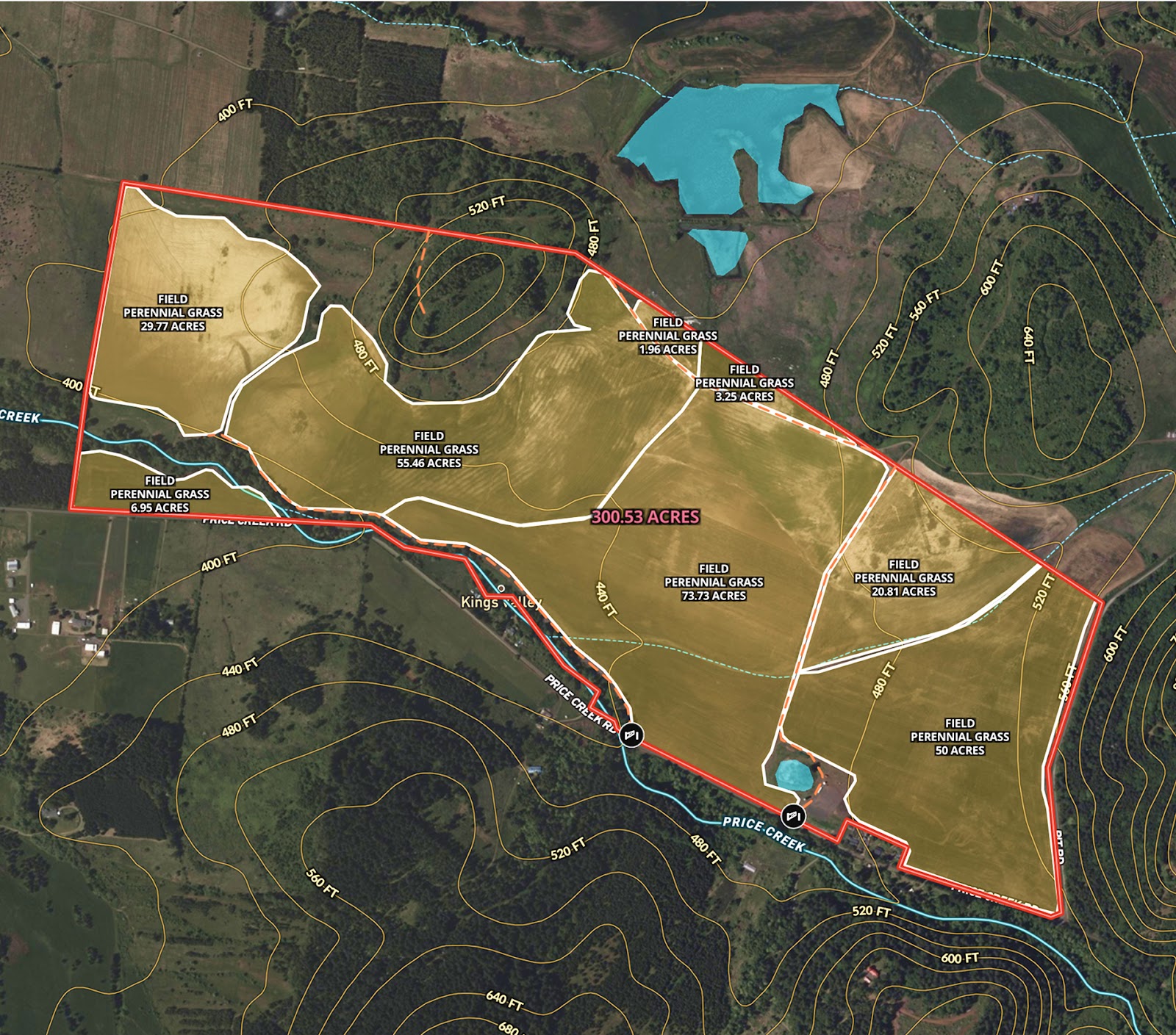
Angie LaPointe, Principal Broker at Berkshire Hathaway HomeServices Northwest Real Estate, is marketing a prime 300-acre agricultural tract located just west of Albany, Oregon—an exceptional opportunity for productive perennial grass cultivation in the heart of the Willamette Valley. To support her marketing efforts, she needed a detailed interactive map that could:
- Showcase over 240 acres of well-established perennial grass fields.
- Highlight individual field boundaries, surface water areas, and topographic features.
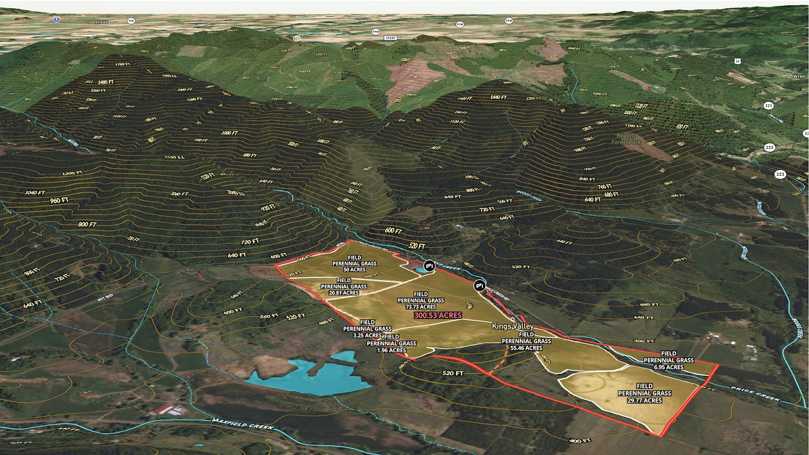
- Illustrate the land’s natural character, including gently rolling terrain and excellent drainage.
Designed to give prospective buyers a clear understanding of the property’s layout and strengths, this interactive map provides a complete visual overview of the land’s structure and potential—making it an invaluable tool for marketing this high-value agricultural property.
Learn How to Create a Map Like This:
- How to make maps in Land id
- Divide a parcel of land in Land id
- Create and edit boundaries
- Draw detailed maps by adding items
- Add labels to maps and mapped items
- Embed photos, videos, 360° walkthroughs, and more onto your map
- Measurement tool
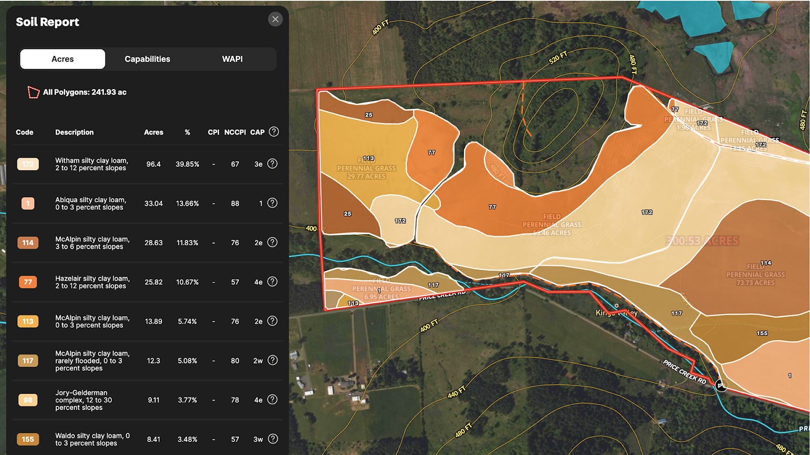
- Run soil reports
- Visualize maps in 3D
- Contour lines overlay
- Surface water overlay
Keep Exploring


5.6 Acre Rural Listing in Bozeman, MT

Commercial Real Estate Off-Market Prospecting

Subdivided Lots for Sale

Data Center Development Site Analysis
Take Your Mapping to the Next Level
Mapping is just the beginning. Land id is the #1 tool for researching, discovering, and showcasing land, and we're here to help you make the most of it, every step of the way.

