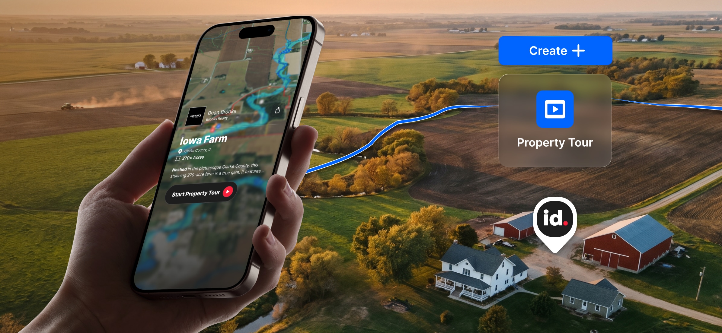
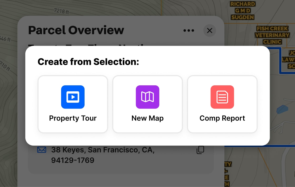
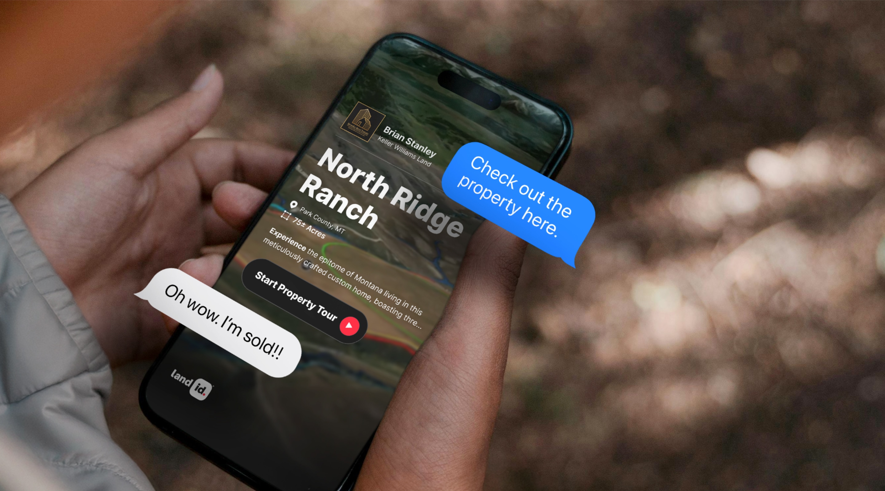
Owner Name, Addresses, Acreage & Land Info
Land id® is the best option for exploring and building parcel maps online that benefit from having the most extensive dataset available. Build maps faster and share them with your audience in minutes.
Mortgage & Assessment Information
Property ownership information provides critical insights for real estate investments. Knowing the owner and their mailing address can help initiate contact, while verifying property boundaries can ensure accurate property assessment and valuation.
Building Details
Identifying a property's building details is essential for assessing its value, potential for renovation, and overall condition. Land id® helps make informed decisions about real estate investments, maximizing their potential value.


Virtual Property Tours for Real Estate
Client-Ready Presentations, Powered by AI & Ready in Minutes
Land id’s Property Tour uses the power of AI to instantly turn property insights into a stunning listing tour. Generate a shareable slideshow that tells a perfectly paced story, with 3D property maps, land data, surrounding context, photos, video, and more. See for yourself—it’s the easiest way to showcase, market, and sell property.


Make Your First Map in 3 Min.
Try for free

Experience Land id® Overlays
Try it For Yourself
Select a tab below to explore Land id® map overlays and uncover hidden details of the land. Discover the wealth of information that lies beneath the surface.


View private parcel information and property lines.

USFW-managed inventory cataloging nationwide wetland details.

Well locations registered with their respective state water well management authority.

Hydrological features such as rivers, lakes, reservoirs, and groundwater.

Pinpoints flood-prone zones, guiding planning and insurance rates.

Maps elevation changes, connecting points of equal height for geographic topography

Govt. owned, managed by agencies for public recreation, conservation, & resource management.

Peaks: High points. Gaps: Low passes between mountains.

A County’s assessment of a property purpose for taxation. Land Use is not zoning.

Boundary marking a city's legal extent and jurisdiction, excluding areas beyond.

Geographical boundaries demarcating county jurisdiction.

Streamlined land units for efficient farm management and government support.

Earth's surface mix of minerals, organics, water, and air.

Oil & Natural Gas Wells from the Homeland Infrastructure Foundation-Level

Details on high-voltage electrical lines: location, characteristics, attributes.

Info on substation location, capacity, and attributes.

Comprehensive info on state's pipelines: location, capacity, substances transported.

View all active projects being conducted by the top 350 homebuilders in the US.

USGS-curated layer with names & locations of two million+ features across the US.

Displays federally protected lands managed for preservation and minimal human impact.
Shows current and future planned fiber internet availability.


Make Your First Map in 3 Min.
Try for free

Testimonials
100% the best feature y’all have created. My clientele is blown away. This is going to be my number-one marketing tool for mapping now, without a doubt. I love that I can send it directly by text and clients can explore a property without even setting foot on it.

Create Property Presentations in Minutes
Loved by Busy Agents & Non-Techy Clients
Property Tour is user-friendly and effective for real estate marketing teams, agents, and clients alike. In minutes, you can create and share a captivating, tap-through virtual visit of any property. Cut down on your marketing workload and tell a more effective property story—whether it’s 1 acre or 100.


Make Your First Map in 3 Min.
Try for free
Join Land id & Start Designing in Canva Today
Try for free
Demo request received.

Join 50k+ Real Estate Pros Using Land id.
Try for freeFAQs


