
Individual Investors
Spot deal-breakers and constraints most investors miss.
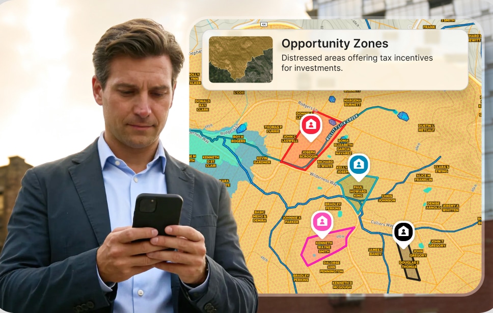
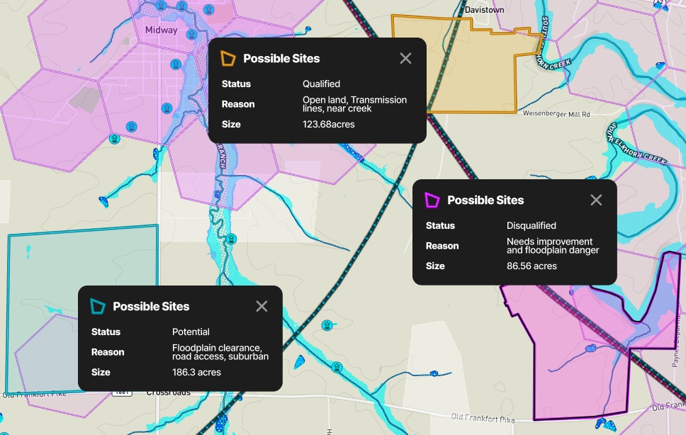
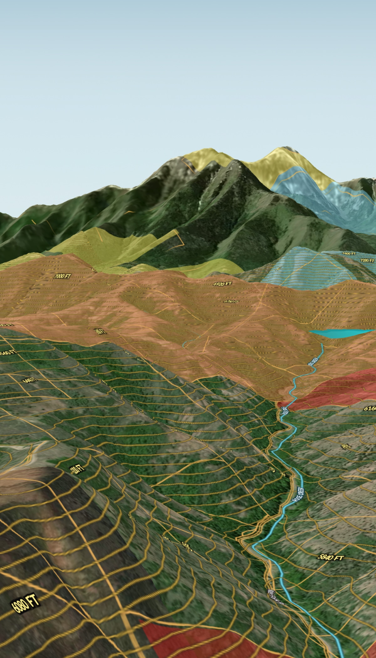
- Check flood zones, wetlands, and slopes in one view.
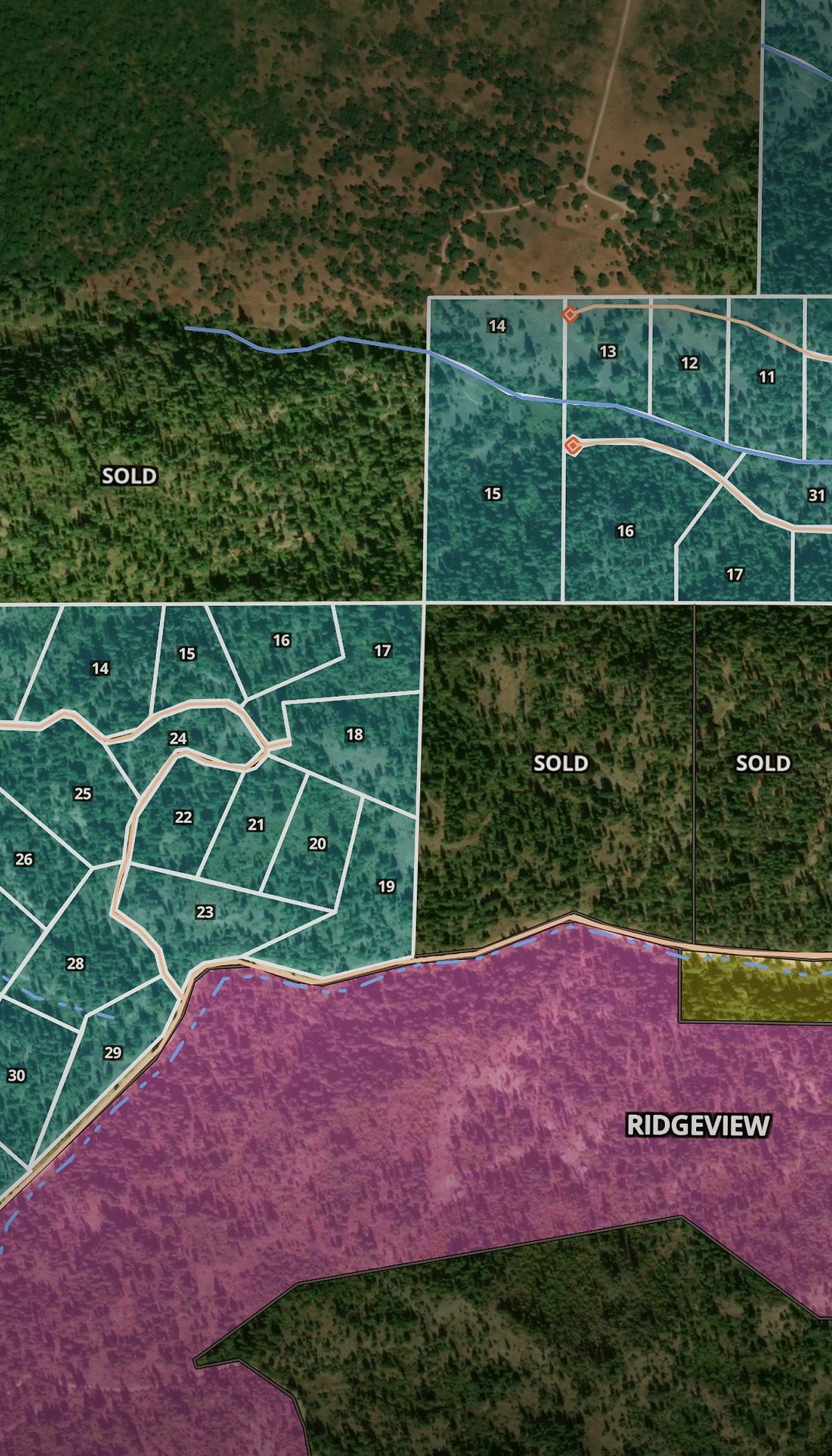
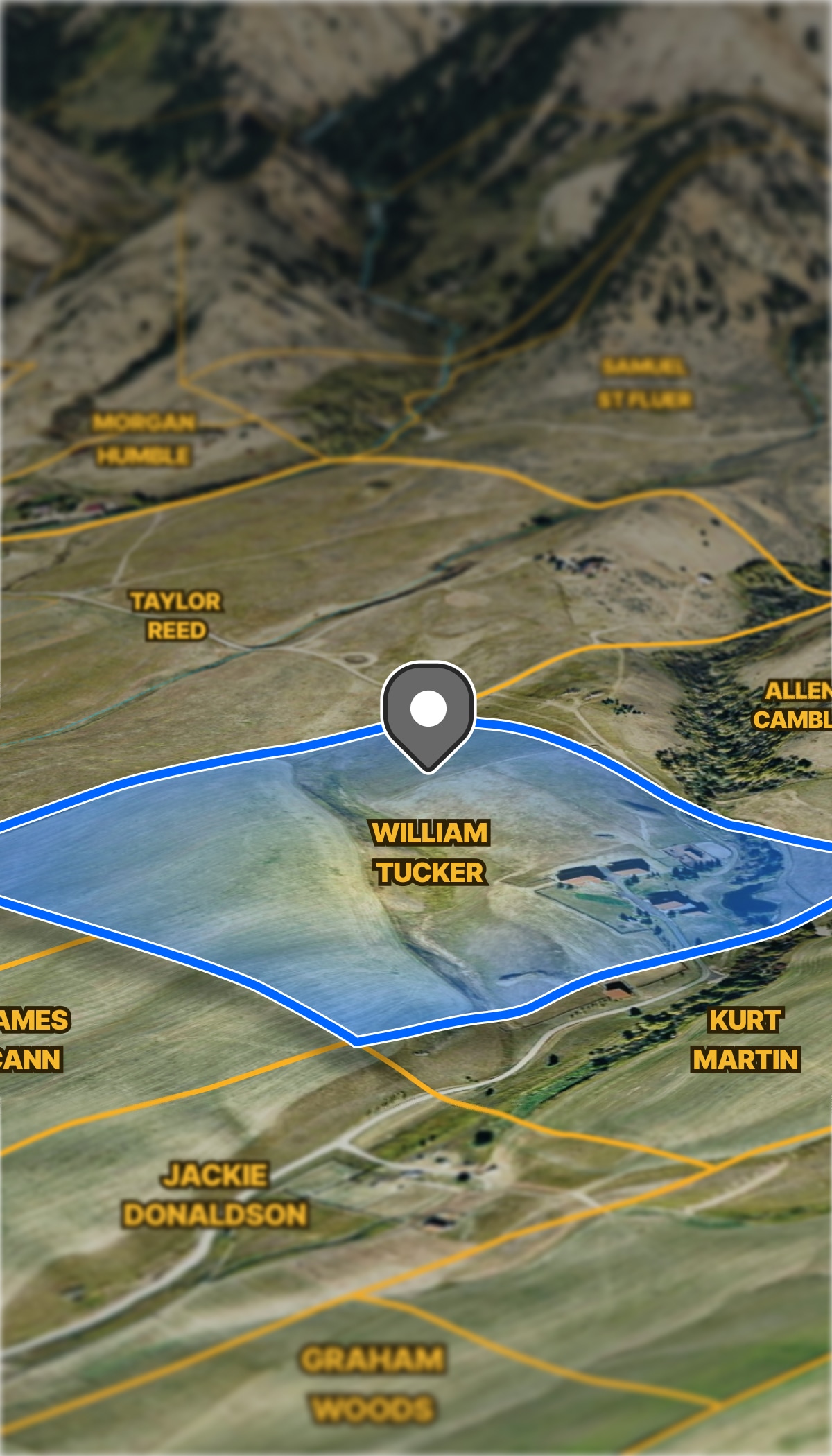
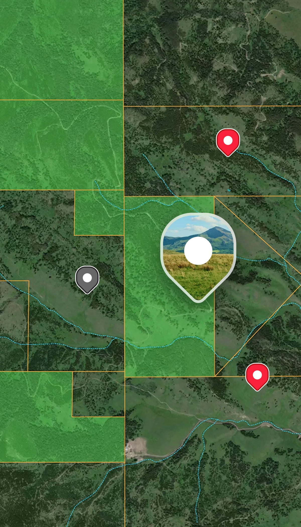
- Verify ownership and parcel boundaries instantly.
- Filter opportunities by the metrics that protect your investment.


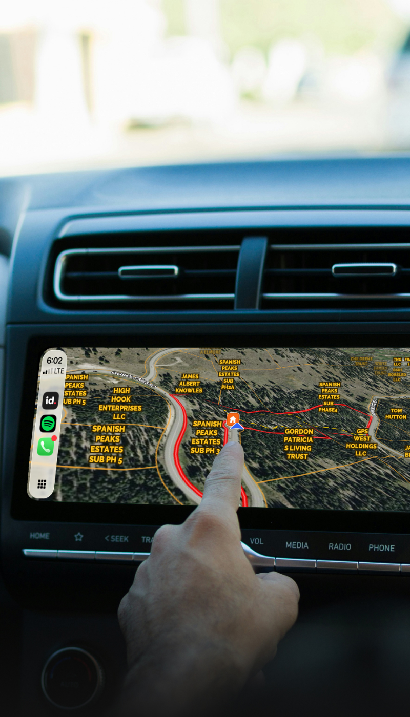
Real estate buyers and investors need to move fast. Evaluate opportunities quickly and move confidently, without cutting corners on due diligence, using Land id.

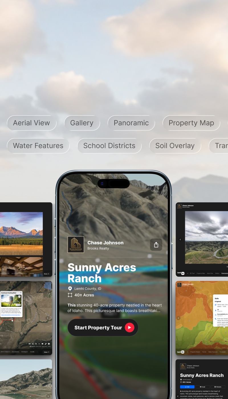
Every property investor faces the same trade-off: be thorough or be first. With Land id, you can be both. Discover the ultimate property buying research app that makes it easy to access parcel data, turn what you find into a visual story, and share it with partners to close deals faster.
If you’ve ever lost an opportunity because your workflow was clunky or due diligence took too long, you need a better land investment due diligence tool. Land id helps you move quickly without cutting corners.
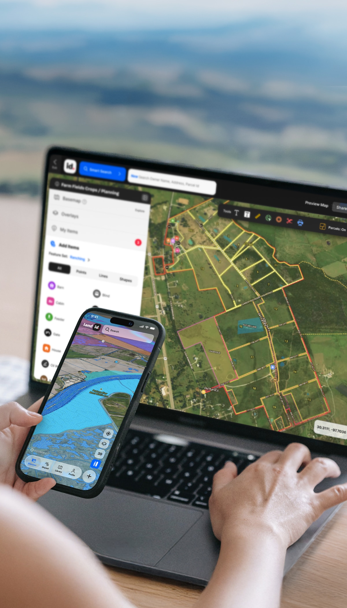
Pull parcel data, high-res aerials, and location context in seconds, so you can quickly decide if a property is worth pursuing.
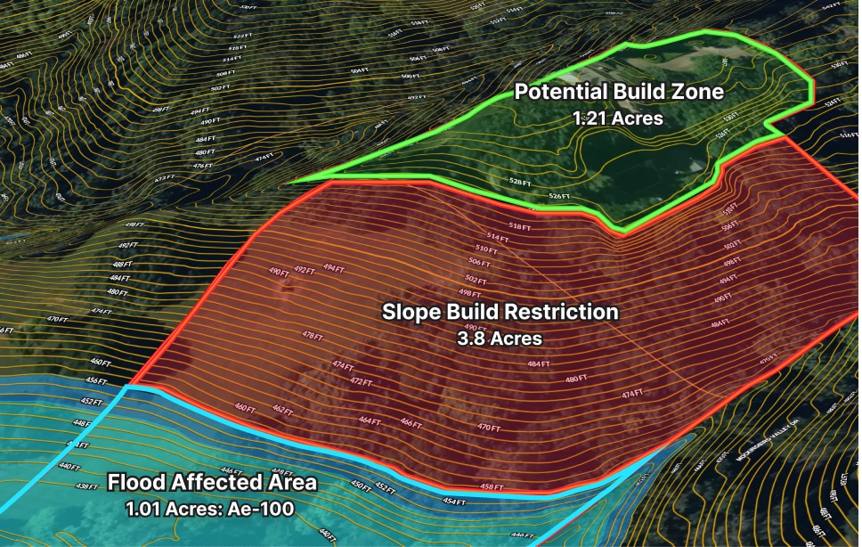
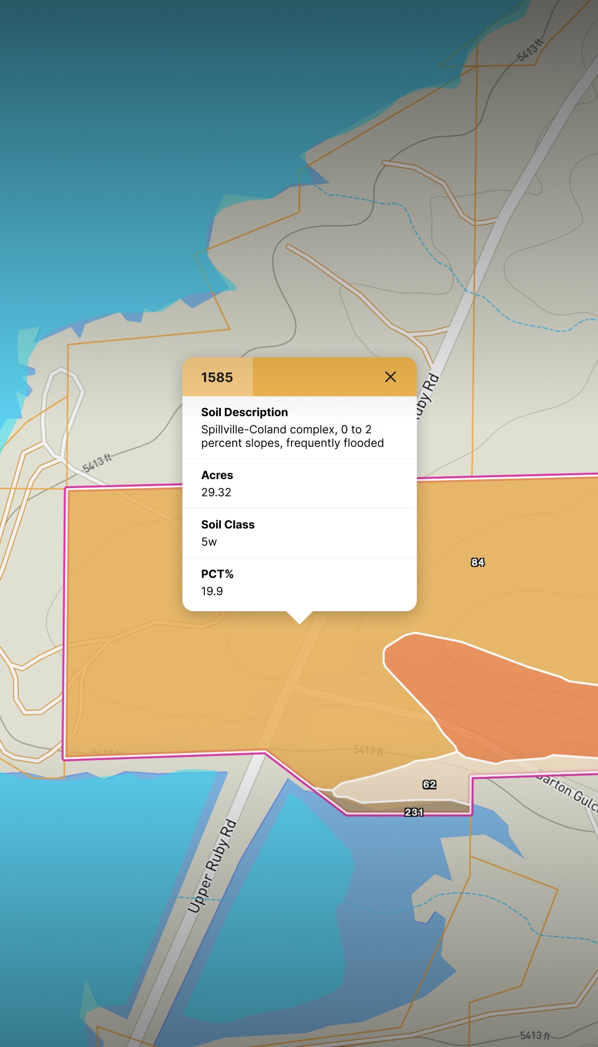
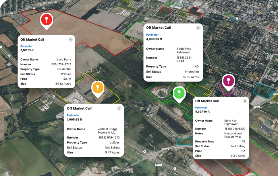
Check flood zones, wetlands, slopes, and other constraints in one view instead of hunting across multiple sources and hoping you didn't miss something.

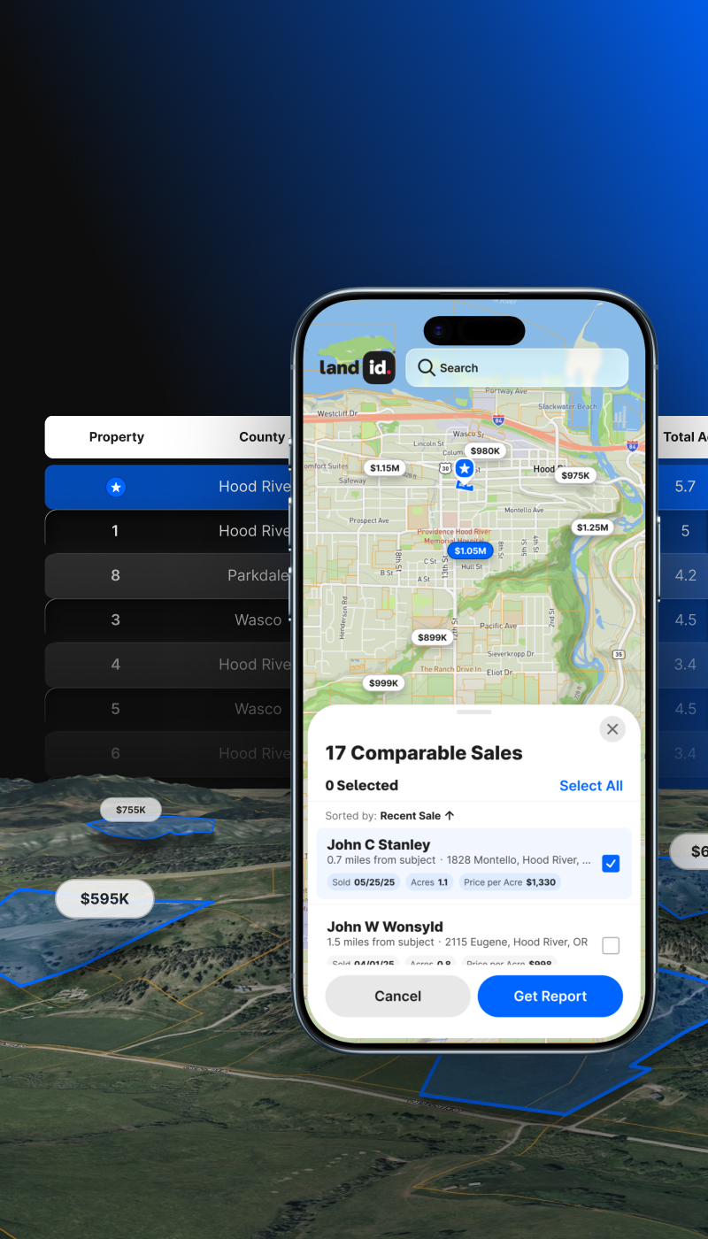
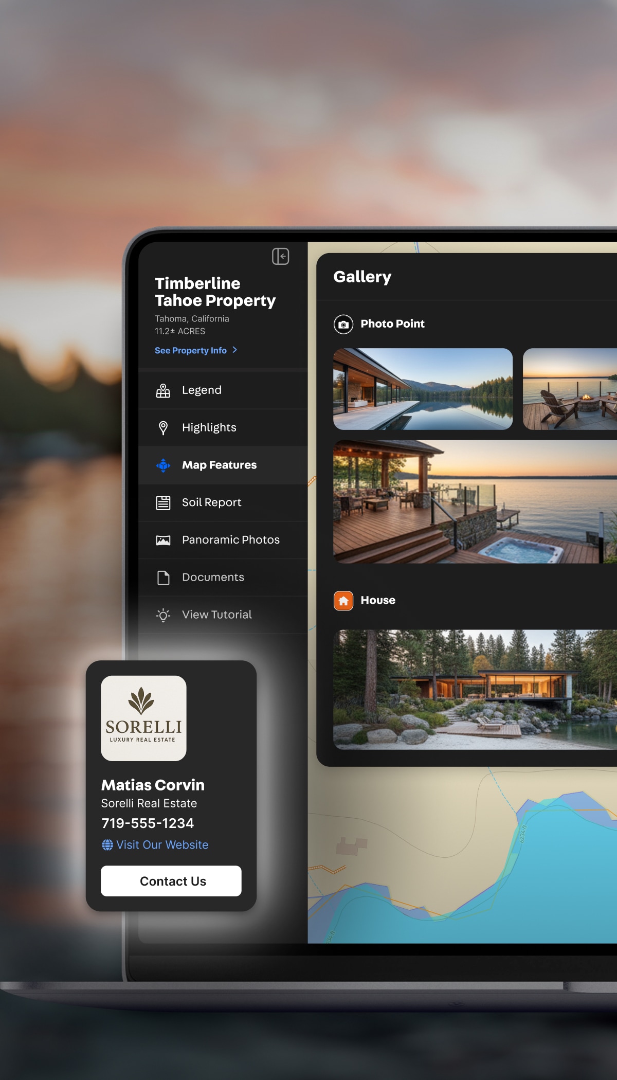
Instead of screenshots and spreadsheets, turn your research into visual property reports that partners and lenders can immediately understand.
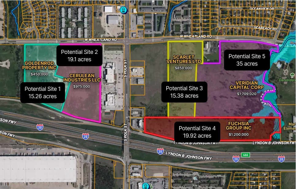
Compare multiple properties, organize your prospects, and decide where to spend your time and capital without slowing your workflow.
Built for Real Estate Buyers & Investors
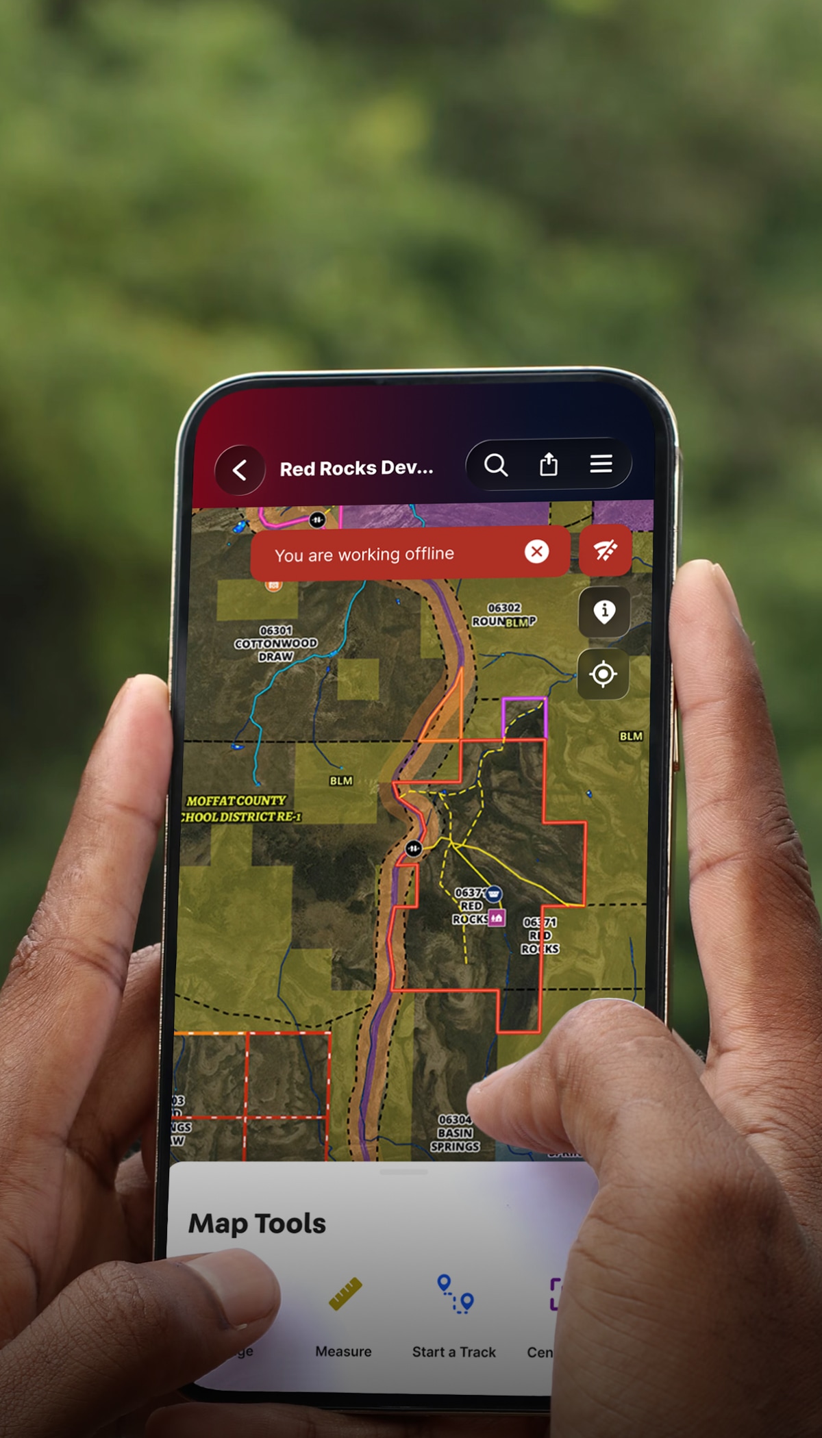
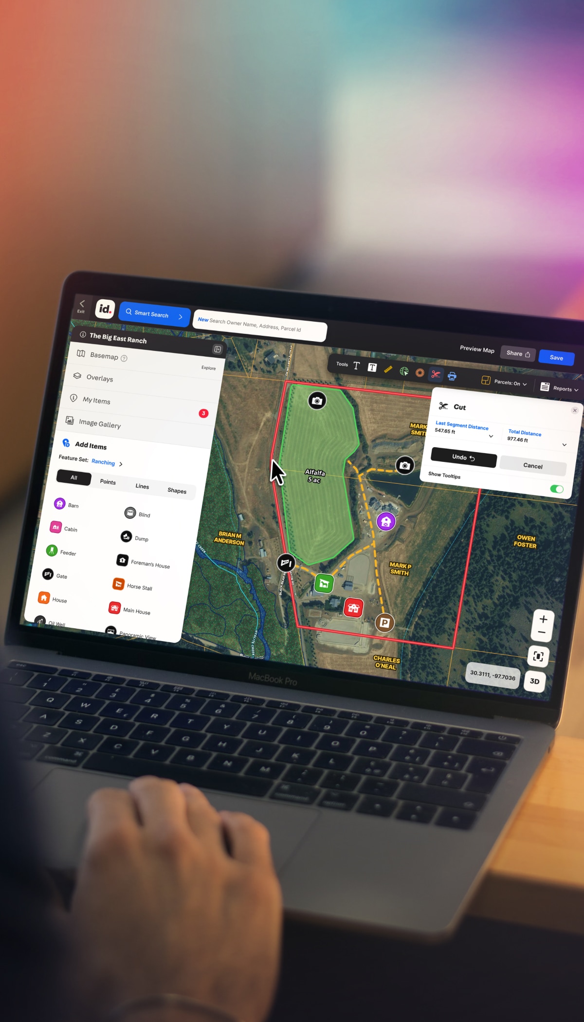
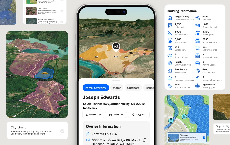
Tired of bouncing between browser tabs, text threads, screenshots, and spreadsheets? Land id combines powerful land ownership data with property boundaries, visual mapping, and streamlined workflows into a modern land investment app designed to help investors research and evaluate properties faster.
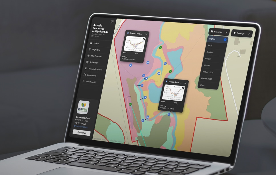
Track the data you need in one place—from acquisitions to collateral to comparable sales. Visualize patterns across your data on the map, then share or export your work.
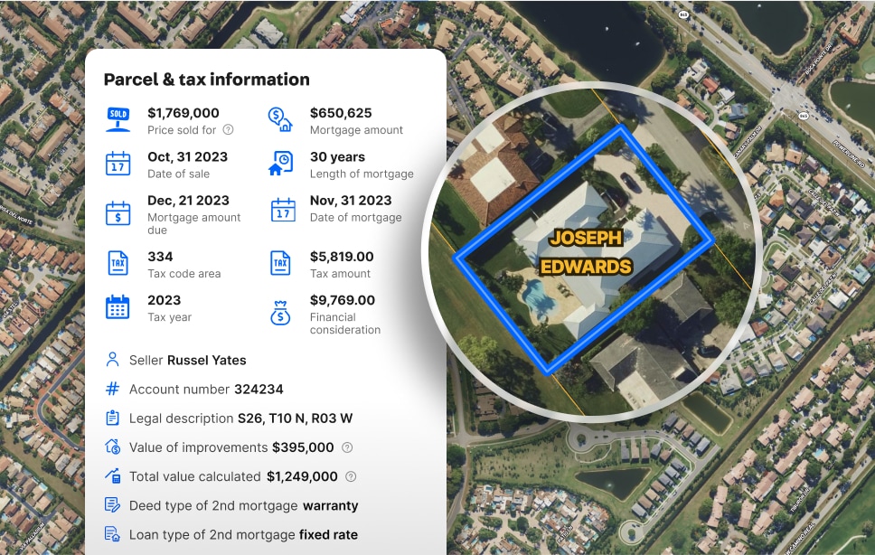
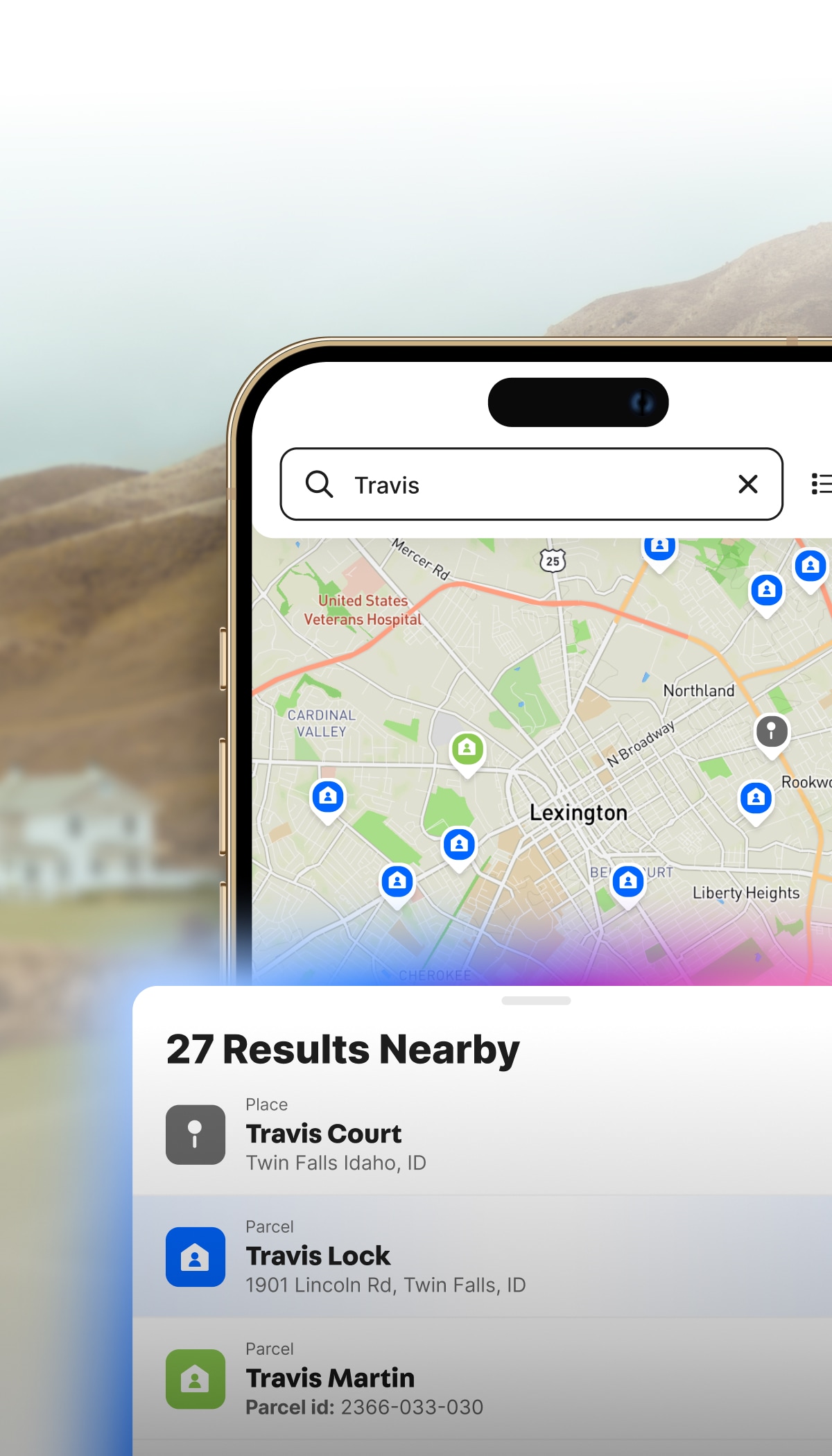
Owner, assessment, building info, acreage, and more, pulled up in seconds. Discover deep parcel data across cities, counties, and all 50 states in one platform.
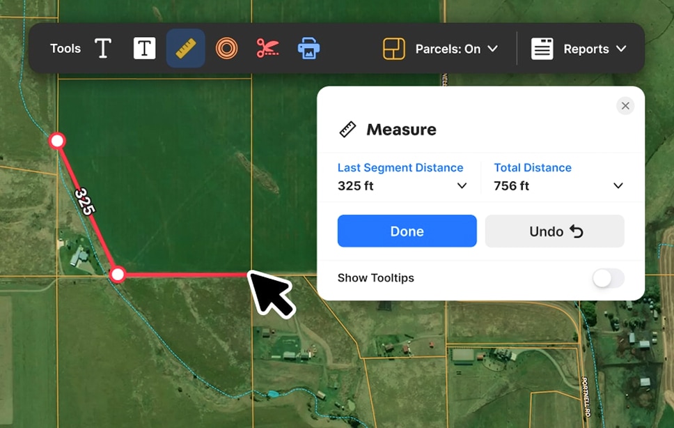
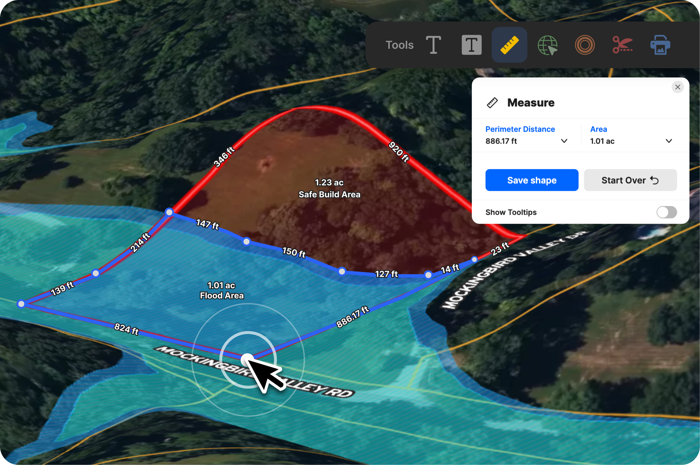
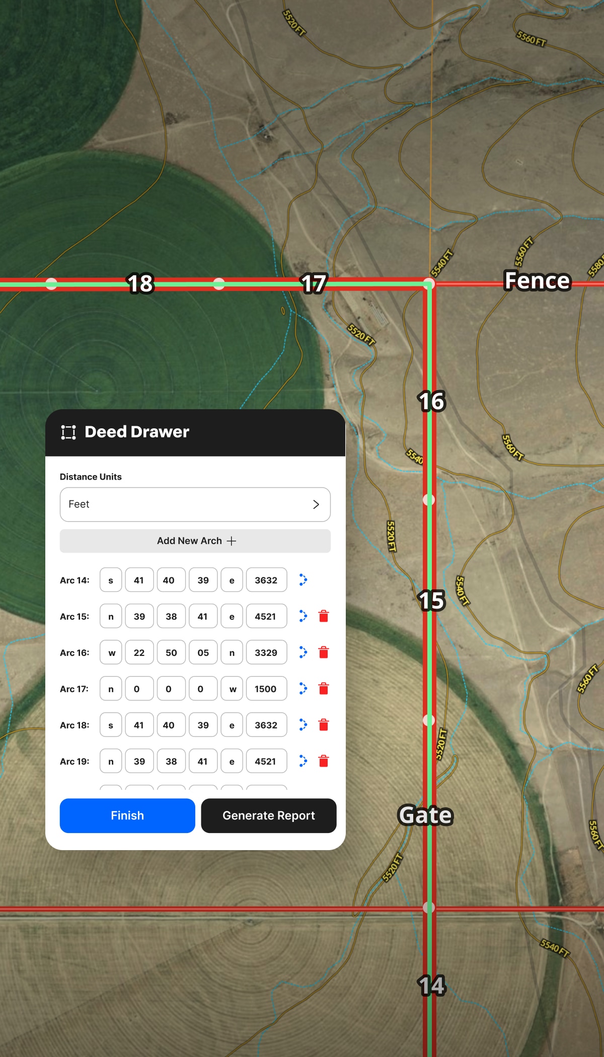
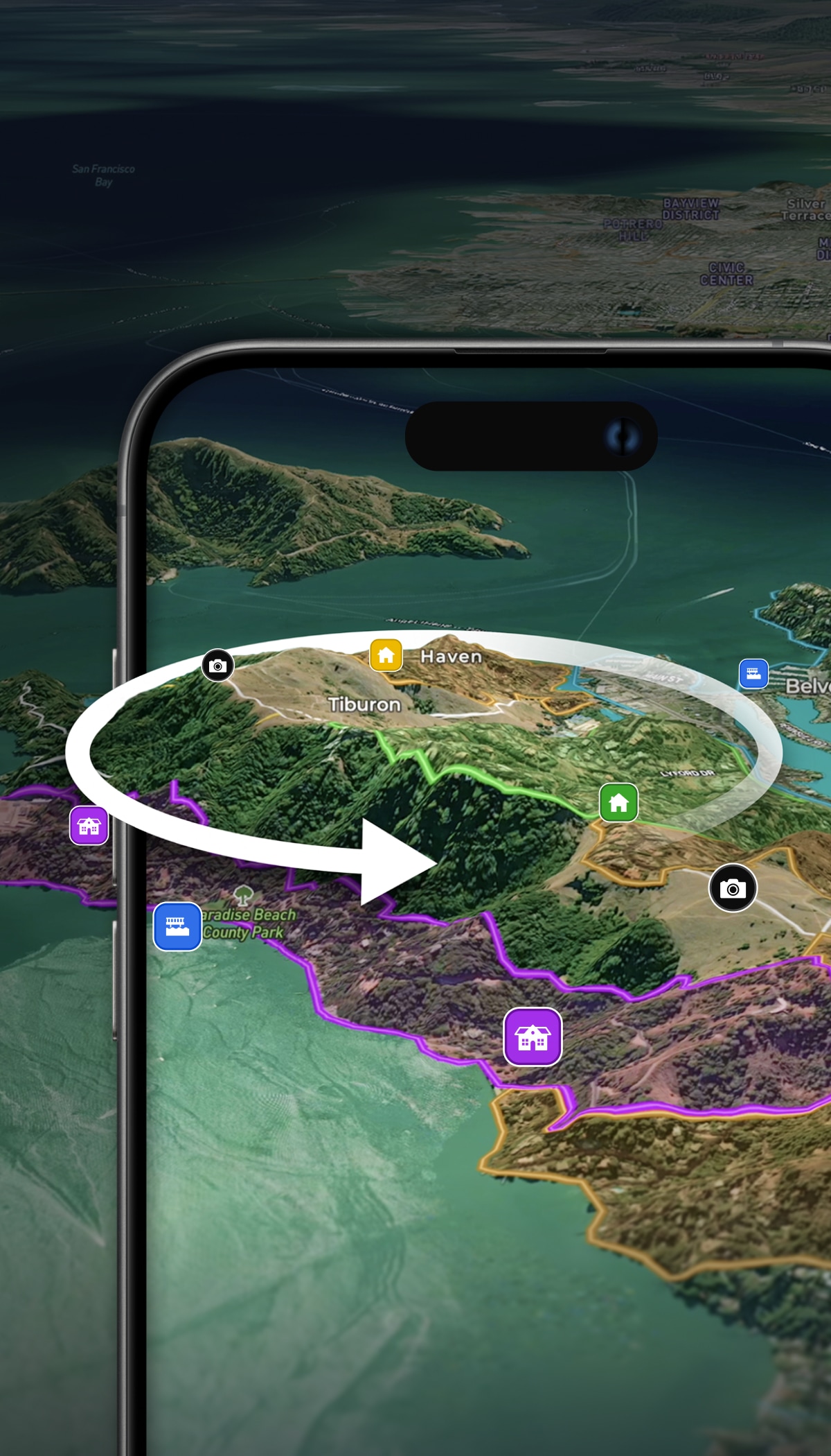
Eliminate eyeballing and guesswork with easy-to-use measurement tools. Draw shapes, create land boundaries, and precisely measure anything to estimate costs and plan smarter.
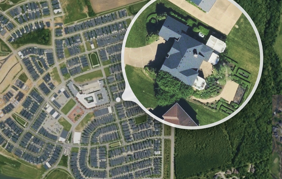
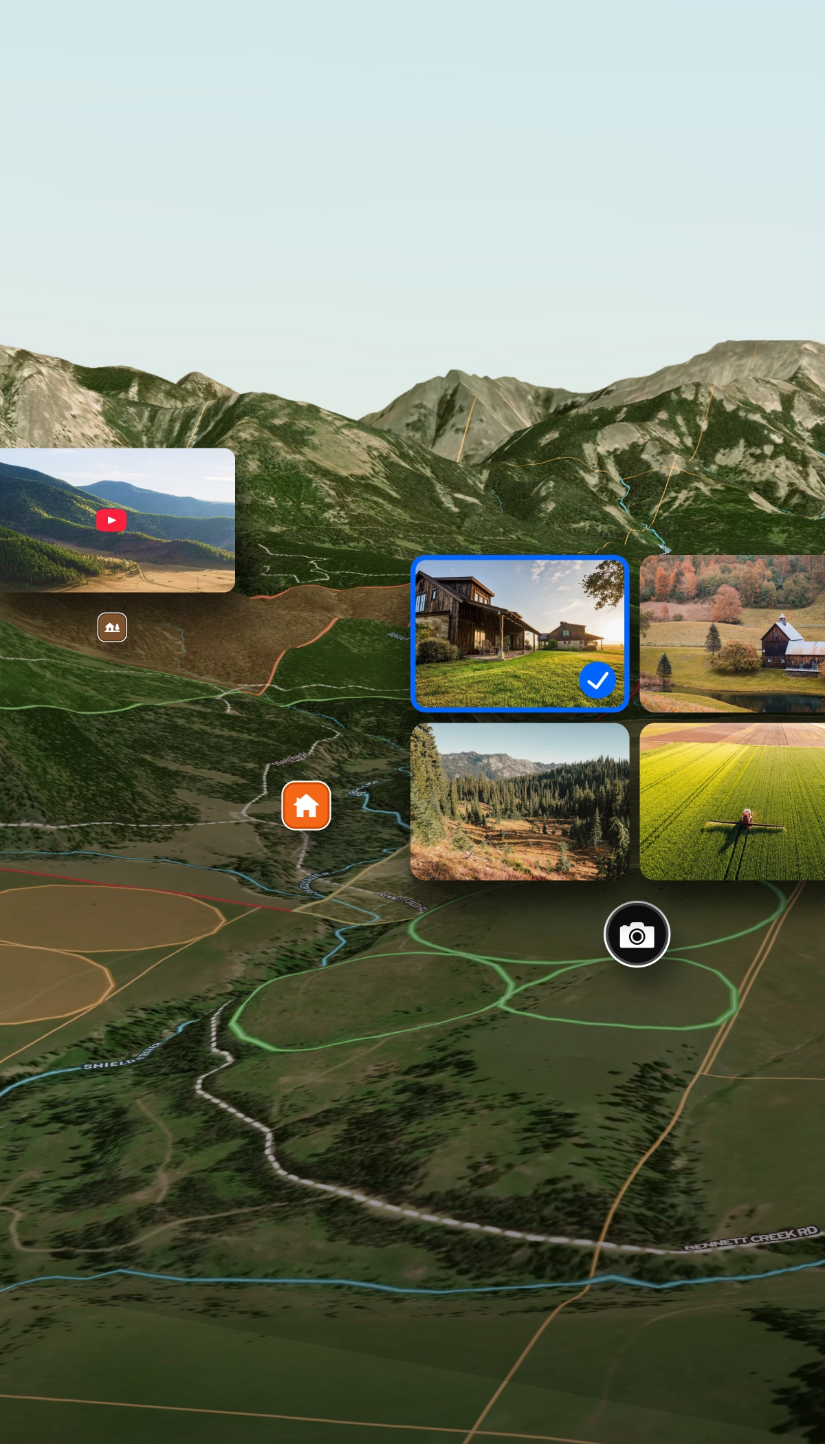
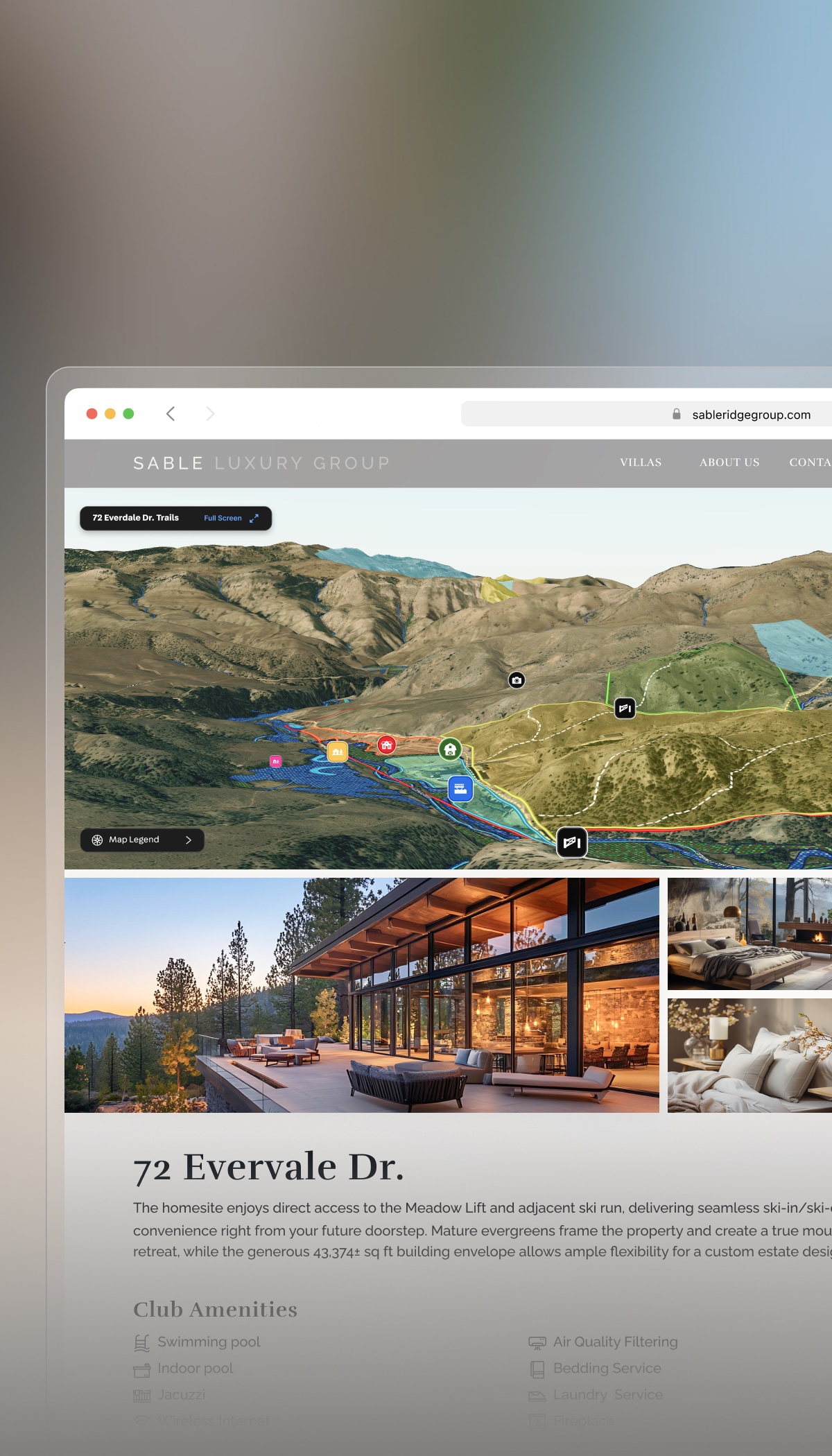
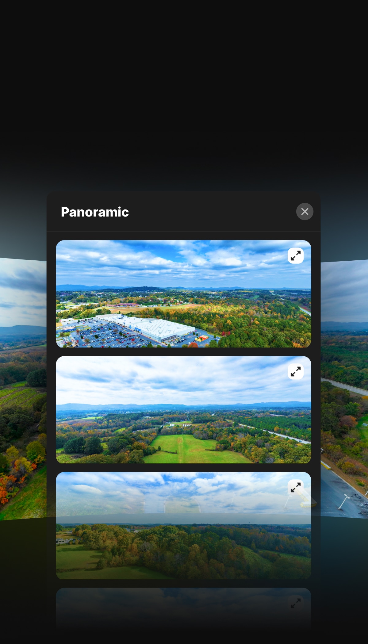
See brilliant, up-to-date satellite imagery to plan better, save on site visits, and communicate important property details.
Better Property Investing
Land id fuels confident decision-making for all types of property investors—whether you’re turning a side hustle into a new revenue stream, flipping land for profit, or growing a corporate portfolio.