


No items found.
The Most Comprehensive Parcel Data Available
From nationwide property ownership to boundary details, Land id® provides valuable data for land owners, real estate agents, and industry professionals for many purposes and needs.
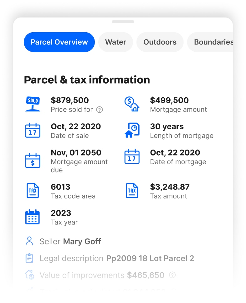
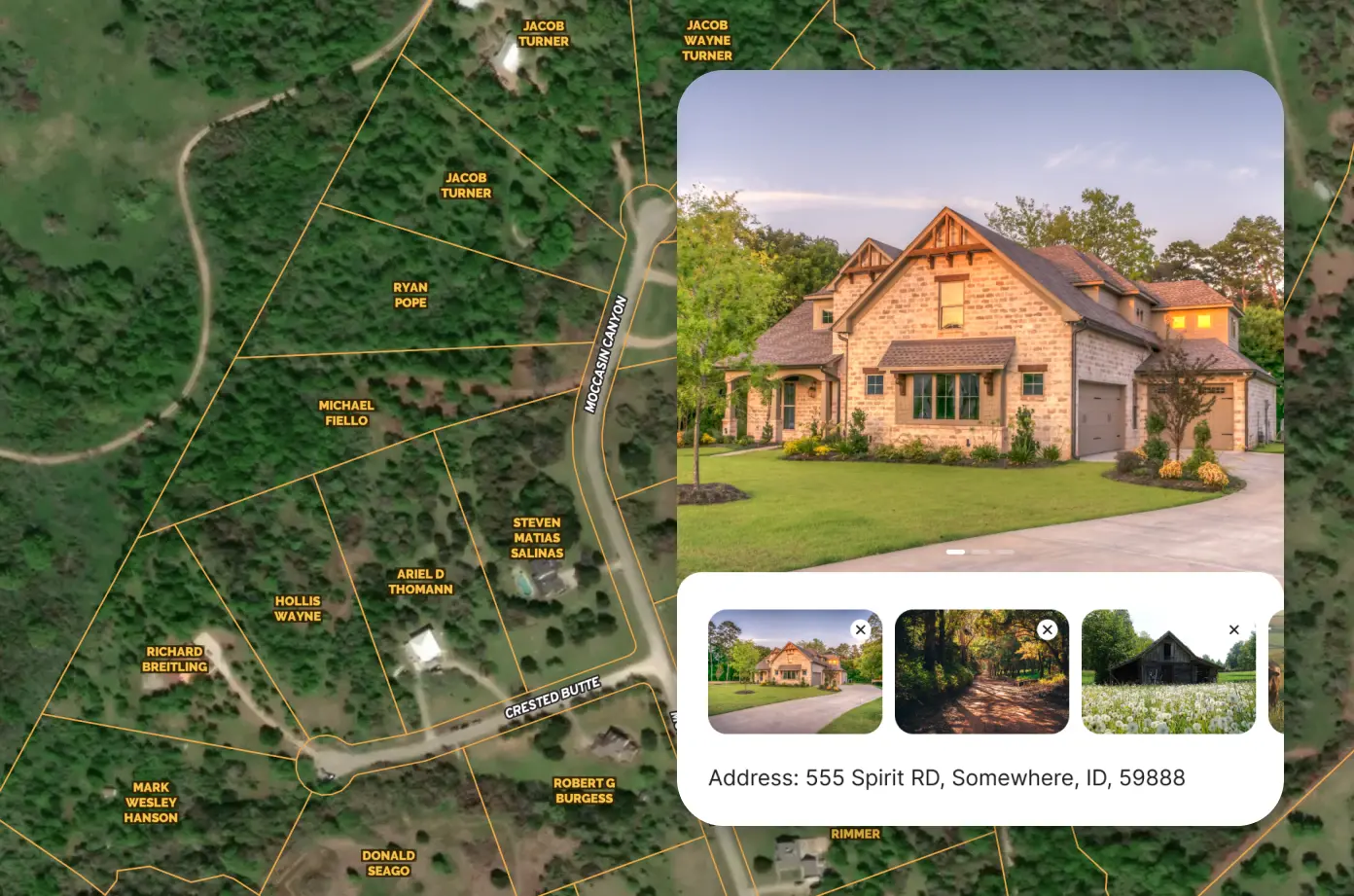
Owner Name, Addresses, Acreage & Land Info
Land id® is the best option for exploring and building parcel maps online that benefit from having the most extensive dataset available. Build maps faster and share them with your audience in minutes.
Mortgage & Assessment Information
Property ownership information provides critical insights for real estate investments. Knowing the owner and their mailing address can help initiate contact, while verifying property boundaries can ensure accurate property assessment and valuation.
Building Details
Identifying a property's building details is essential for assessing its value, potential for renovation, and overall condition. Land id® helps make informed decisions about real estate investments, maximizing their potential value.


Go Beyond Basic Mapping
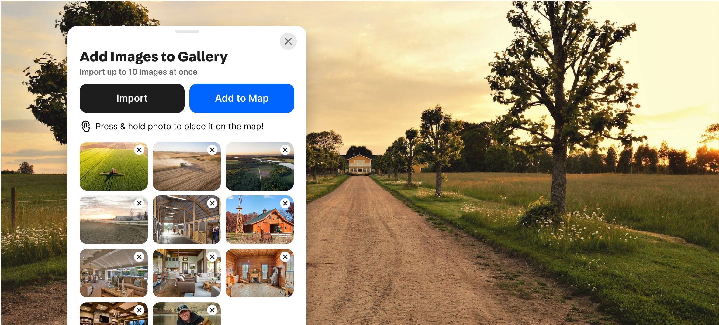
Bring Your Maps to Life
Land id allows you to effortlessly embed photos and videos, bringing your properties to life and creating a dynamic viewing experience.


No items found.
No items found.

Explore Private Parcel Data & Property Boundaries
Download the Land id app and try for free.

Make Your First Map in 3 Min.
Try for free
Land id®
Normal

Experience Land id® Overlays
Try it For Yourself
Select a tab below to explore Land id® map overlays and uncover hidden details of the land. Discover the wealth of information that lies beneath the surface.

Thank you! Your submission has been received!
Oops! Something went wrong while submitting the form.

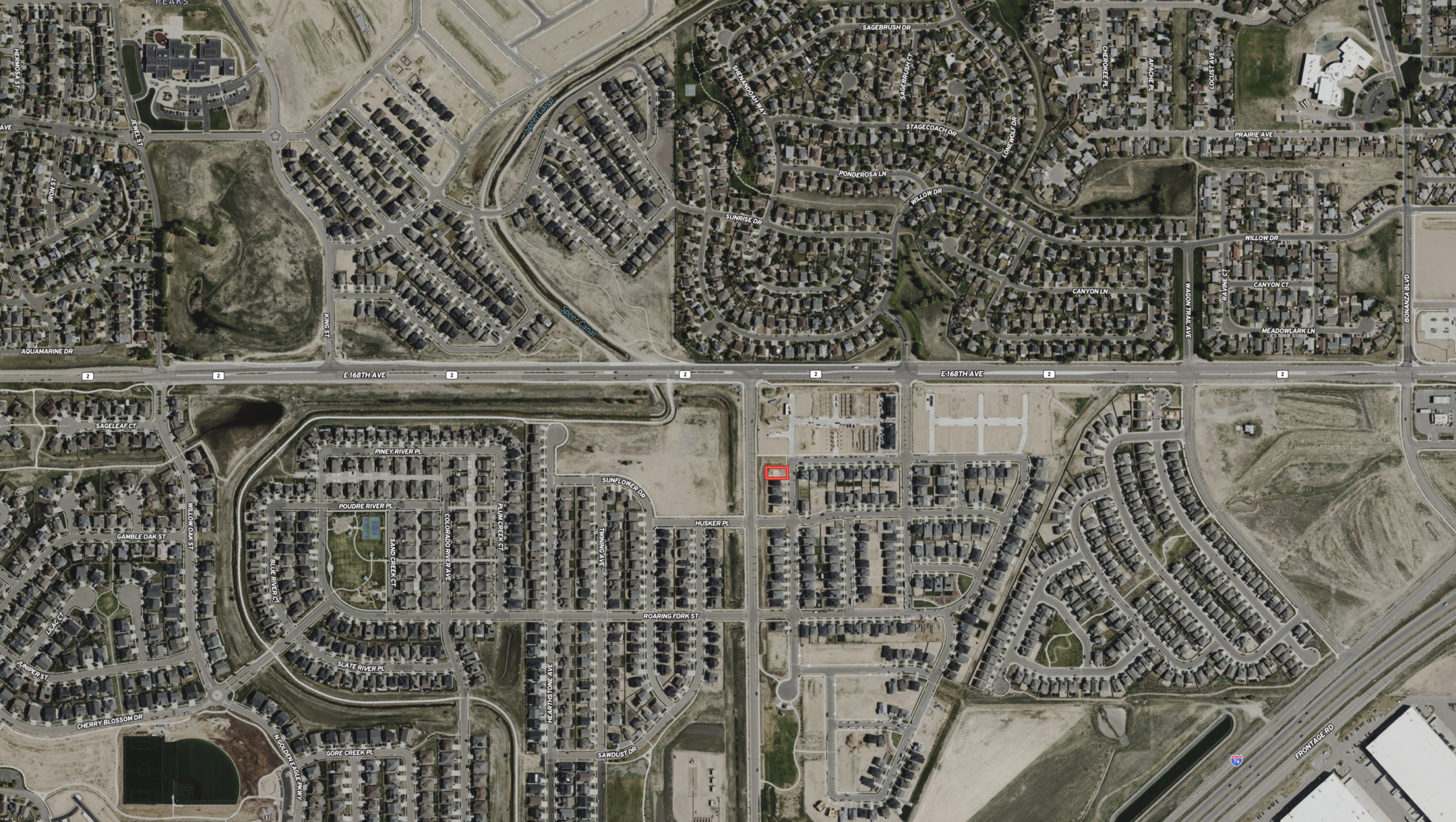
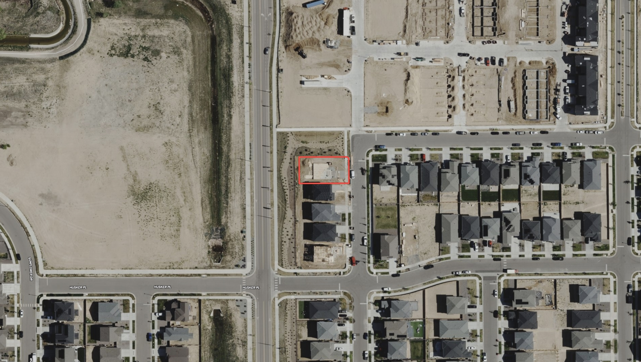
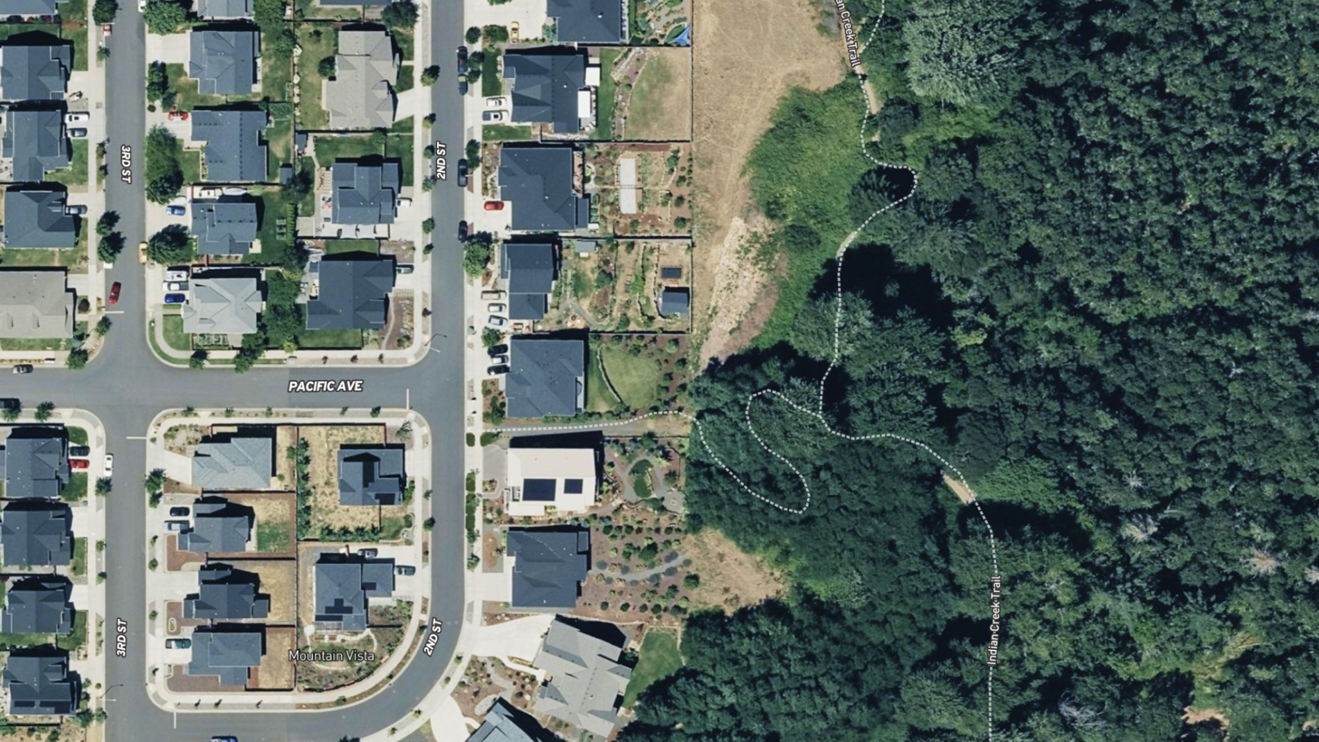
Private Parcels
View private parcel information and property lines.
Parcels

Wetlands
USFW-managed inventory cataloging nationwide wetland details.
Water

Water Wells
Well locations registered with their respective state water well management authority.
Water

Surface Water
Hydrological features such as rivers, lakes, reservoirs, and groundwater.
Water

FEMA Floodplain
Pinpoints flood-prone zones, guiding planning and insurance rates.
Water

Contour Lines
Maps elevation changes, connecting points of equal height for geographic topography
Outdoors

Fed/State Land
Govt. owned, managed by agencies for public recreation, conservation, & resource management.
Outdoors

Summits and Gaps
Peaks: High points. Gaps: Low passes between mountains.
Outdoors

Land Use
A County’s assessment of a property purpose for taxation. Land Use is not zoning.
Boundaries

City Limits
Boundary marking a city's legal extent and jurisdiction, excluding areas beyond.
Boundaries

County Lines
Geographical boundaries demarcating county jurisdiction.
Boundaries

FSA CLU
Streamlined land units for efficient farm management and government support.
Boundaries

Soil Overlay
Earth's surface mix of minerals, organics, water, and air.
Soils

Oil Wells
Oil & Natural Gas Wells from the Homeland Infrastructure Foundation-Level
Infrastructure
Transmission Lines
Details on high-voltage electrical lines: location, characteristics, attributes.
Infrastructure

Substations
Info on substation location, capacity, and attributes.
Infrastructure

Pipelines
Comprehensive info on state's pipelines: location, capacity, substances transported.
Infrastructure

Housing Devs.
View all active projects being conducted by the top 350 homebuilders in the US.
Nearby

Points of Interest
USGS-curated layer with names & locations of two million+ features across the US.
Nearby

Wilderness Areas
Displays federally protected lands managed for preservation and minimal human impact.
Nearby

Fiber Optic Service
Shows current and future planned fiber internet availability.
Infrastructure


Photo & Video on All Platforms
Try the Land id® Mobile App
With Land id, you can create immersive property experiences for your viewers, enabling them to grasp every detail of the land.


Create a Visual Journey
Explore Land in Unprecedented Detail
With Land id’s innovative photo and video embed feature, you can showcase your properties in an experiential way and immerse your audience in the environment.

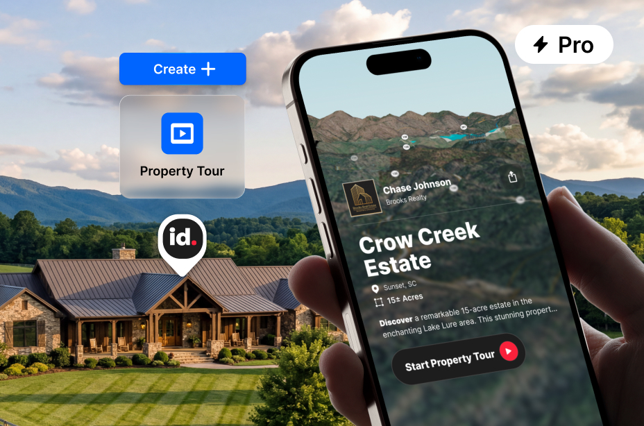

AI-Powered Tours for Any Property
Create a shareable slideshow tour of any property with a few clicks. Show 3D views, boundaries, soil data, water features, and more. No design work required.
Add Photos to Your Waypoints
Bring your waypoints to life by adding photos that provide a more vivid and detailed representation of the location. Not only will photos enhance the visual experience, but they can also serve as helpful reminders and cues for navigation when revisiting the location in the future.
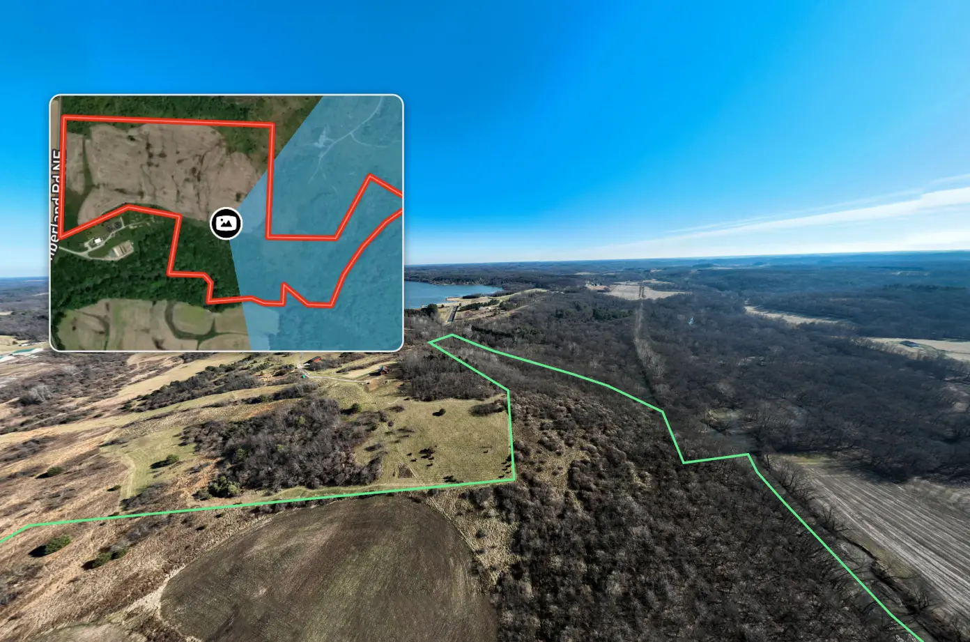
360˚ Property Panoramas
Experience the world around you like never before with the captivating panoramic map images. This innovative technology empowers you to explore your surroundings from every angle, providing an unparalleled level of immersion and bringing your land to life in stunning detail.
Make Your First Map in 3 Min.
Try for freeExplore Private Parcel Data & Property Boundaries
Download the Land id app and try for free.
Testimonials
No items found.


No items found.
No items found.
Explore Private Parcel Data & Property Boundaries
Download the Land id app and try for free.
Make Your First Map in 3 Min.
Try for freeJoin Land id & Start Designing in Canva Today
Try for free
Demo request received.
One of our experts will reach out shortly to schedule your demo.
Oops! Something went wrong while submitting the form.
FAQs
No items found.
Explore Private Parcel Data & Property Boundaries
Download the Land id app and try for free.
