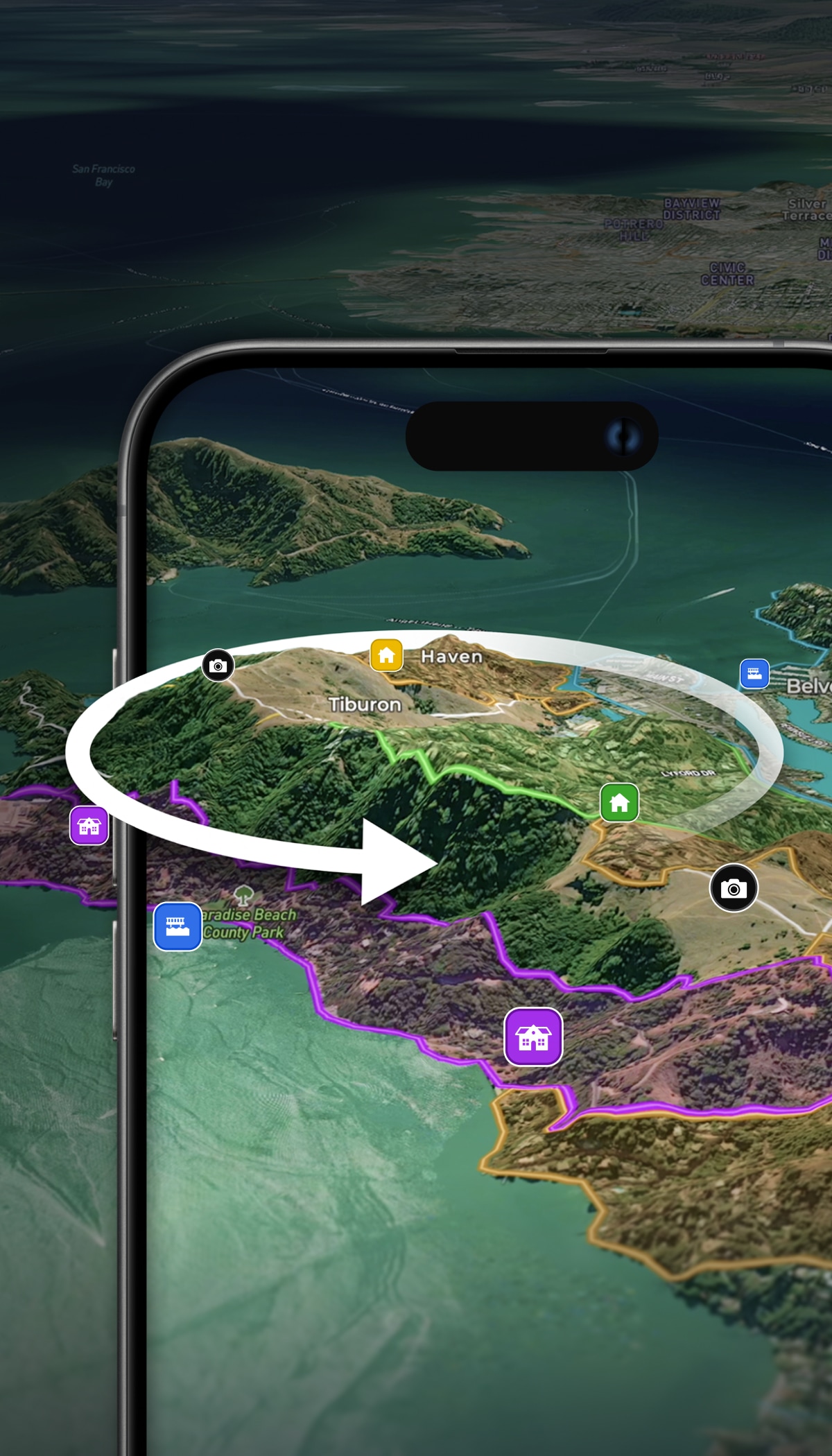

Hunting & Recreational Use
Your land, mapped for everyone who visits it.
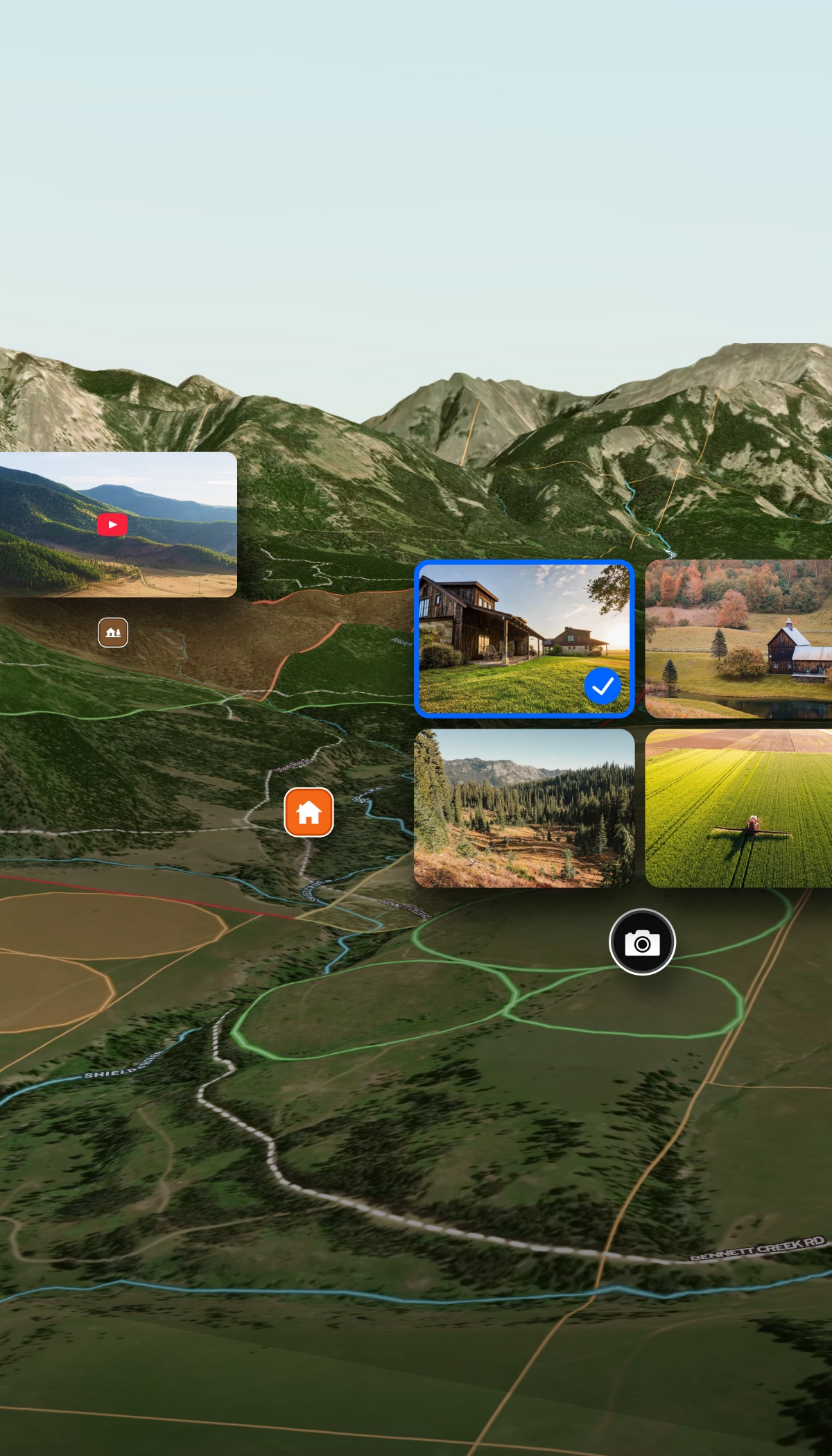
- Name and share trails, blinds, feeders, and fishing spots.
- Keep guests, family, and hunters oriented and safe on the property.
- Build a beautiful map worth printing and sharing.


From planning future acquisition to managing property improvements, Land id delivers the tools you need to understand, improve, monetize, and enjoy every corner of your property.

Your property holds more potential than you think. Land id brings it all into view—terrain, boundaries, water features, and more—so you can plan smarter, manage from anywhere, and share information about your property with the people who need to know it.
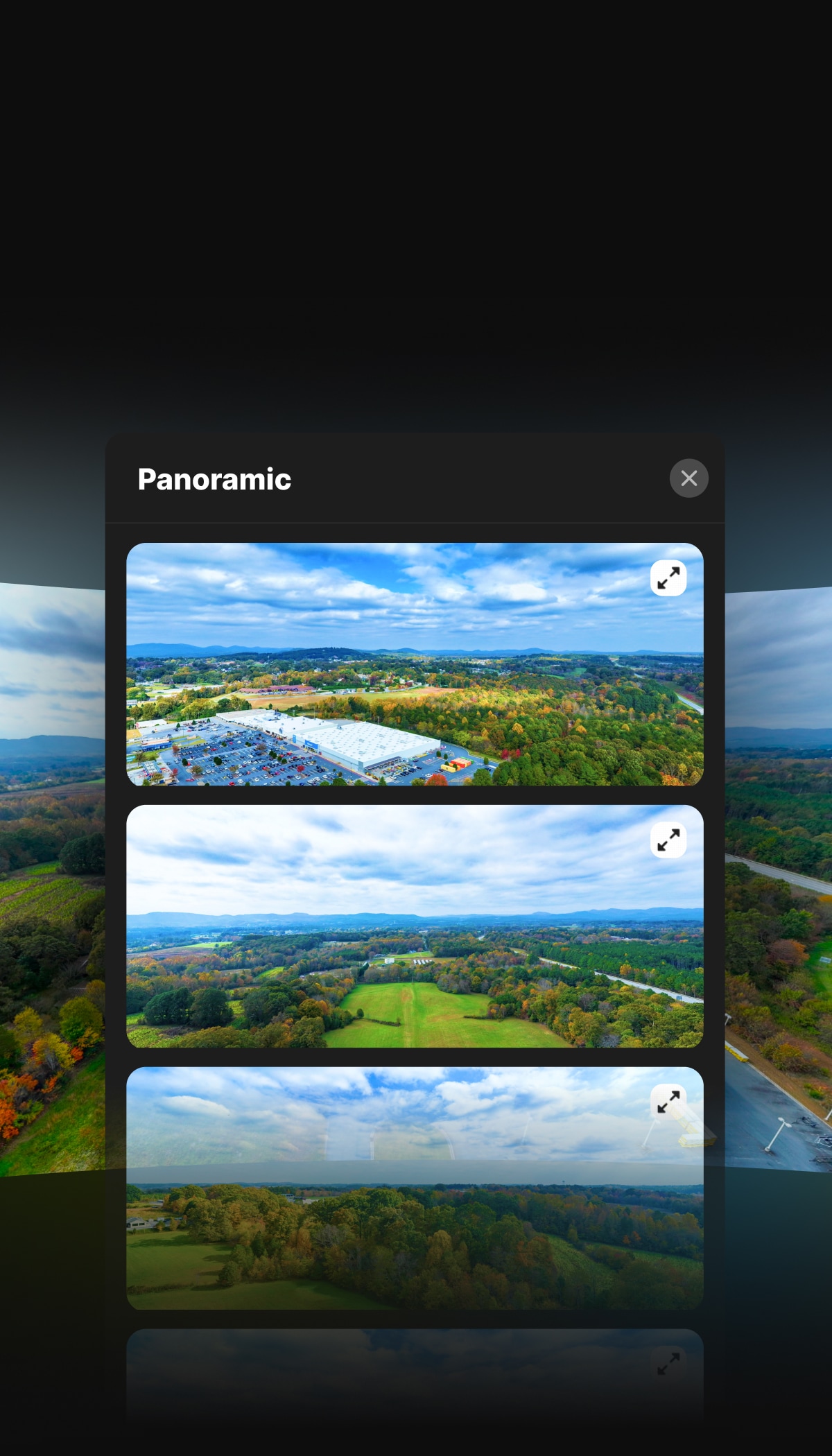
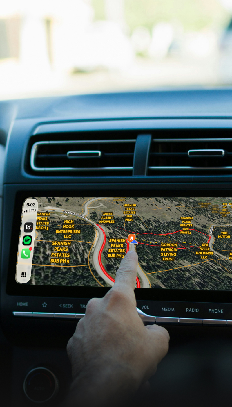
Pull up Land id on your laptop or phone. Share digital maps, interactive property tours, or high-res print-outs. Land id is made to move with you.
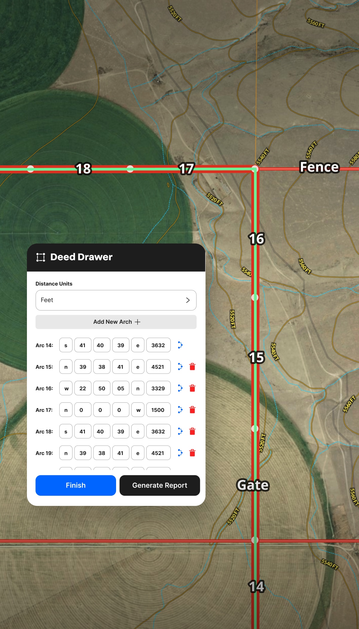
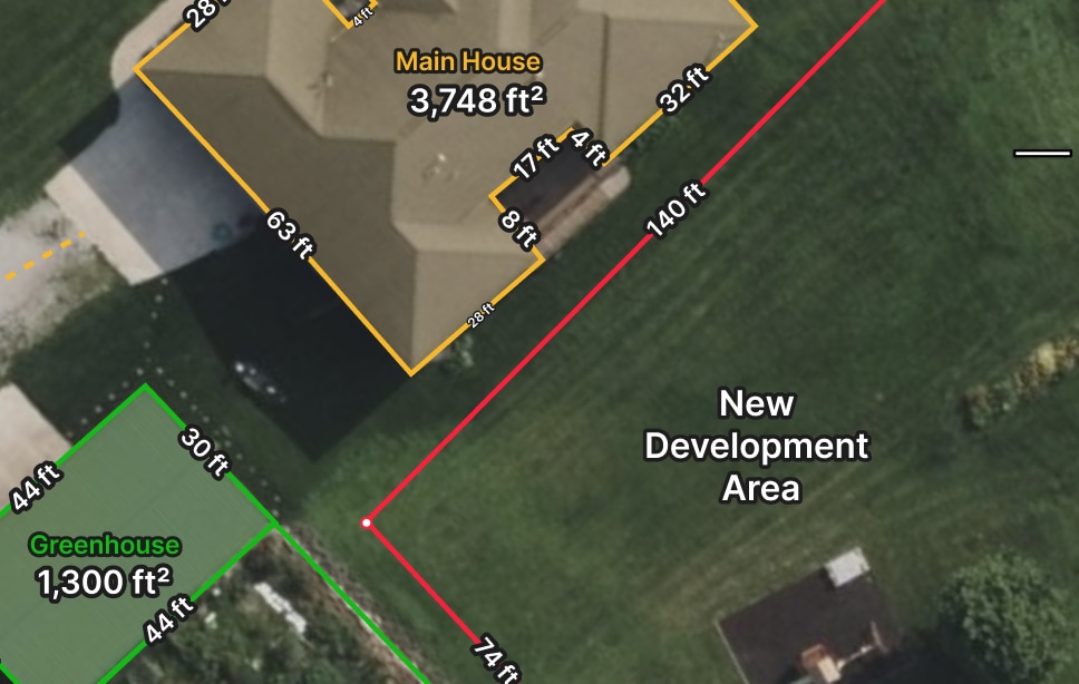
Before you spend thousands, see what you're actually working with. Measure area, perimeter, and distance for cost estimation. Combine high-res aerials with contours, water features, and soil data to vet ideas, costs, and options.
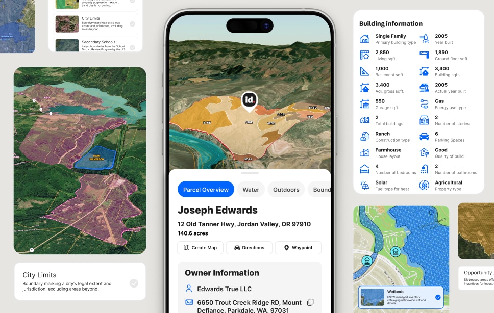
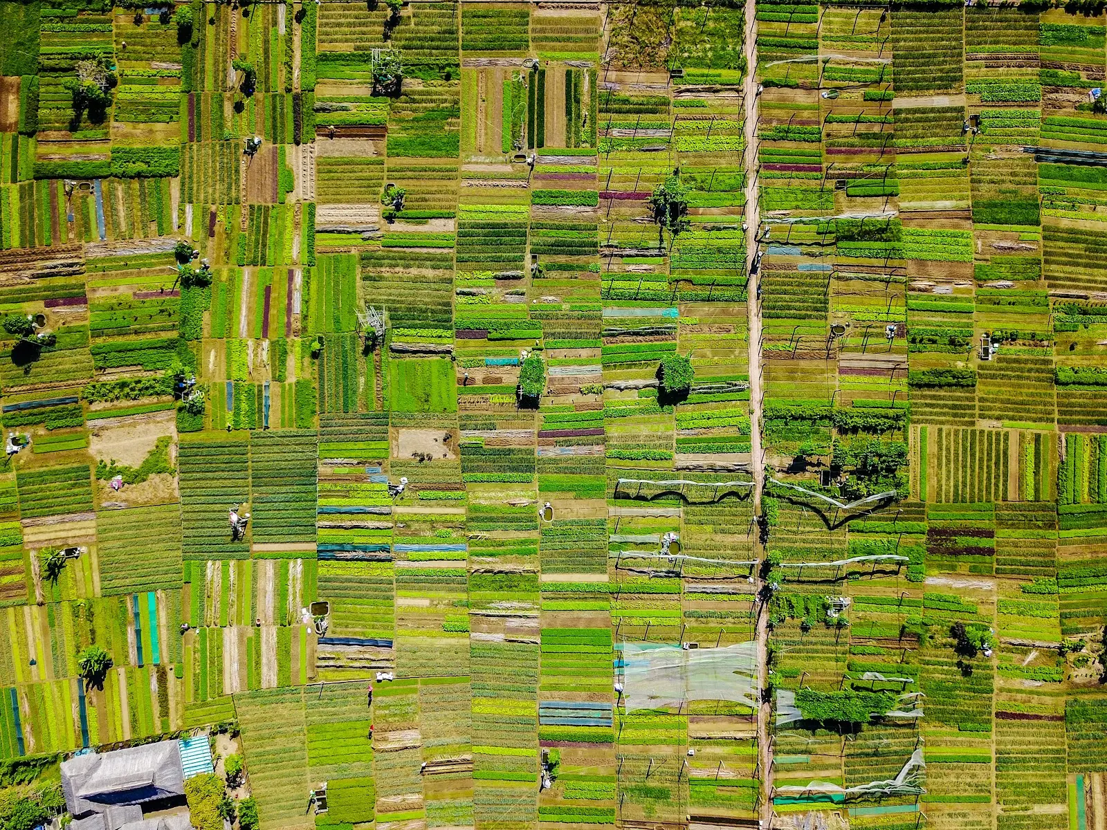
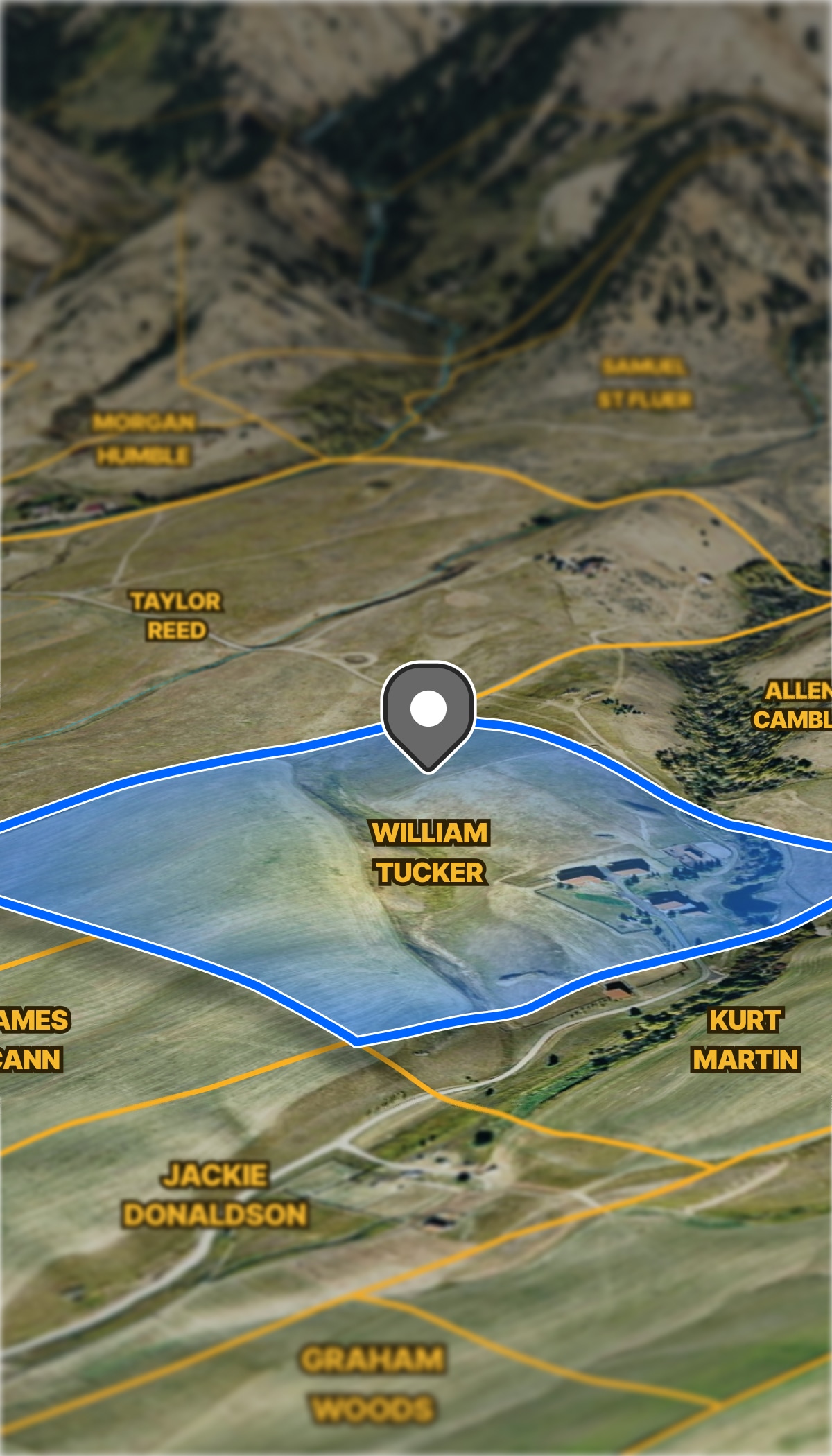
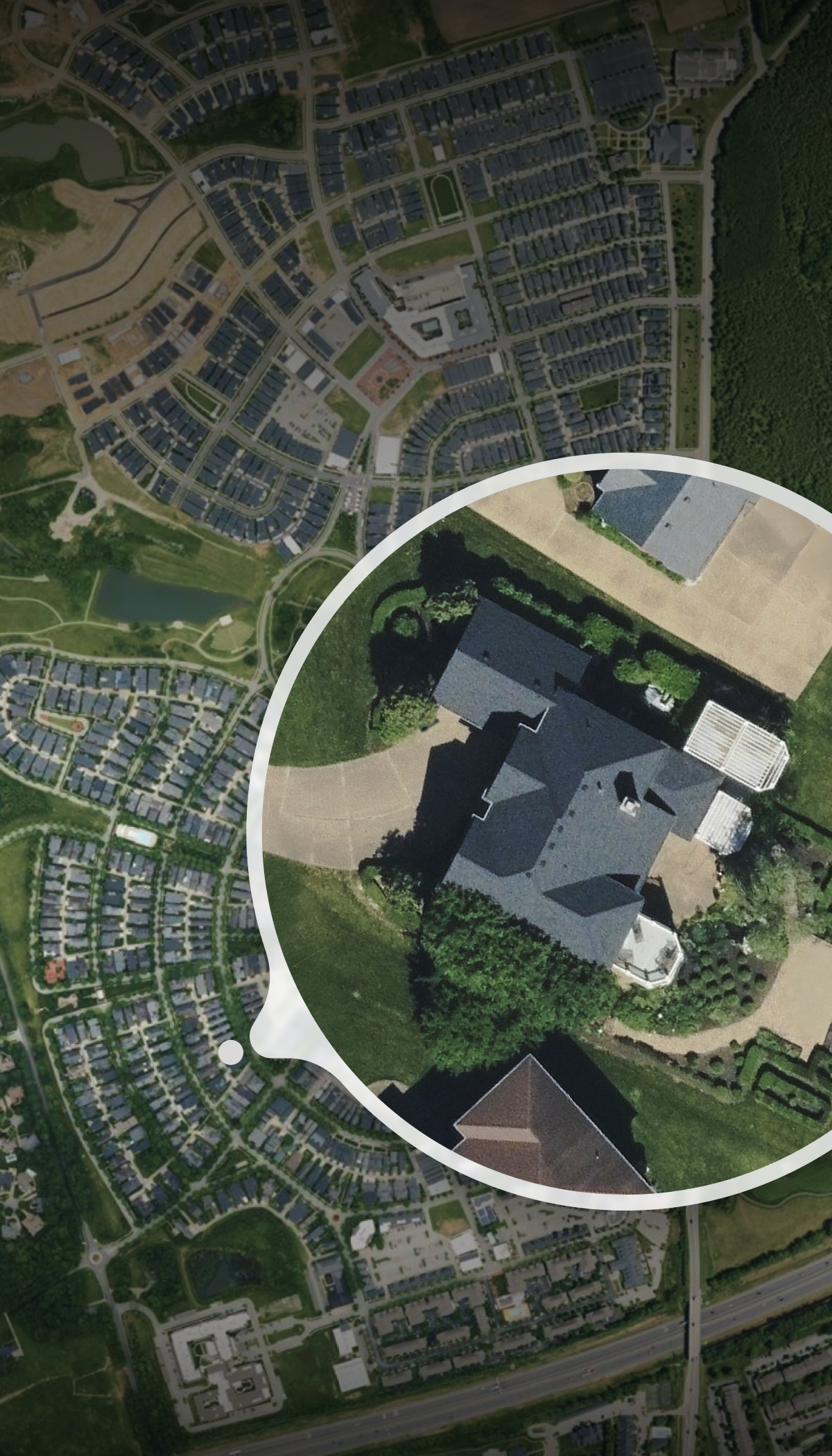
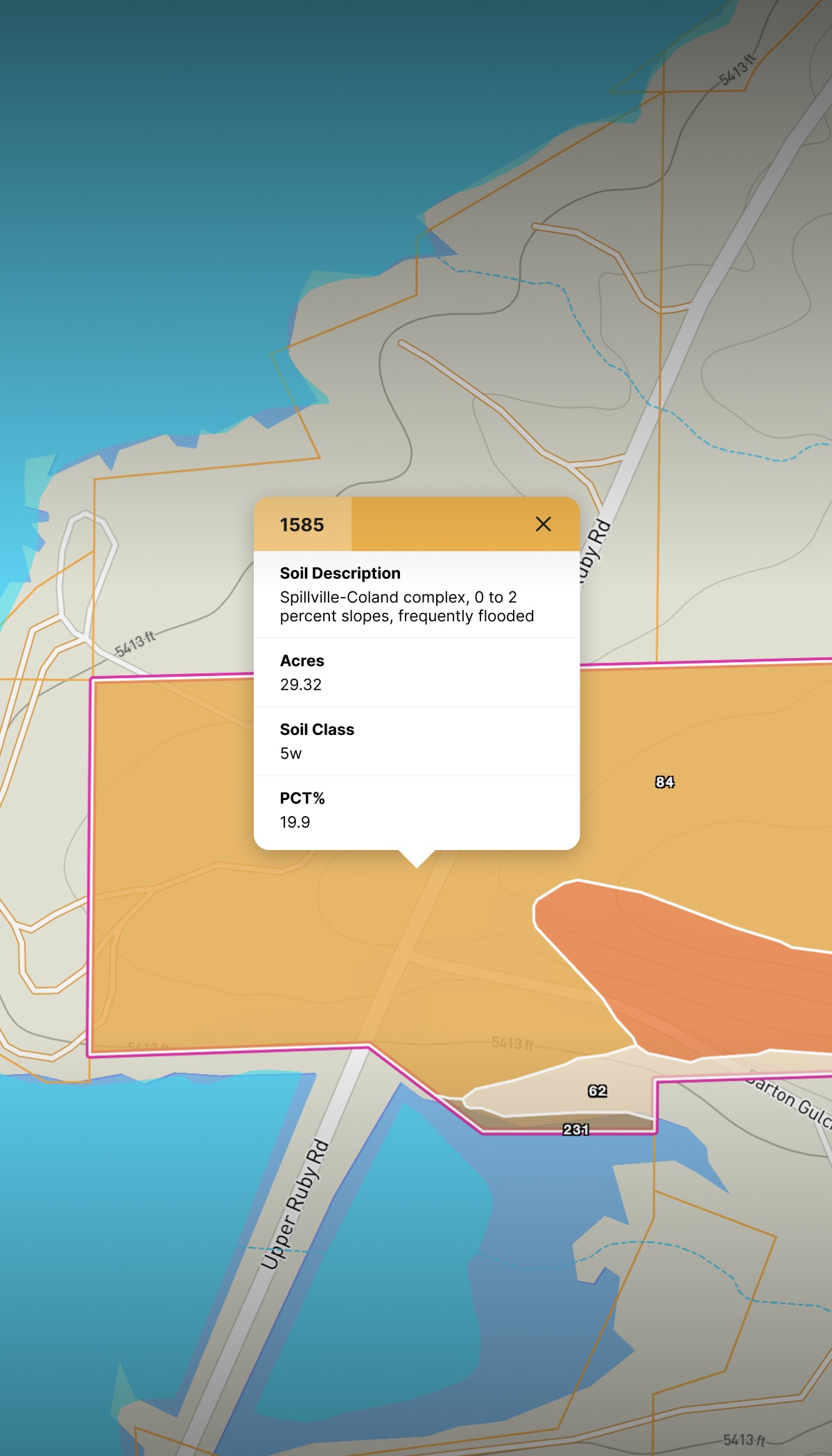
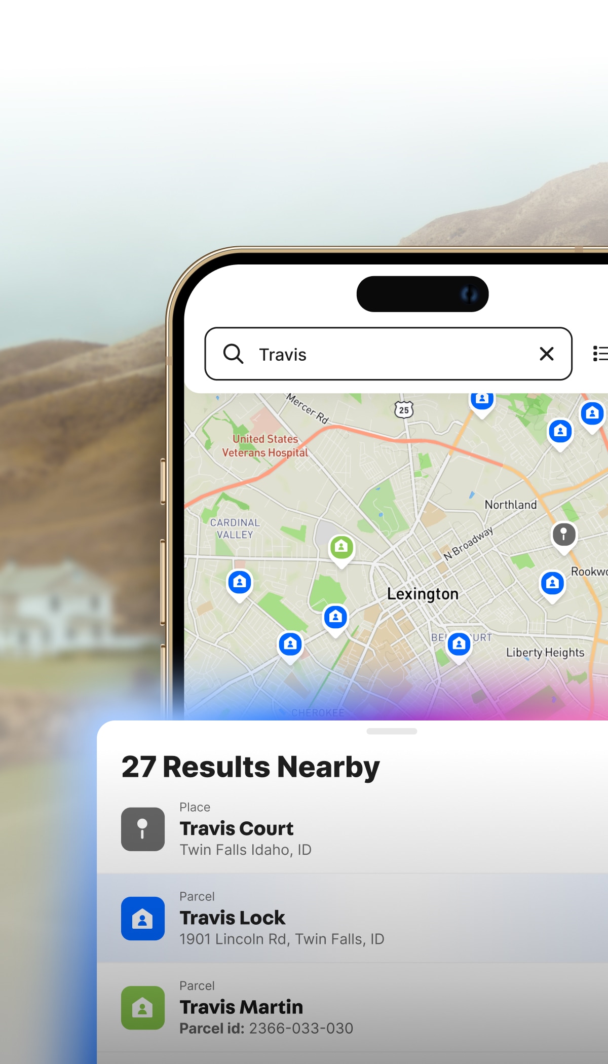
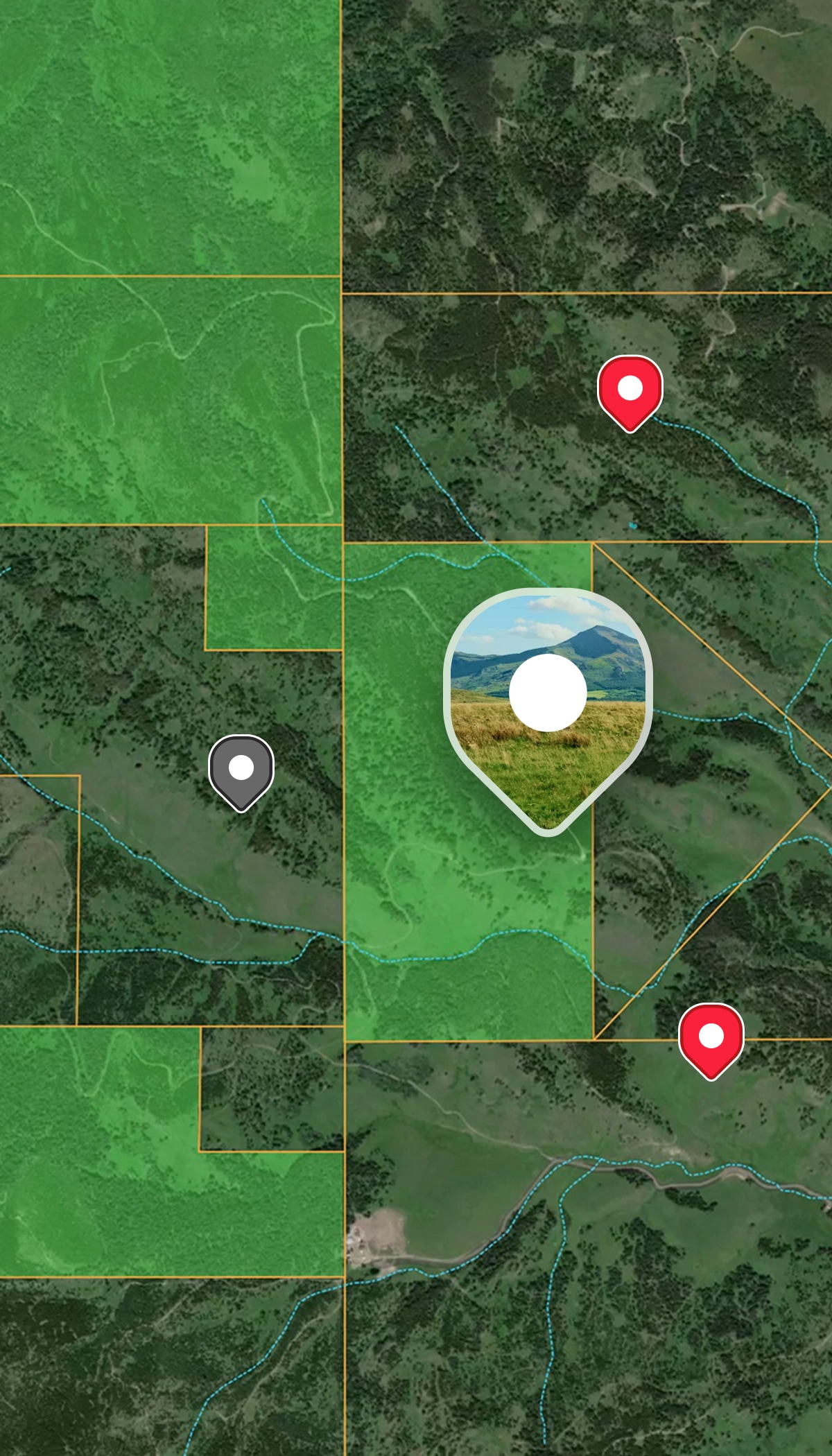
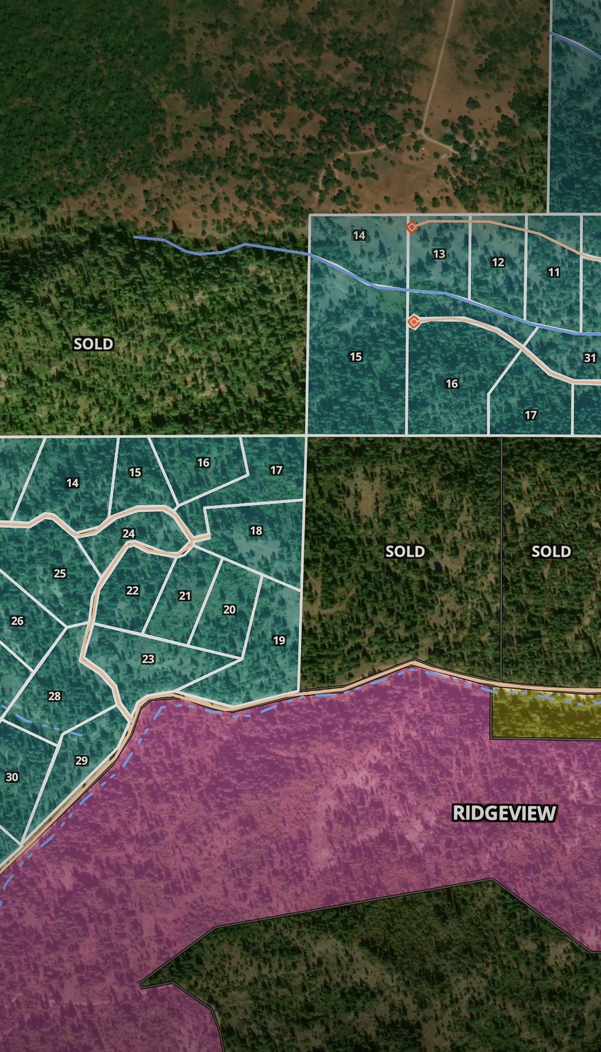
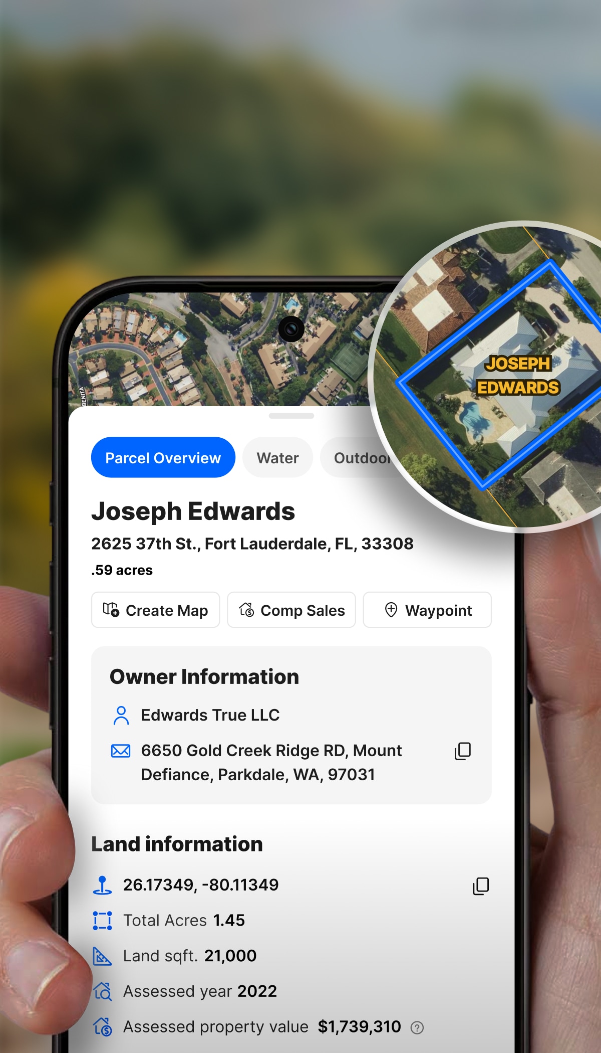
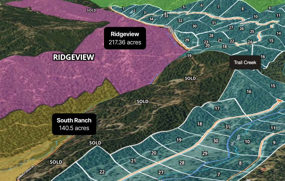
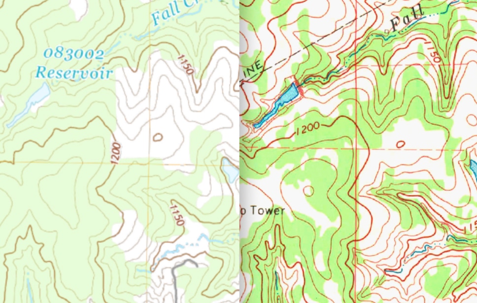
Boundaries, high-res aerials, neighboring parcels, water features, timber potential. Land id helps you discover what your land actually contains—and what it can do for you.
No more long calls trying to describe where the back pasture is. Let a Land id map be your communication tool. Mark fence lines, clearing zones, access roads, or anything that matters, and send it to contractors.
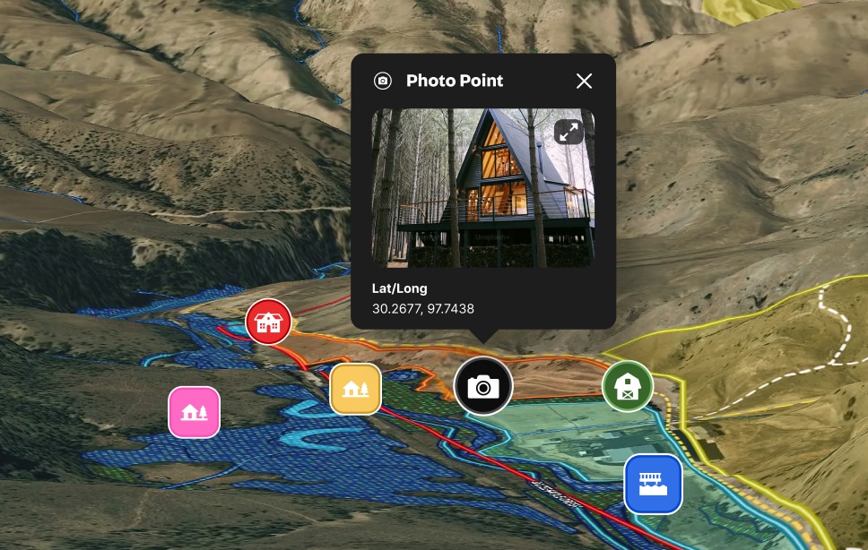
Build a living story of your land, from named trails to hunting blinds to guest houses. Make sure anyone coming to visit or explore experiences the land’s beauty the way you do.
Land Ownership Management Software
Land id is the ultimate land owner app, making land project tracking easier than ever. Visualize and track your land assets, keep accurate records of changes over time, and share your work with anyone who visits or works on your property—even if they don’t have a Land id account.
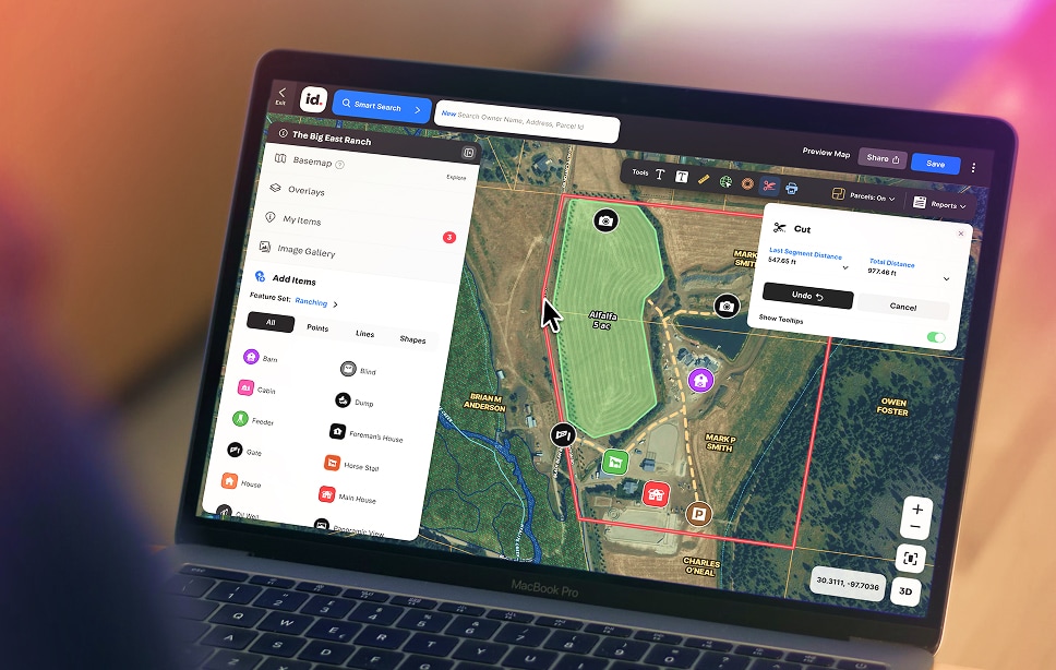
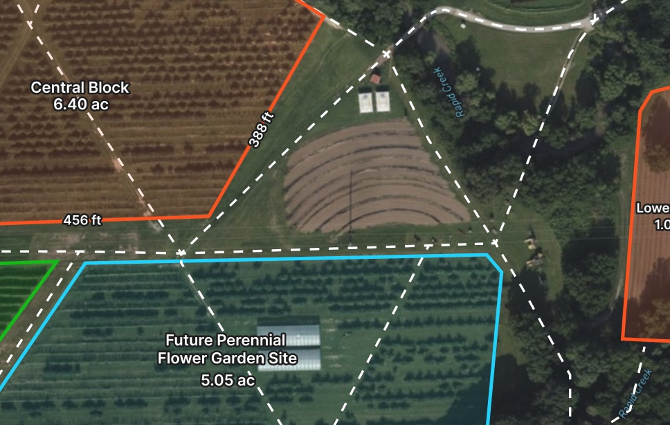
Create detailed maps in minutes—for planning, presentations, or personal use. Add boundaries, measurements, features, custom notes, or anything else to show off the property.
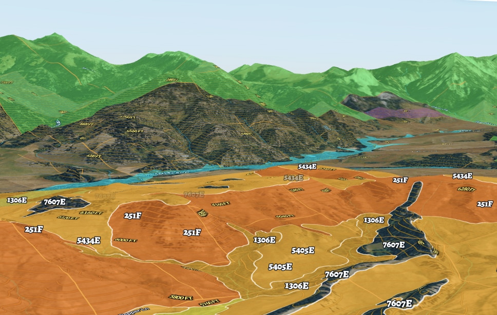
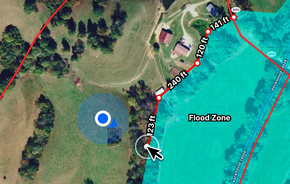
Toggle on flood zones, soil types, transmission lines, fiber optic service, water access, and more. Up-to-date data across 40+ overlays, so every decision has the full picture behind it.
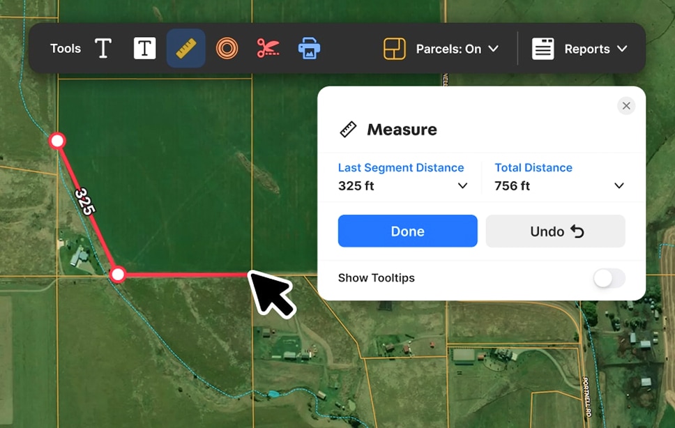
Eliminate eyeballing and guesswork with easy-to-use measurement tools. Draw shapes, create land boundaries, and precisely measure anything to estimate costs and plan smarter.
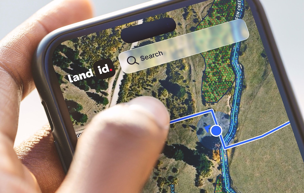
Research properties at your desk, verify boundaries on your phone, and walk property lines with live GPS tracking that shows exactly where you are on the map. Land id works where you do.
Easily Manage Property Projects
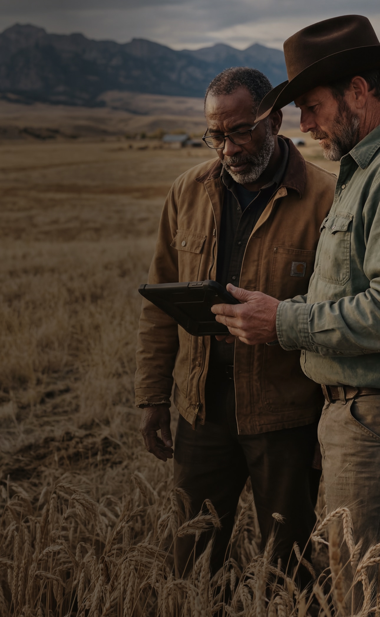
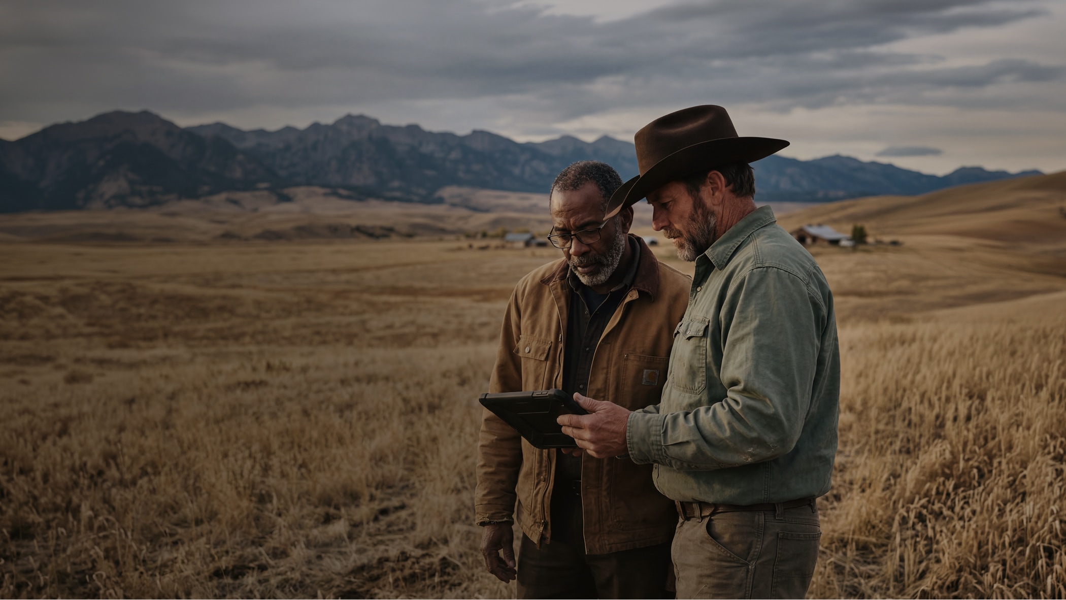
Recreational rancher, resource manager, or hands-on tinkerer—no matter what type of landowner you are, Land id works for the way you manage and use land. A single platform combines intuitive mapping, property boundary management, and land project tracking tools to help you stay connected to your property wherever you are.
I use the map all the time for everything from real estate work to my farm work for measuring fence lines etc, or deer hunting layouts etc. It's my go to map tool.
Lawrence Hegar
Hegar Land Group
It is very easy to use and the layout is fantastic.
Chris Thomas
I use Land id to map out and manage 15 hunting blinds and feeders on our 3,600 acre deer lease.
Steve Holzwarth