/
Commercial Real Estate

Build Your Competitive Edge in Commercial Real Estate

Commercial deals run on relationships, credibility, and whoever stays one step ahead. Combine Land id’s property insights with your market expertise, and turn those insights into clear communication stakeholders can see, understand, and act on.

Better Insights.
Clearer Communication.
Faster Deals.

For even the most complex commercial deals, Land id is the commercial real estate mapping software that makes it easy to tell a clear, compelling story to stakeholders. Quickly pre-qualify opportunities, create property tours and maps, and share with investors, developers, and clients. Keep everyone aligned and informed every step of the way.

Don’t Let Deals Collect Dust

Land id’s on-demand insights function as a powerful commercial real estate due diligence tool, helping teams answer questions quickly and keep complex deals on track.

Due Diligence in Your Pocket

Make quick work of due diligence, even on the road or out of cell range, with maps and data that highlight what makes a property viable—access, infrastructure, subdivision potential, and more.

Visualize & Track Your Pipeline

Map every opportunity in your market so you’re always ready. Tag statuses, track ownership, and keep your entire pipeline visible—not buried in a spreadsheet.

Level Up Your Marketing

Spreadsheets and screenshots aren’t marketing. Turn complex property data into shareable, easy-to-digest maps, tours, and reports that tell a stronger story.

Stay Productive Wherever You Are

When your car is your office, Land id travels with you. Create Property Tours, maps, and reports on the go. See your location on any property, in context, in real time—without a major learning curve.

Trusted by Industry Pros

The #1 Software for Commercial Real Estate Mapping

Features Made for the Pace of Commercial Real Estate

Land id fits into your busy workflow—from prospecting to presentation, from desk to phone to site visit. Map collections of sites in minutes. Use advanced mapping tools to overlay site plans, then identify and measure setbacks, easements, and buildable areas. Share branded maps, tours, and reports right from your desktop or phone.

Show Context With 40+ Data Layers

Toggle on flood zones, soil types, transmission lines, fiber optic service, water access, and more. Up-to-date data across 40+ overlays, so every decision has the full picture behind it.

Learn More

Measure Precisely for Better Planning

Eliminate eyeballing and guesswork with easy-to-use measurement tools. Draw shapes, create land boundaries, and precisely measure anything to estimate costs and plan smarter.

Learn More

Overlay Site Plans & Surveys on Any Map

Align any site plan, survey, or image to its exact location. See how your documents line up against boundaries, overlays, and surrounding parcels.

Learn More

Work From Your Desktop or Live in the Field

Research properties at your desk, verify boundaries on your phone, and walk property lines with live GPS tracking that shows exactly where you are on the map. Land id works where you do.

Learn More

Transitional Land Mapping & Research

Built for Transitional Land Deals & Beyond

Land id is great for any complex real estate conversation—especially transitional land mapping and marketing, where research and analysis is time-consuming and difficult. Help clients visualize potential and understand context for faster, more confident decision-making.

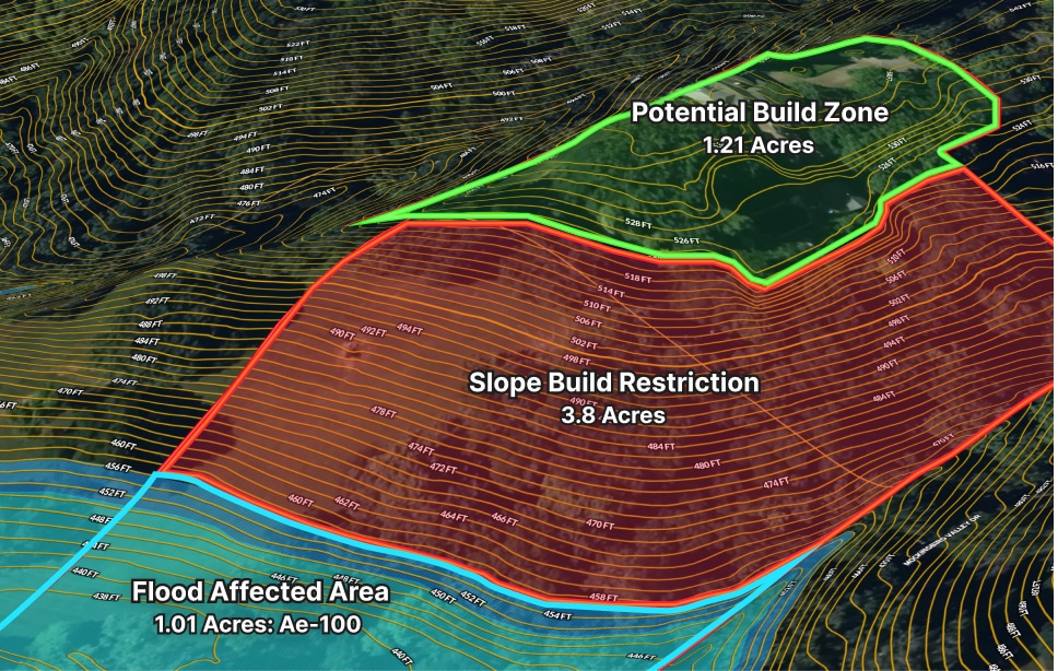
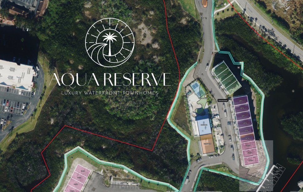
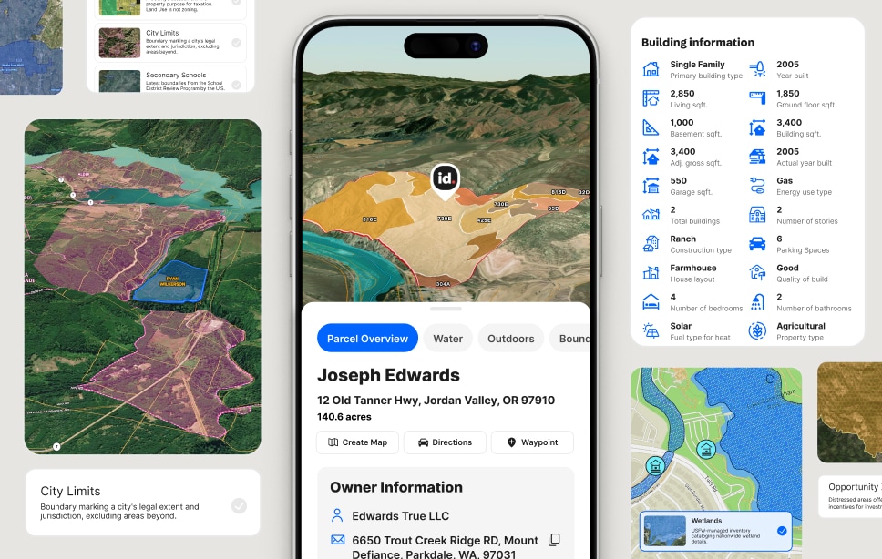
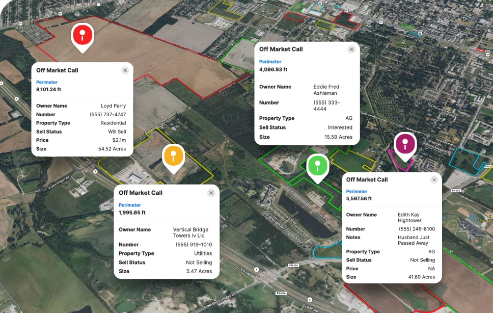
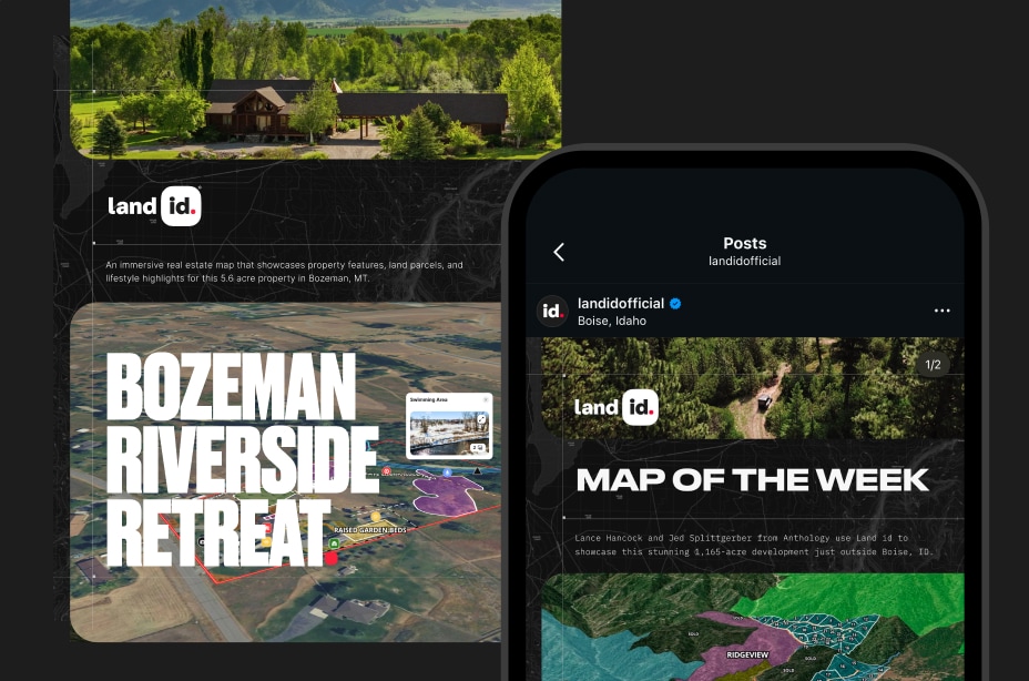
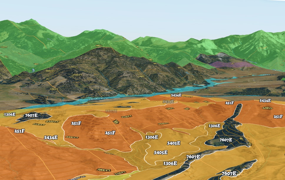
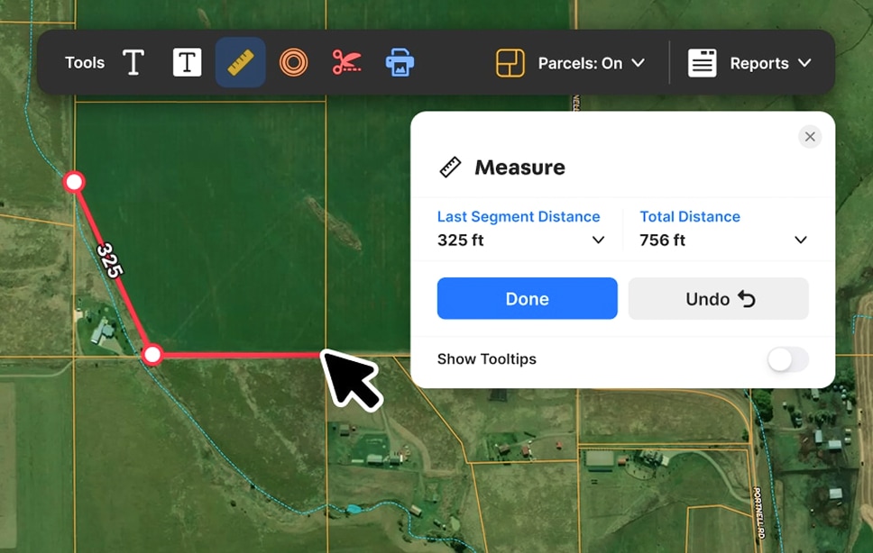
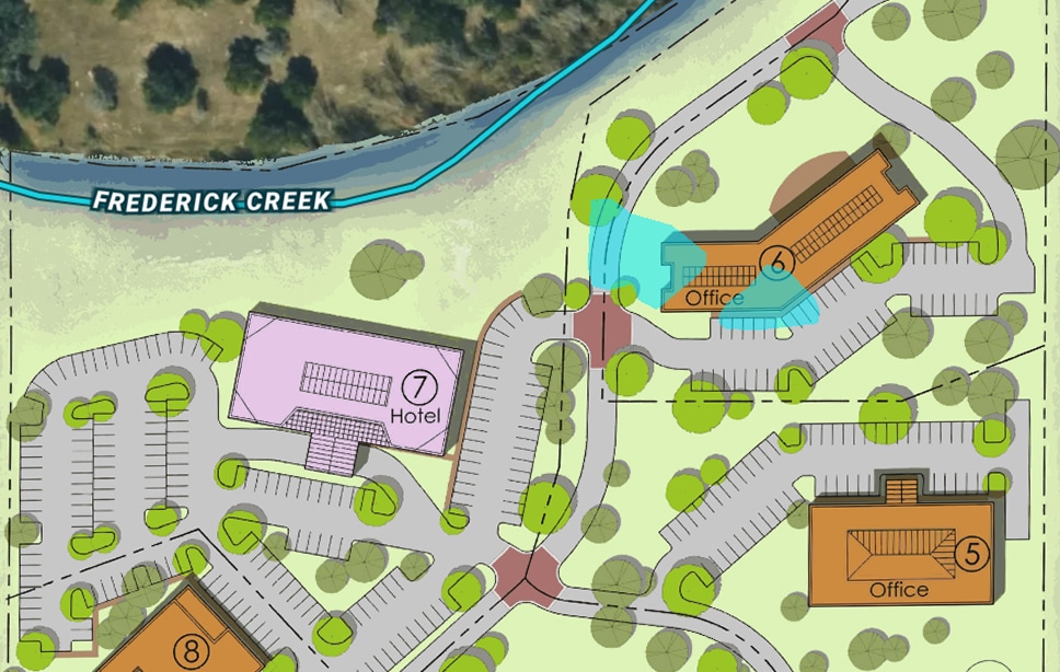
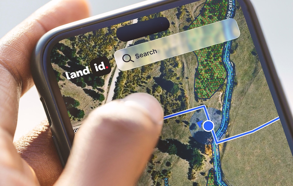
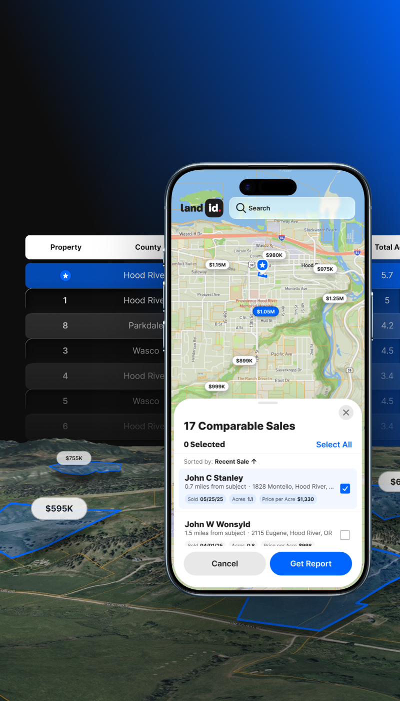
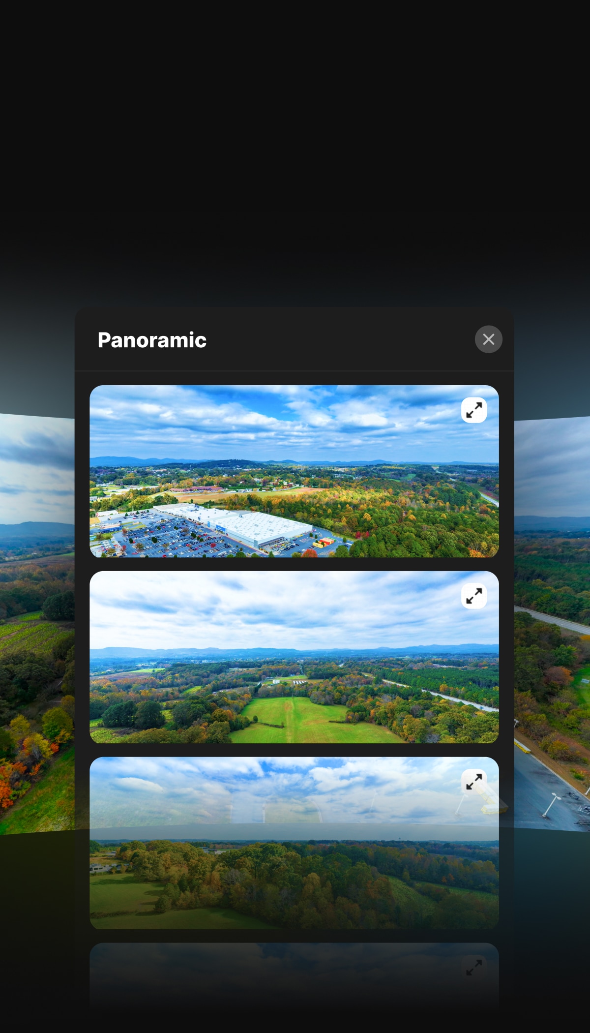
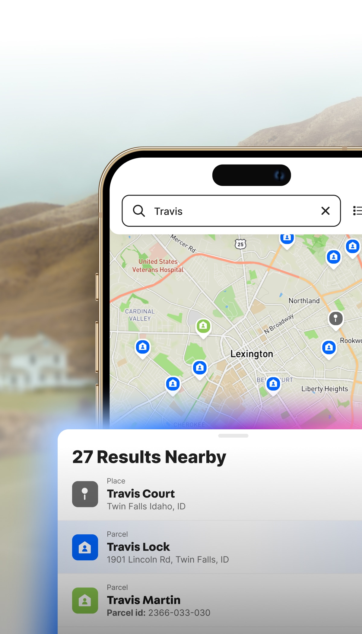
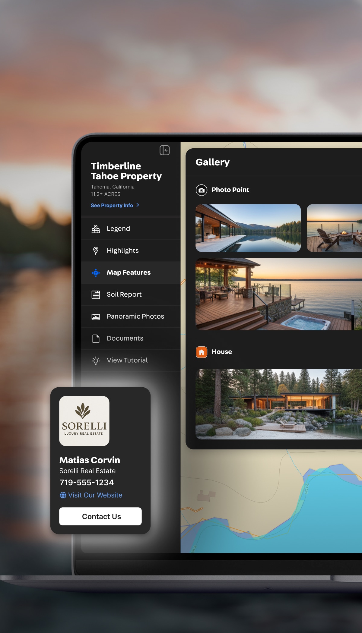
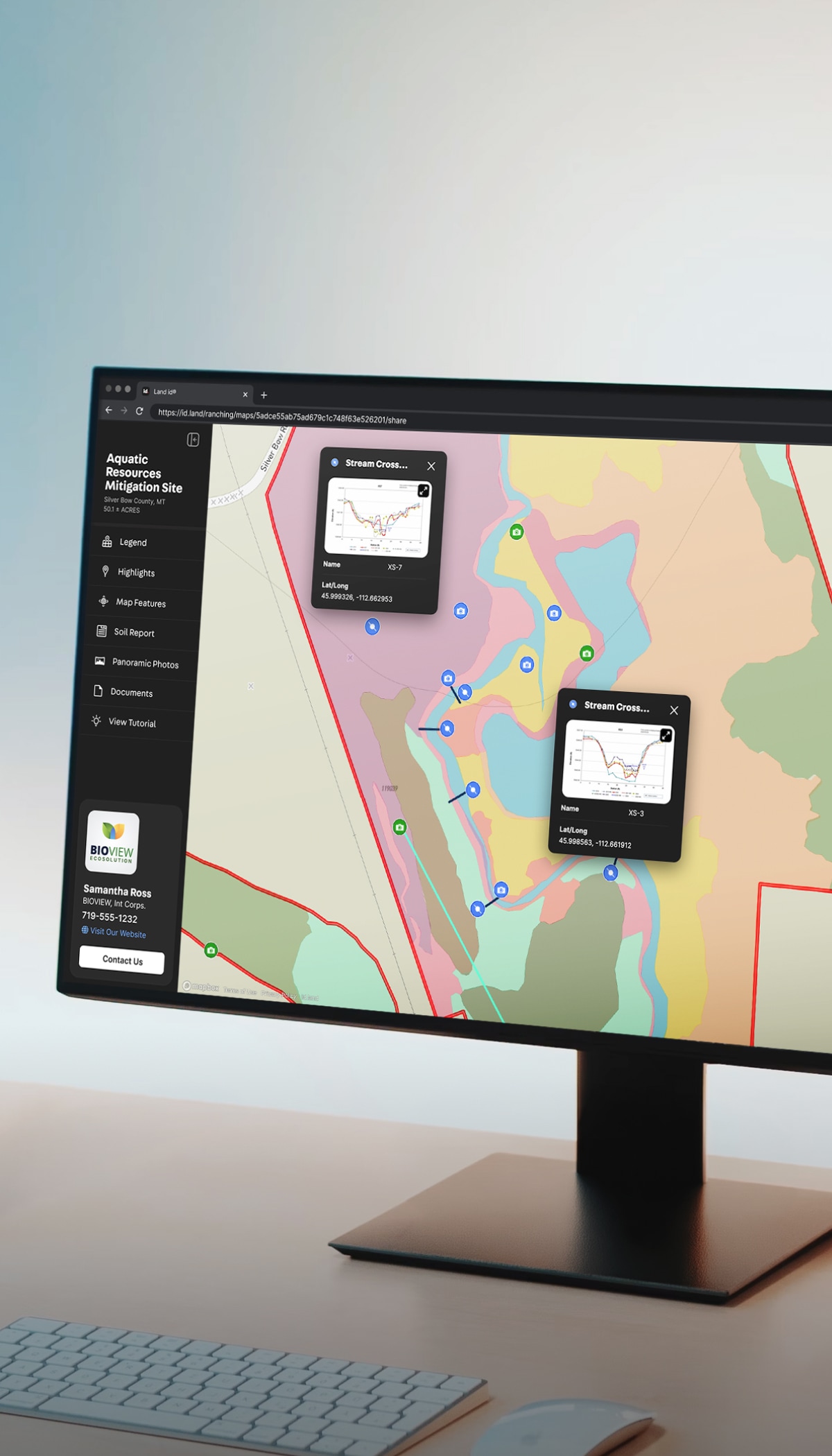
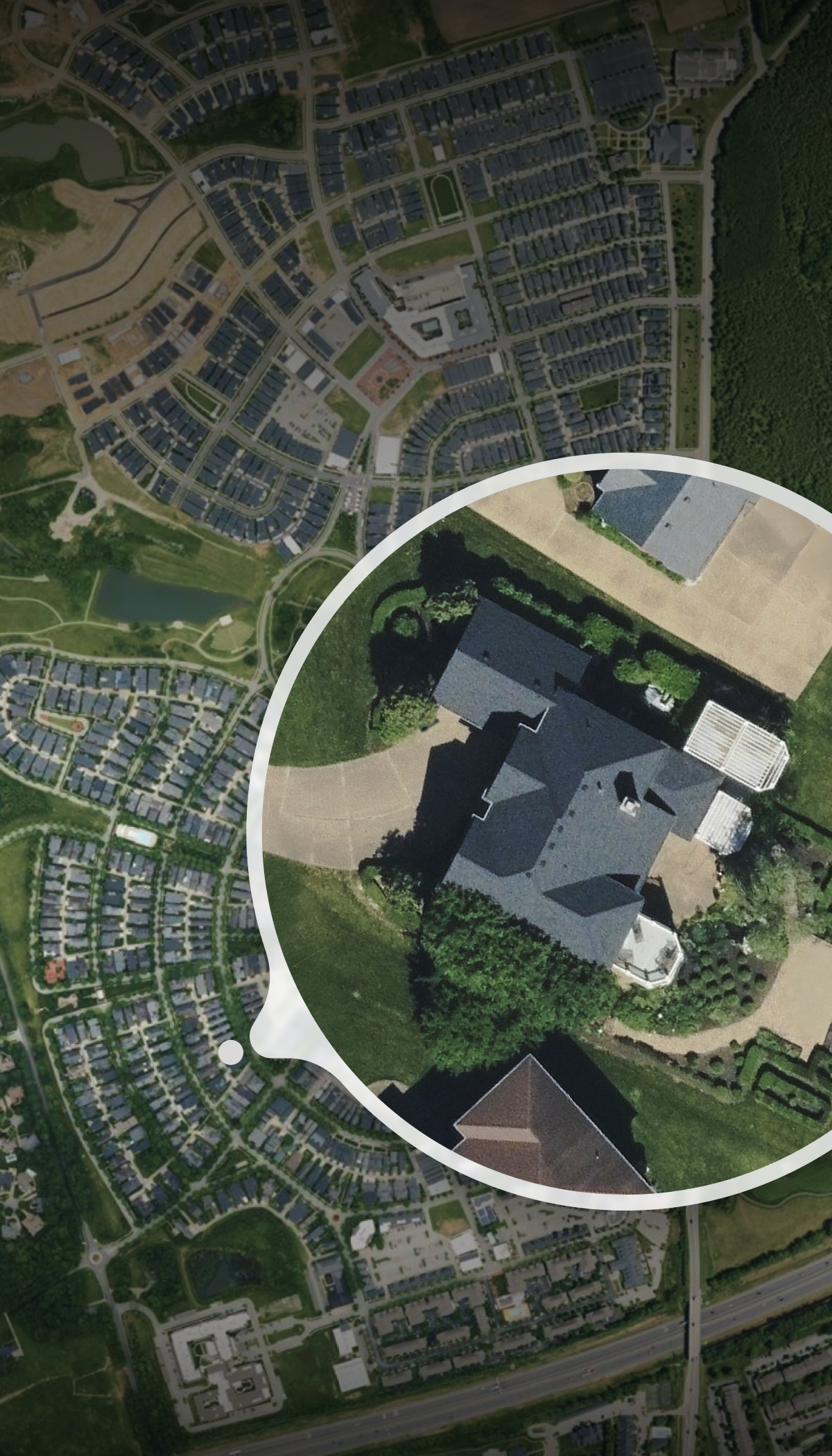
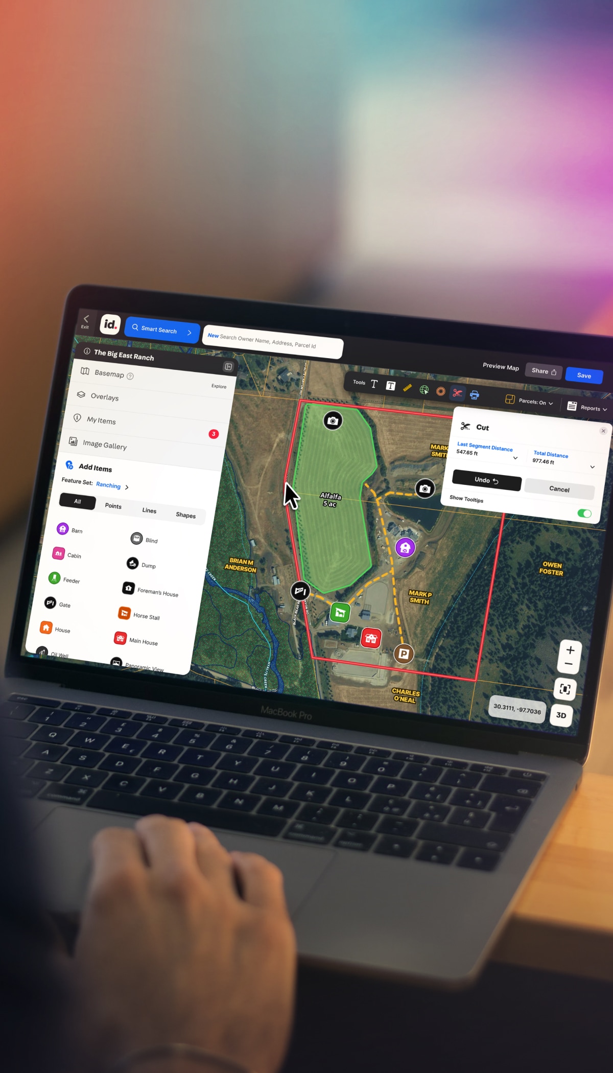
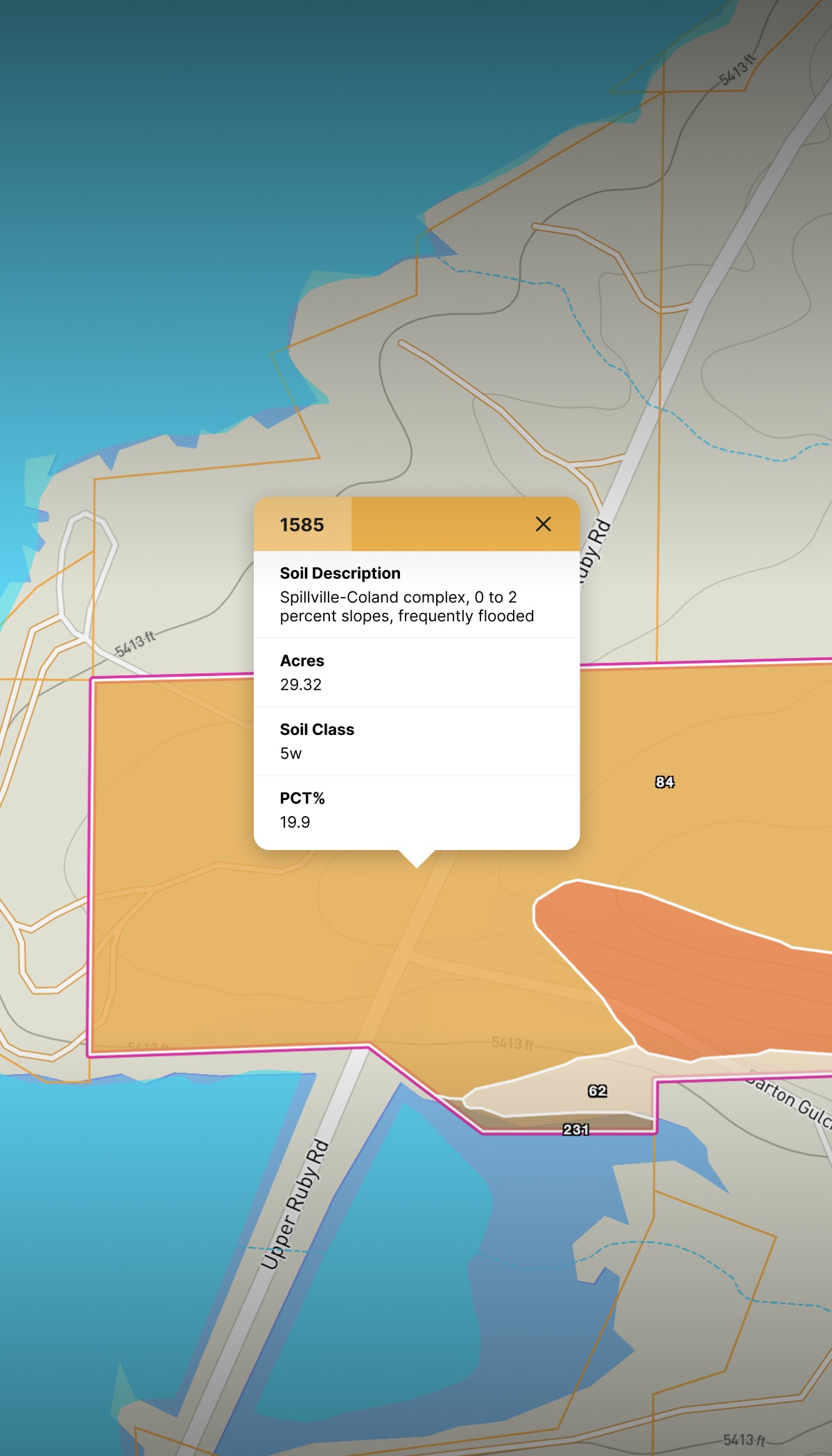
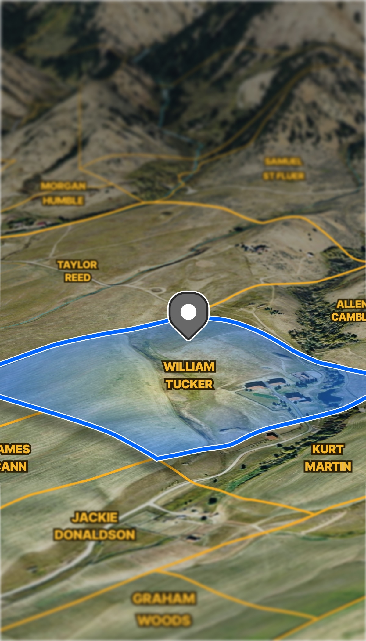
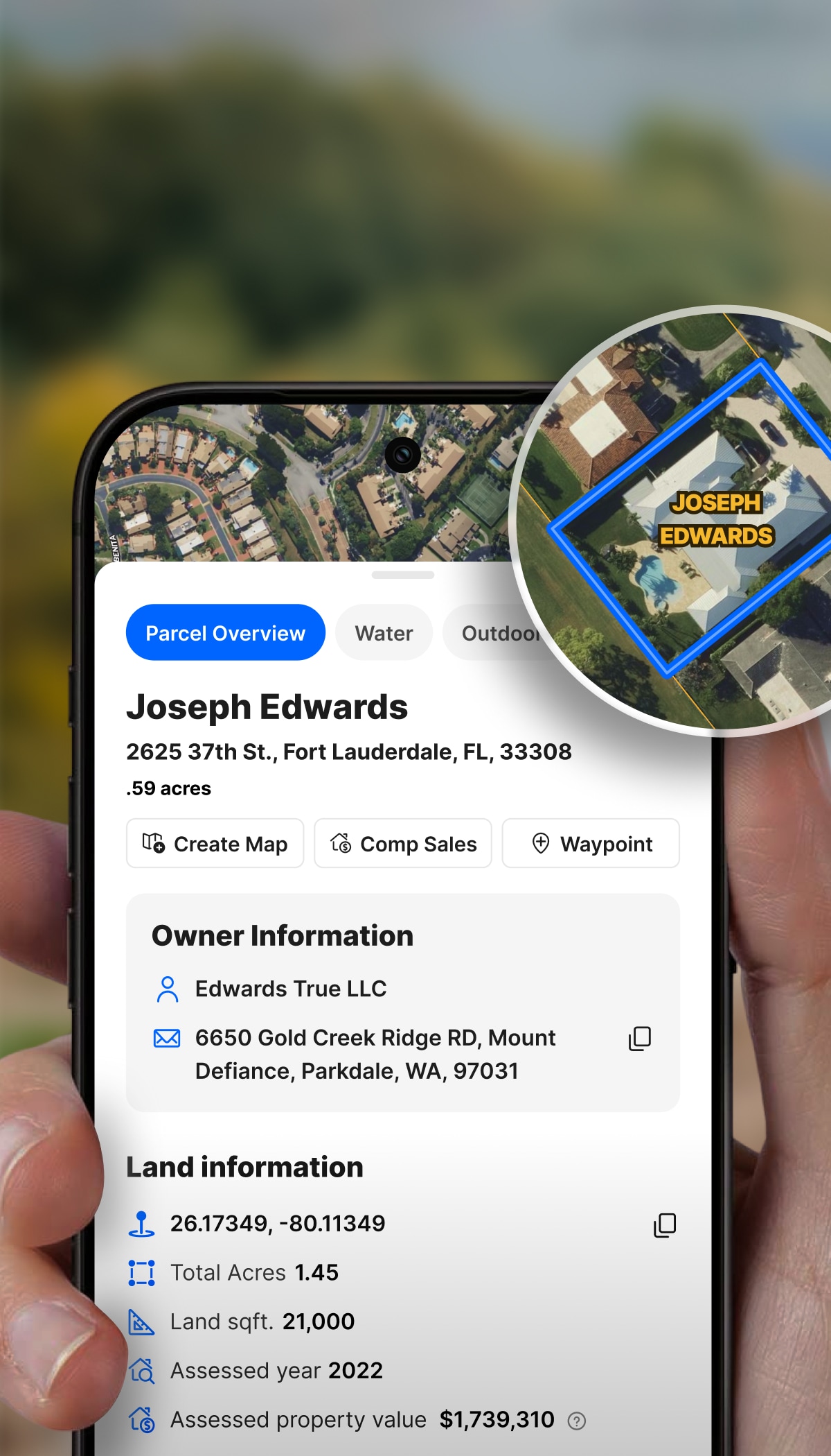
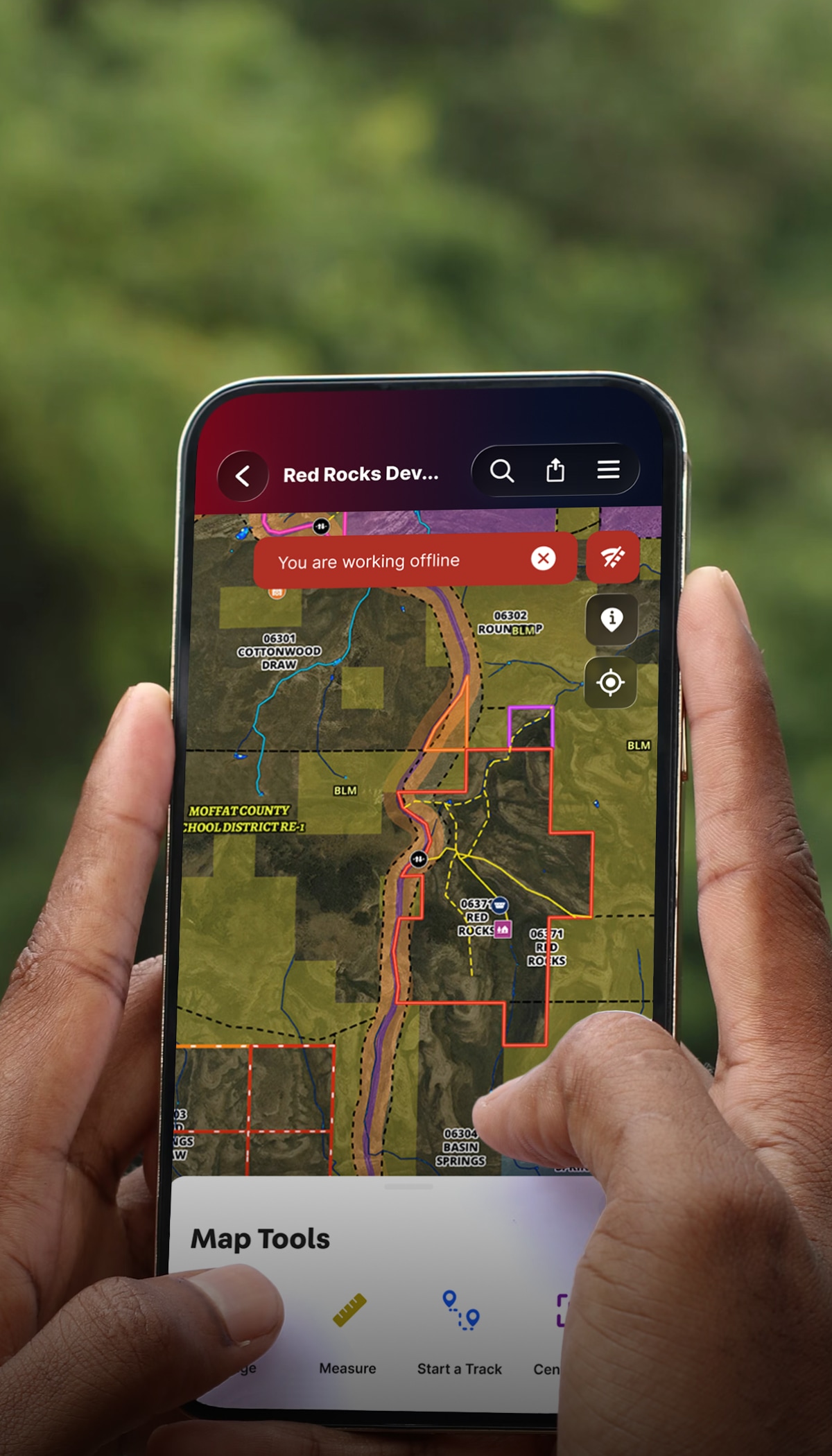
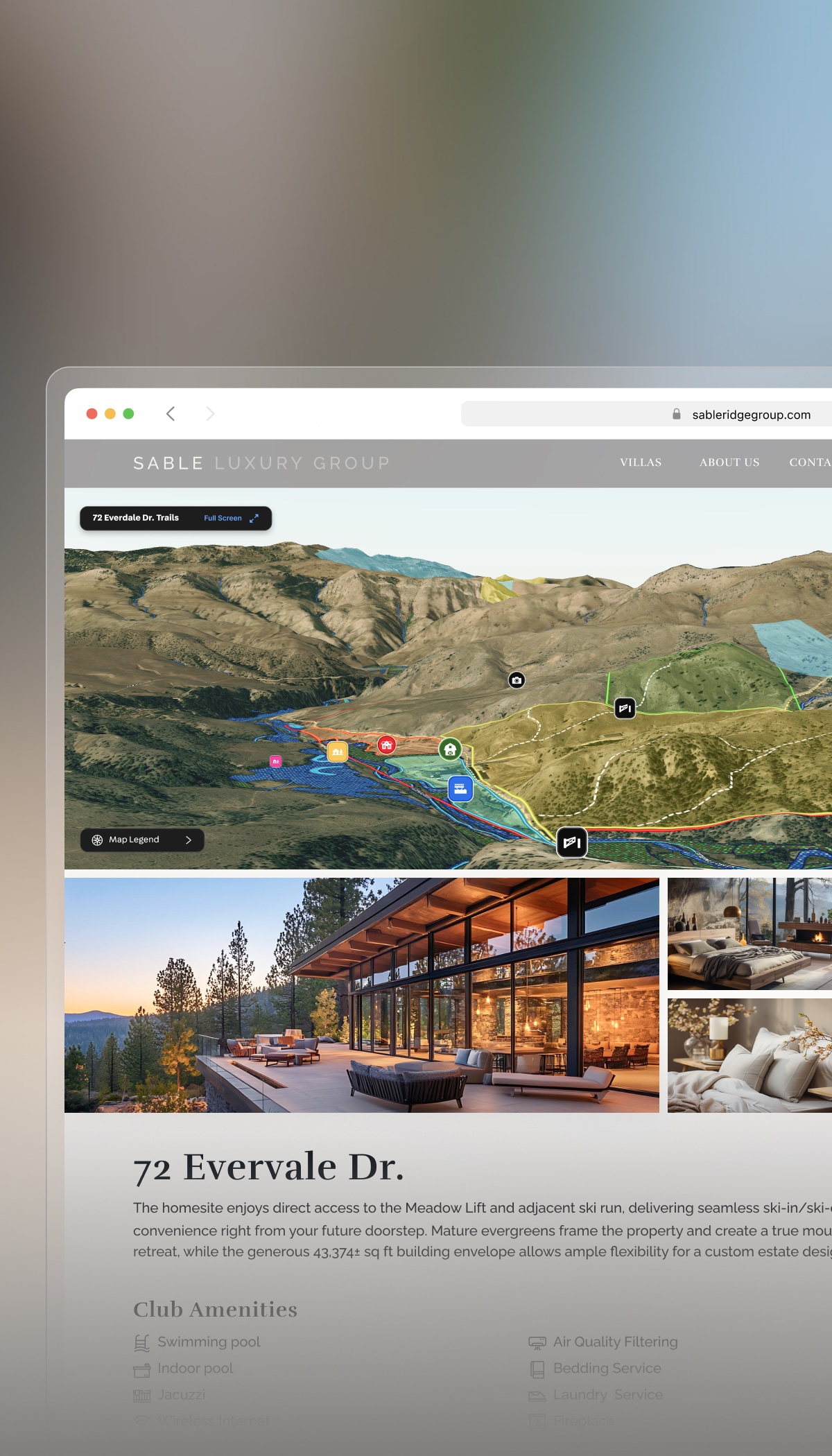
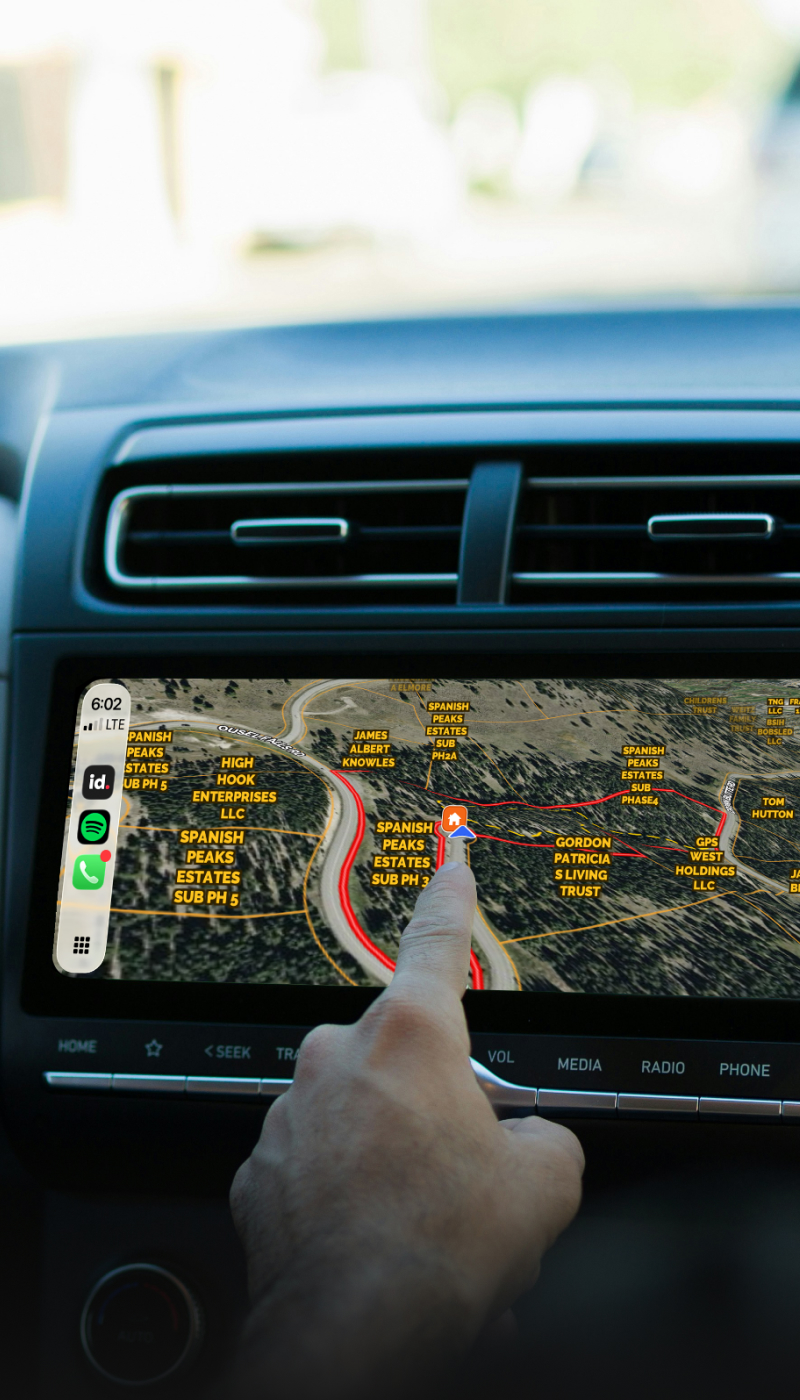
Analyze Development Potential

Get a clear, visual understanding for future development.

  • See wetlands, utilities, access, and surrounding development in one place.
  • Map nearby and planned developments to guide strategy.
  • Identify risks before they become issues.

Simplify Land Acquisition Research

When everyone sees the same picture, decisions happen faster.

  • Share maps, reports, and tours in one simple link.
  • Replace spreadsheets with visual, decision-ready insights.
  • Align brokers, buyers, and stakeholders quickly.

Market Highest & Best Use

With Land id data in hand, turn it into compelling marketing assets.

  • Overlay site plans onto a parcel map to show your vision.
  • Combine maps, data, photos, and video into one experience.
  • Show, don’t explain, what makes the site a great investment.

Learn How to Market Properties With Land id’s Training Course

Watch the Videos

More Resources

Get the Most Out of Your Commercial Appraisal with GIS

Appraisers play an essential role in the sale of any commercial real estate.

Finding the Ideal Location With Geospatial Technology

The area a home is located in determines a great deal for the people living there: where their kids can go to school, how long their commute is, what they do for entertainment… It’s no wonder that a 600 sq/ft. studio apartment in SoHo, New York can cost more than a 6-bedroom house in rural Indiana.

A Day in the Life of a Real Estate Agent—Powered by Land id

Discover how Land id powers smart real estate marketing with branded maps, parcel data, and insights that help agents win listings and close faster.

FAQs

Does Land id have zoning data?

Can I overlay a site plan or engineering drawing on a map?

Can I use Land id Pro to manage multiple properties or projects?

What infrastructure data does Land id show?

Can I share my Land id® maps with someone who doesn’t have the app?