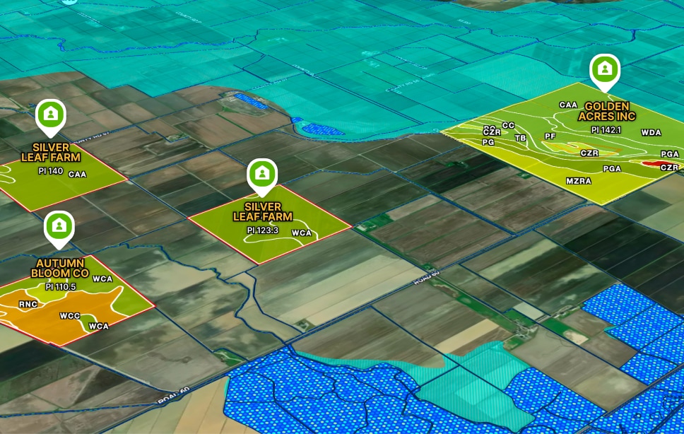
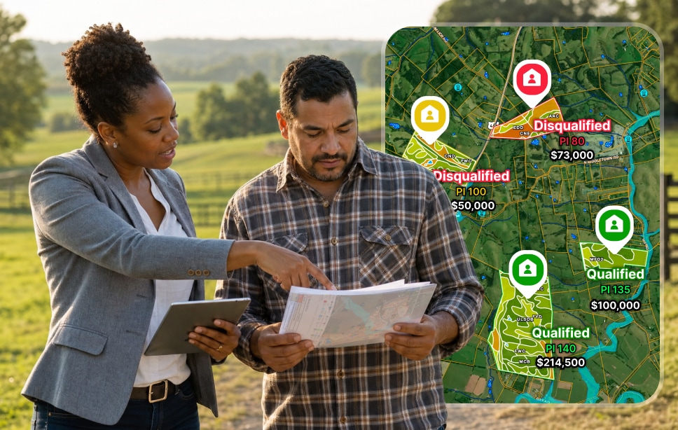
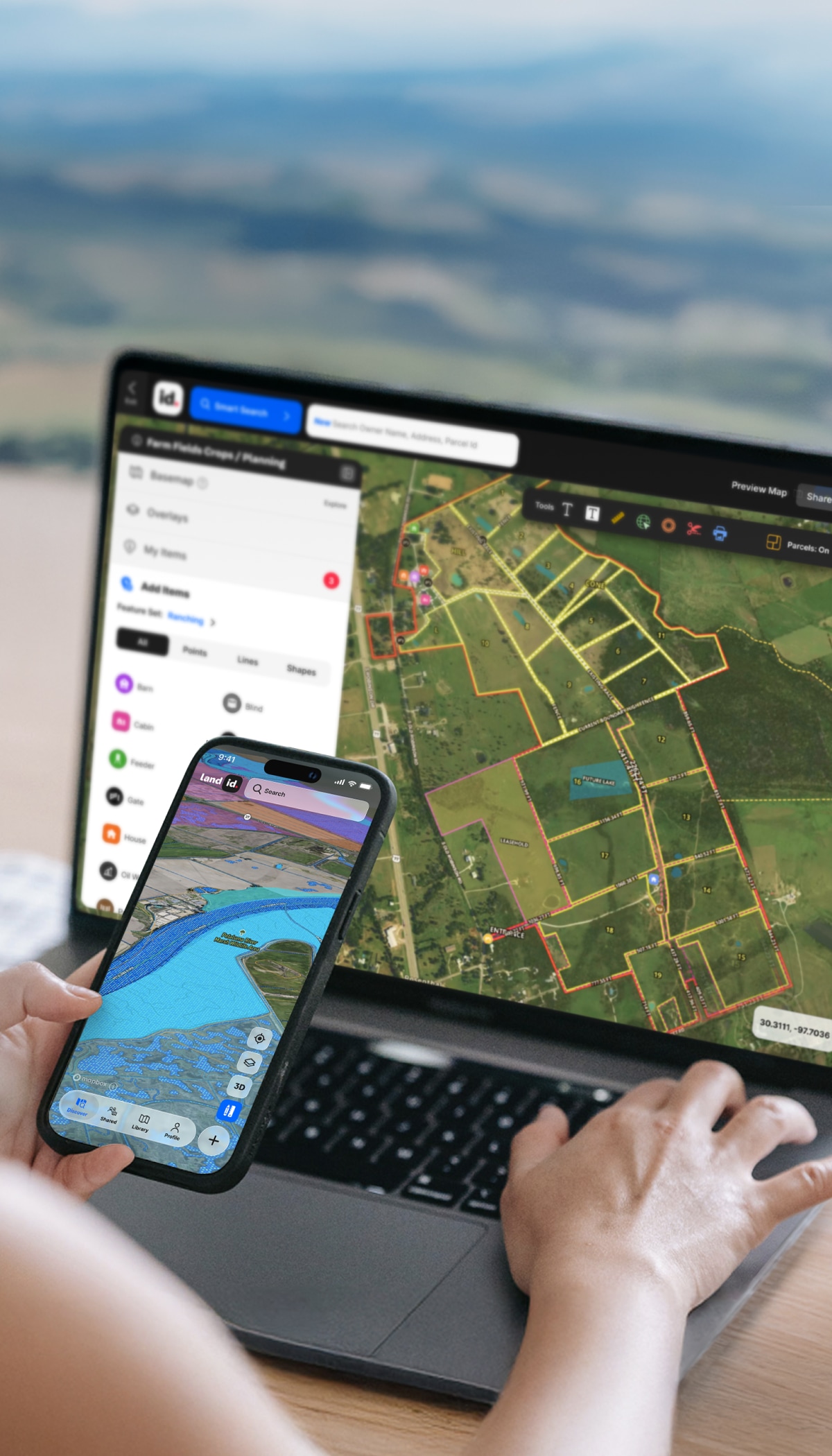
/
Farming & Agriculture

Maximize Revenue for Farming & Agriculture

When farmland is a business asset, Land id ensures you make the most of it. Whether you’re buying, investing, or running a commercial ag operation, access land data that makes or breaks ROI.

All the Data to Determine a Farm’s Value

From soil reports and FSA fields to state-specific crop productivity indices, Land id consolidates the specialized land data you need to validate profitability and make confident investment decisions.

Your Favorite Commercial Ag Due Diligence Tool

Stop toggling between clunky county sites, soil databases, and mapping tools. Get everything you need in a unified, user-friendly platform.

Understand Production Potential

Access soil data with state-specific crop productivity indices so you can estimate yield potential and calculate ROI with confidence.

Verify Every Acre You're Paying For

Overlay FSA fields on up-to-date, high-resolution aerial imagery to confirm boundaries and tillable acreage. Avoid surprises with accurate field data.

Catch Deal-Breakers Early

Evaluate slope, flood zones, wetlands, and other environmental constraints to spot issues before they become expensive problems.

Get Insights In-Field

Pull up boundaries and comprehensive land data on your phone, in real-time, while walking the property. Make informed decisions on-site.

Trusted by Industry Pros

Farmland Mapping Software With Soil Data

The Features You Need to Make Smarter Ag Land Investments

High-res contours, CSR2 soil productivity, online measurements, agricultural land research, and a powerful suite of advanced mapping tools make Land id a must for maximizing your commercial farming investment.

Soil Analyses for Land Planning & Valuation

Discover soil type, classification, and agricultural potential to make informed decisions.

Learn More

Show Context With 40+ Data Layers

Toggle on flood zones, soil types, transmission lines, fiber optic service, water access, and more. Up-to-date data across 40+ overlays, so every decision has the full picture behind it.

Learn More

See Every Detail in High Res

See brilliant, up-to-date satellite imagery to plan better, save on site visits, and communicate important property details.

Learn More

Create Comparable Sales Reports in Minutes

Leverage AI-enabled searching to generate professional, data-backed comparable sales reports—right in Land id.

Learn More

Software for Rural & Ranch Operators

How Farm Investors, Consultants & Agents Use Land id

Whether you're building a farmland portfolio, managing operations for landowners, or working as an agent in commercial rural land, Land id gives you the land data and tools you need to work faster and smarter.

Farm Investors

Evaluate properties faster and assess ROI across your portfolio.

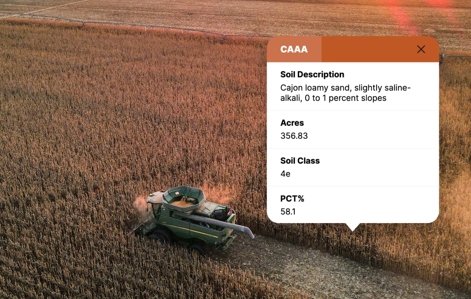
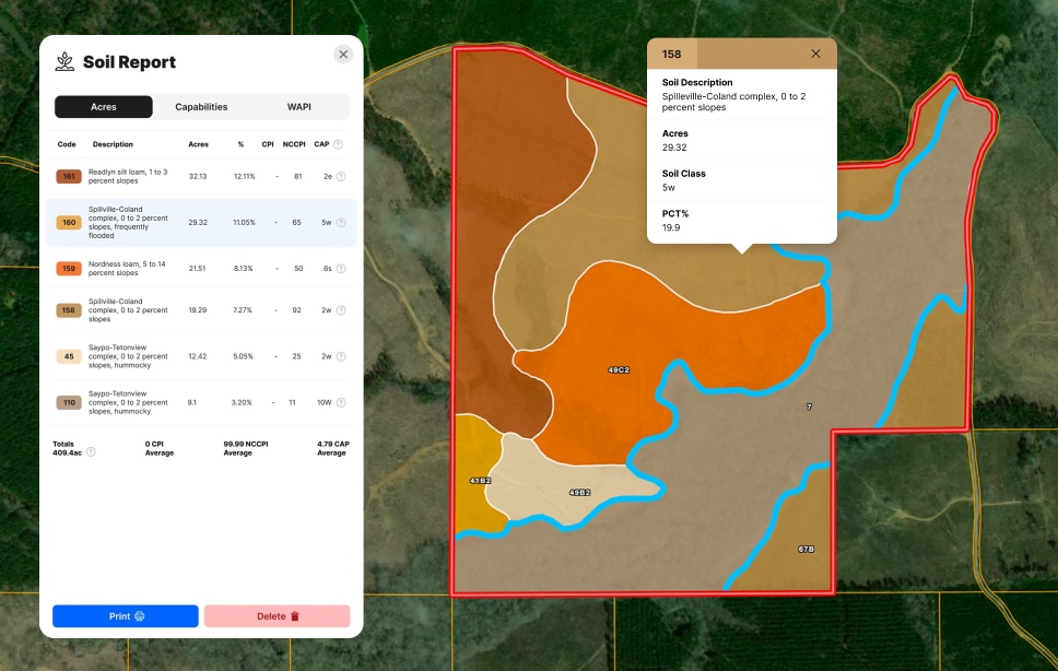
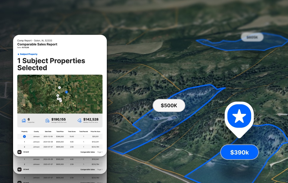
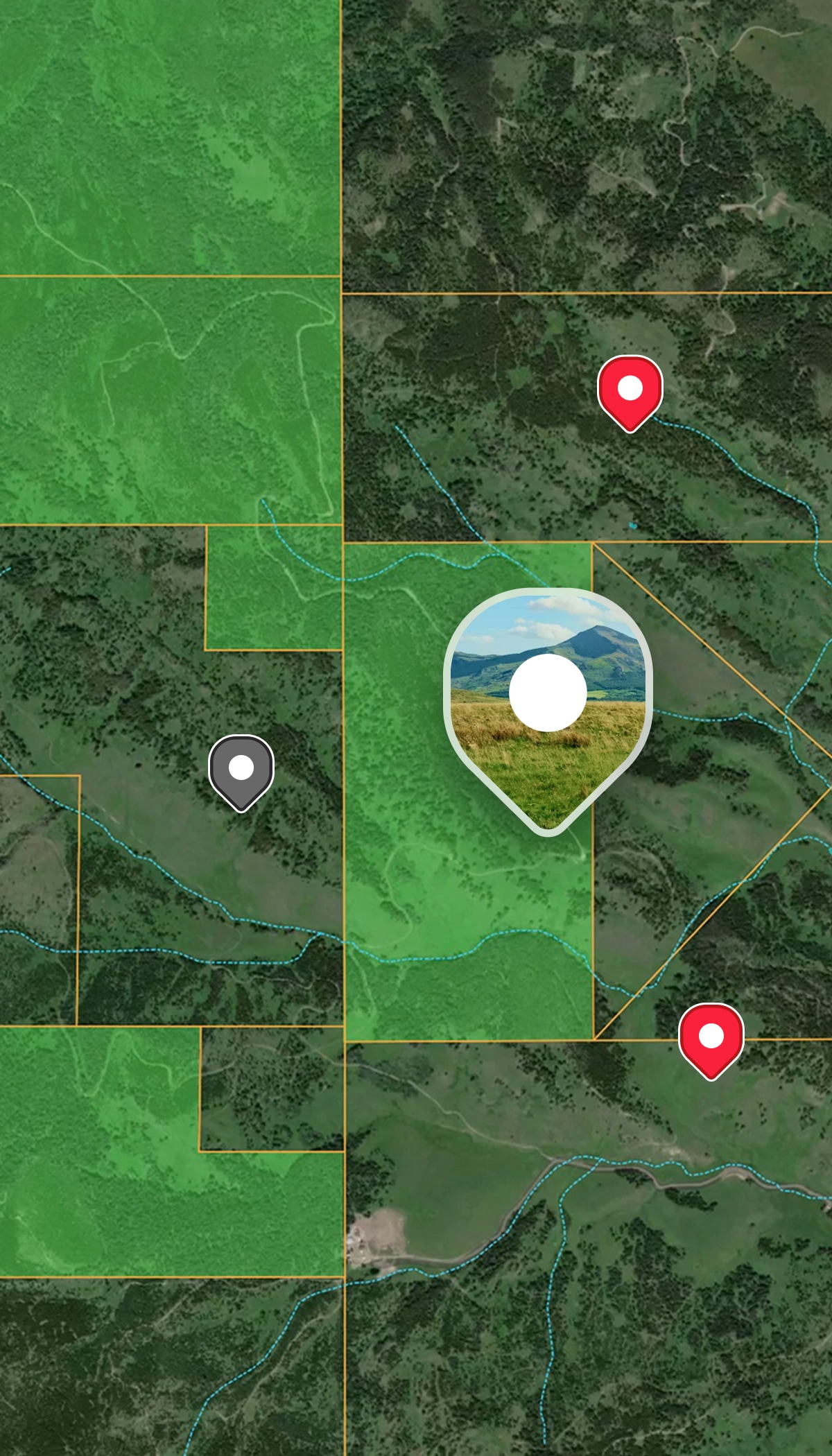
  • Compare soils and crop productivity indices across multiple farms.
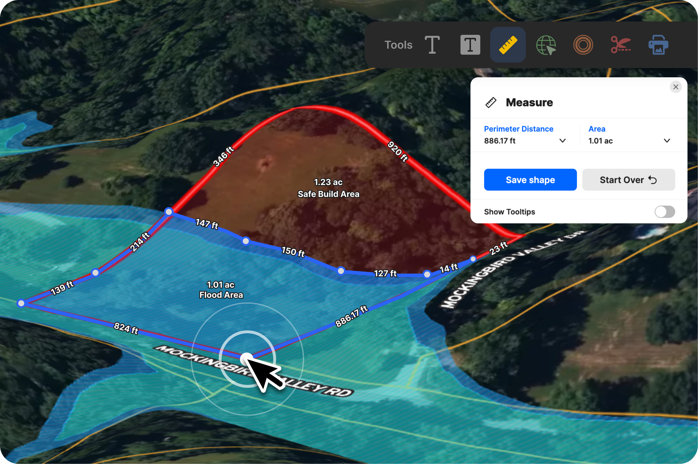
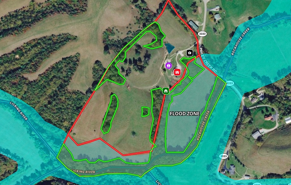
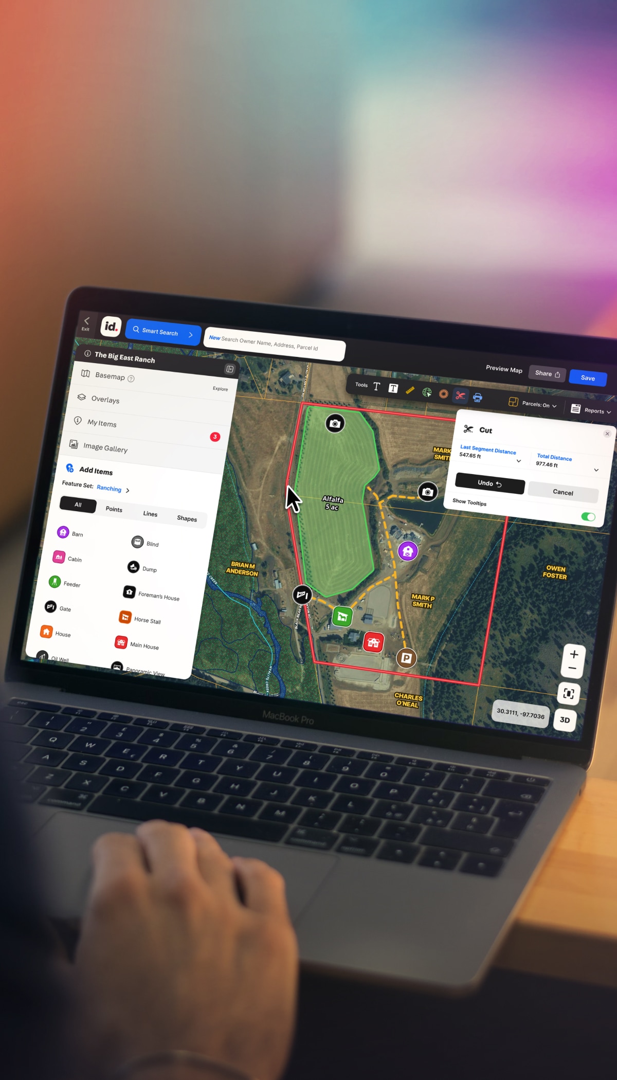
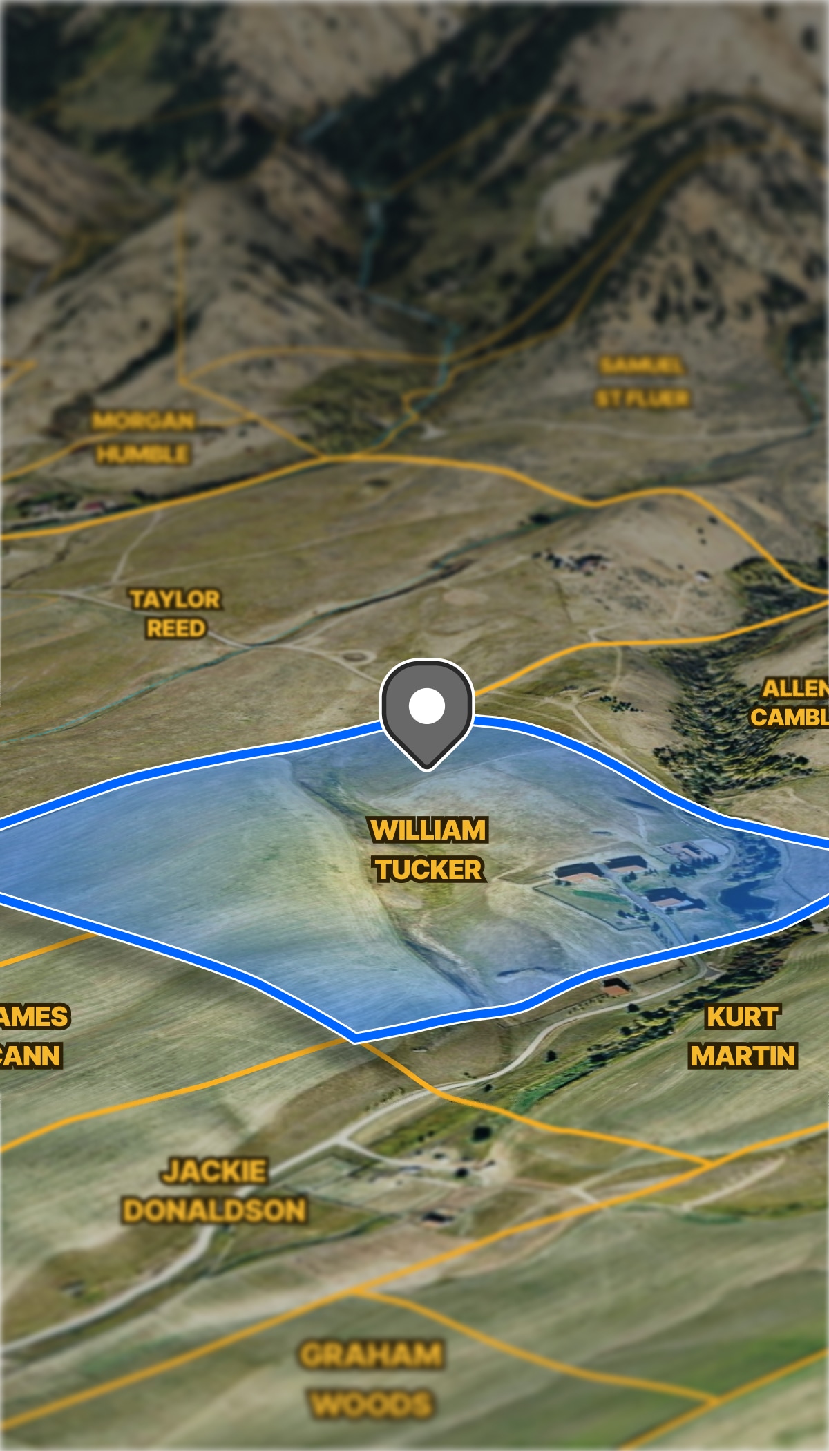
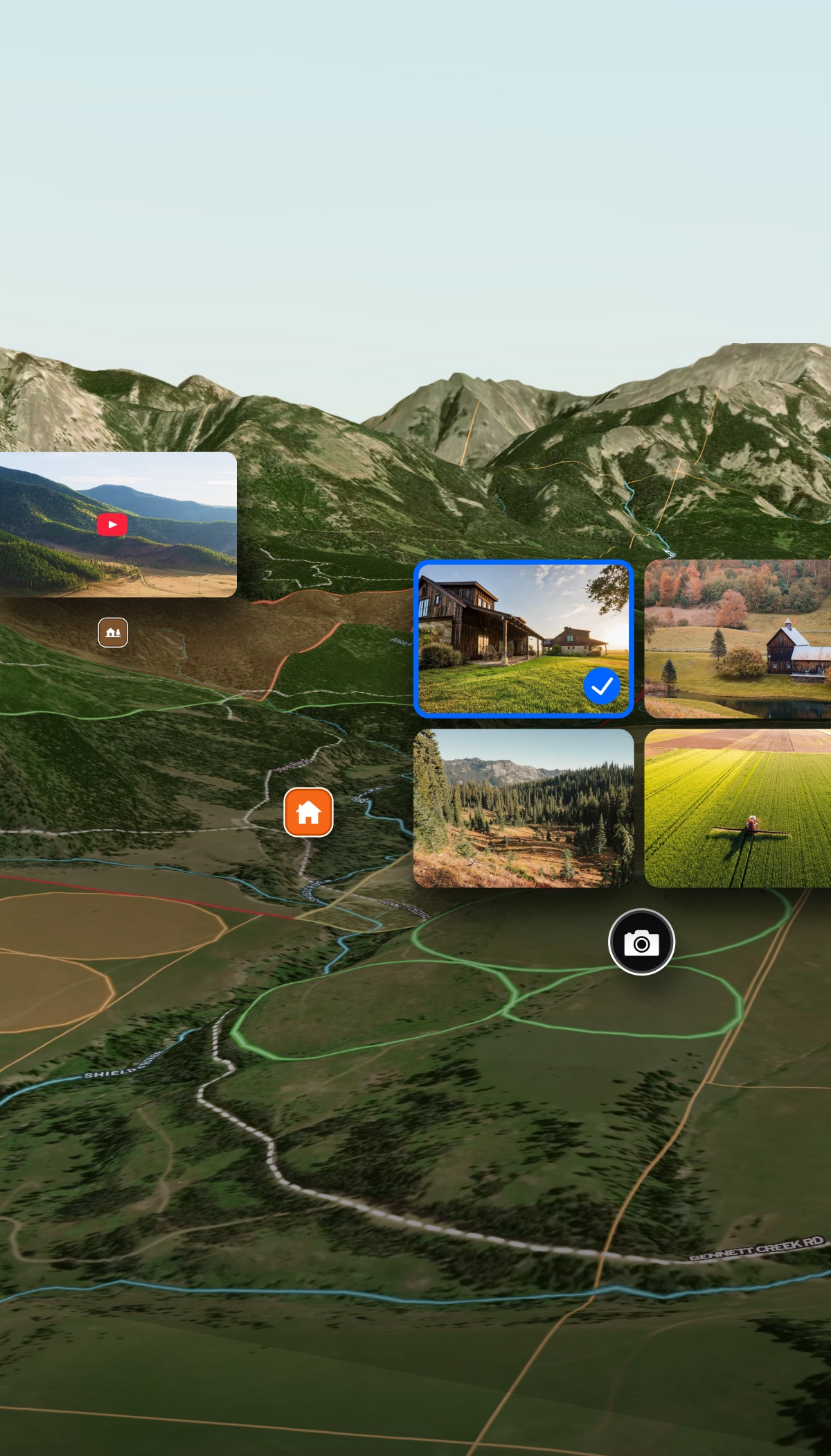
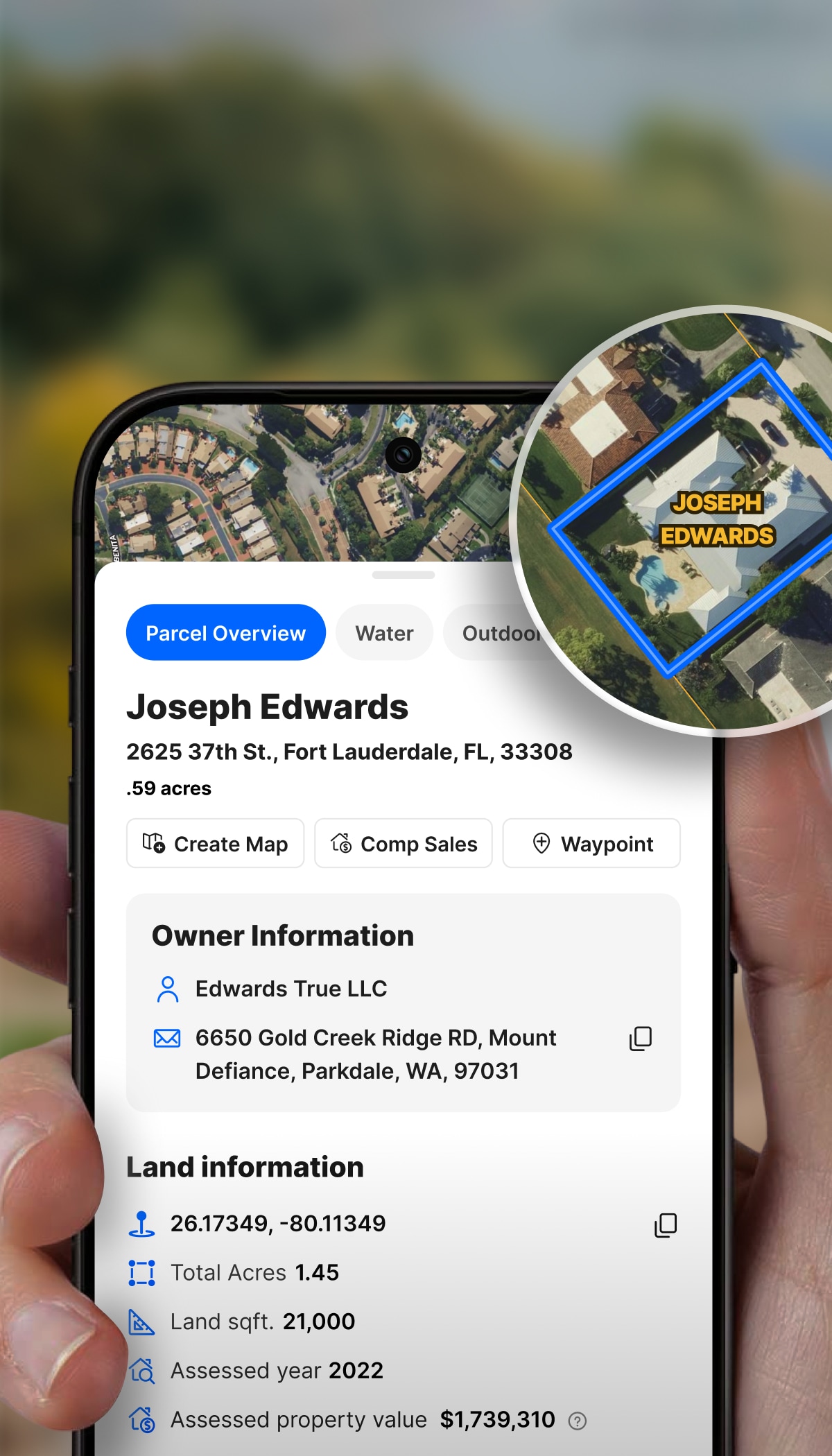
  • Track acquisition targets and owned properties with saved maps.
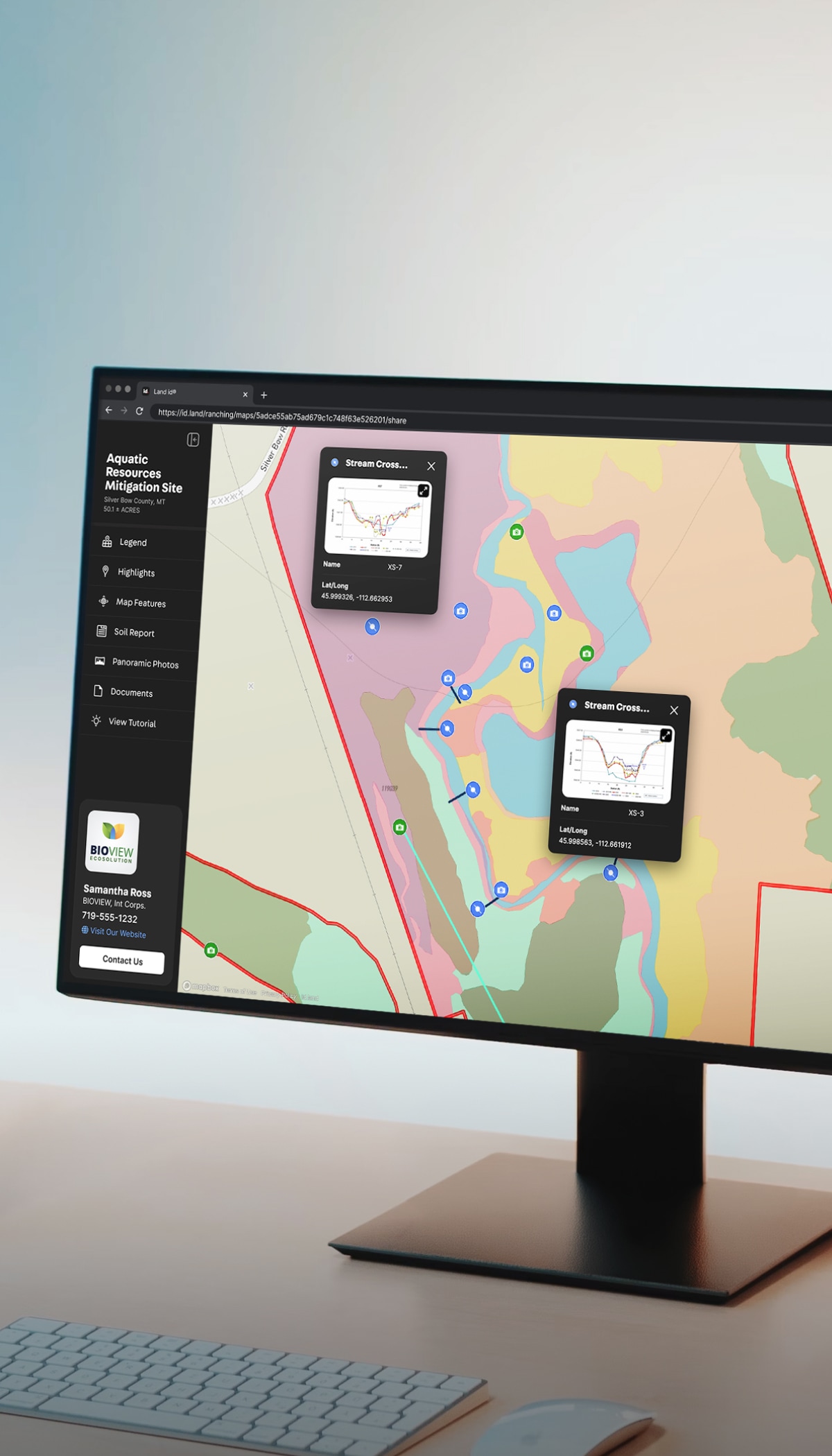
  • Share due diligence with co-investors via interactive and printable maps and reports.

Farm Managers & Ag Consultants

Show landowners field conditions and communicate plans visually.

  • Document drainage issues or soil problems with FSA overlays and photos.
  • Propose infrastructure improvements using contours and measurement tools.

Farm Real Estate Agents

Market farms and pre-qualify buyers with crucial land data.

More Resources

5 Ways to Prepare Your Land For The Growing Season

For all the farmers, gardeners, and growers out there, the growing season is fast approaching. Before we can start planting though, there’s a lot that needs to be done to get the earth ready. In the spirit of spring, we wanted to share a few of the myriad of ways you can prepare your land for a successful growing season.

Everything You Need To Know About Land Capability Classification

As a farmer or rancher, knowing your soil is vital to how you use your land – you wouldn’t want to waste your time and resources planting crops in an area they ultimately won’t be able to grow in.

How to Avoid Costly Mistakes With Accurate Land Measurements

FAQs

Does Land id include state-specific crop productivity indices like CSR2?

Does Land id show FSA Common Land Units (CLU)?

What soil data does Land id provide for farmland evaluation?

How is Land id different from the county GIS and USDA soil databases I already use?

Can I use Land id Pro to manage multiple properties or projects?