

Todd Peterson of ToddsFotos.com continues to raise the bar for real estate and agricultural marketing with his all-in-one online “toolbox” for agents. His platform brings together professional photos, marketing materials, production records, and now, interactive maps powered by Land id®, to create a comprehensive and visually compelling listing experience.
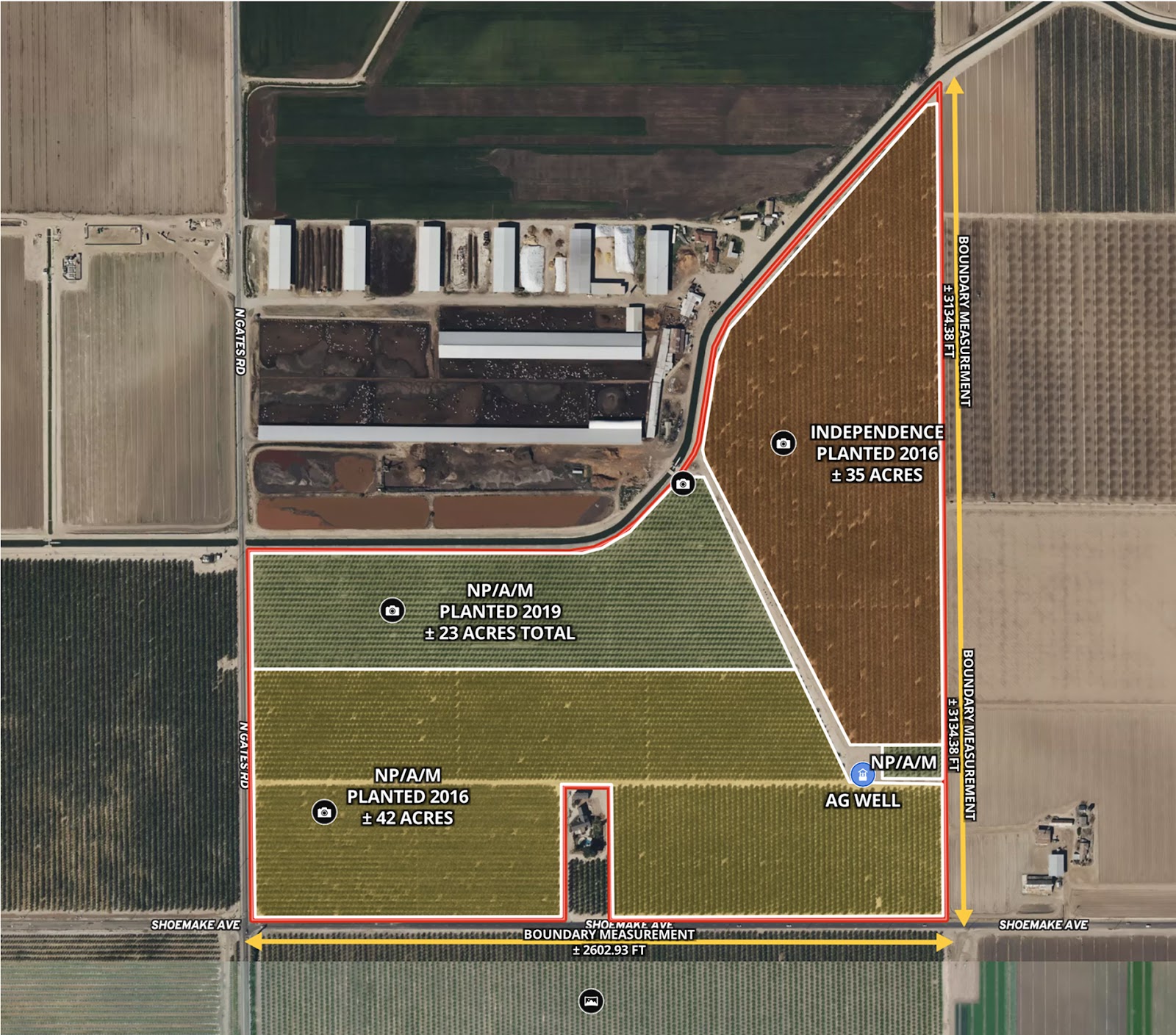
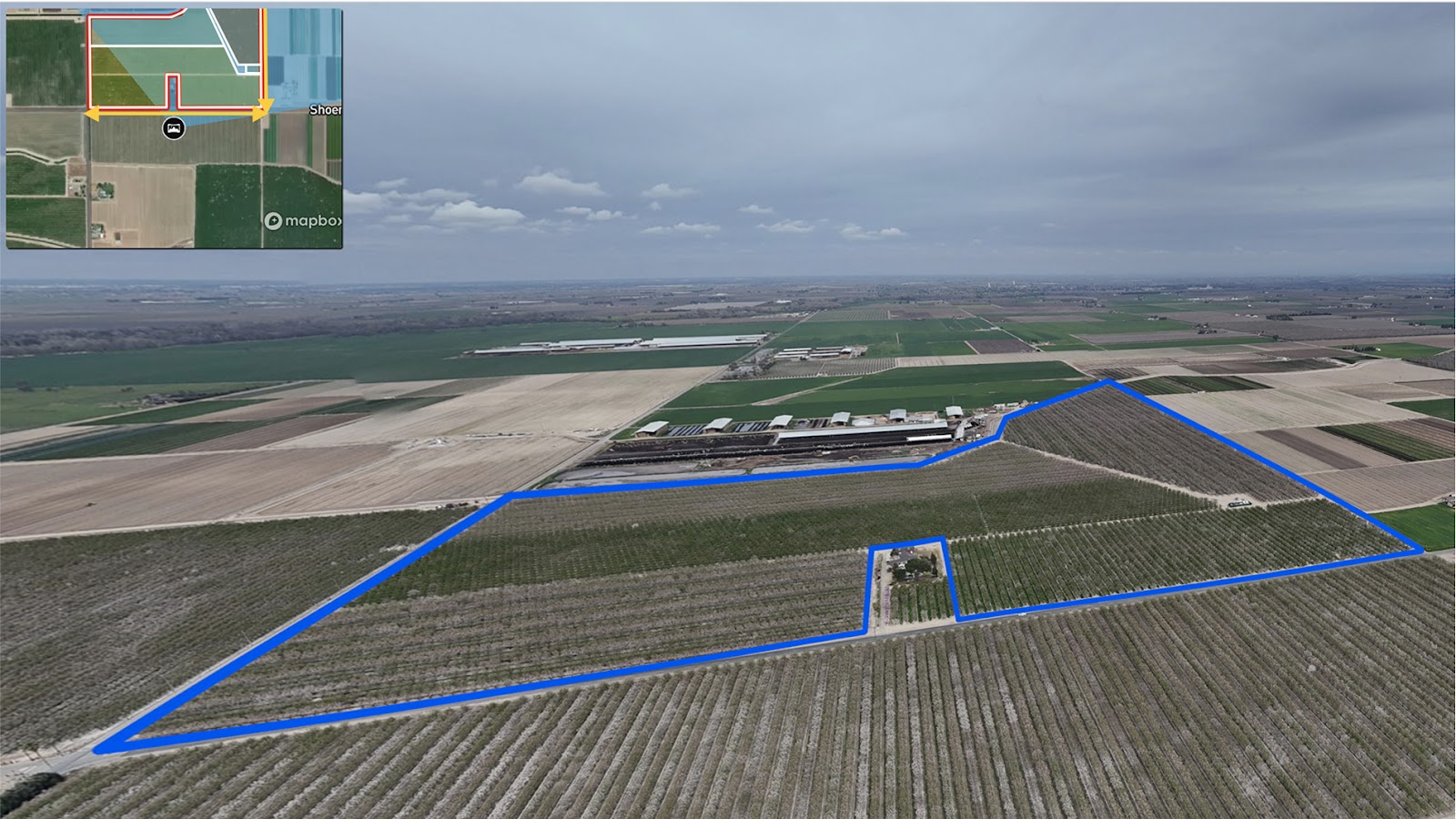
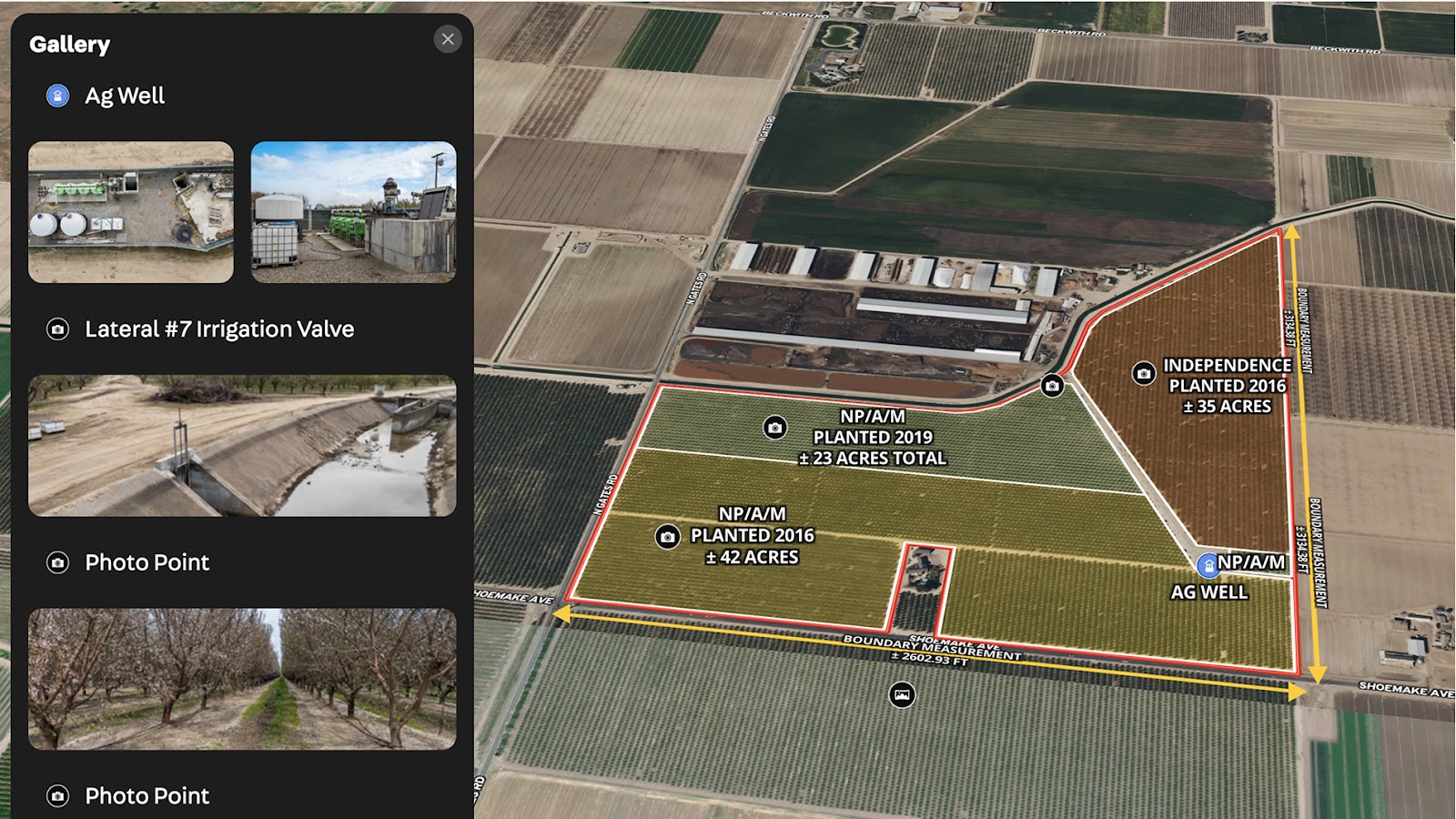
This custom map highlights a 107-acre almond farm in Stanislaus County, California. The property includes Nonpareil, Aldrich, and Monterey varieties planted in 2016 and 2019, along with Independence almonds planted in 2016. The map clearly outlines the layout of the blocks, access points, and supporting infrastructure, giving prospective buyers a complete view of the farm's production footprint.
By embedding Land id maps, Todd helps agents showcase property details with clarity and confidence—offering an edge in a competitive market and delivering a modern experience buyers appreciate.
Learn How to Create a Map Like This:
- How to make maps in Land id
- Draw detailed maps by adding items
- Add labels to maps and mapped items
- How to embed photos, videos, 360° walkthroughs, and more onto your map
- Add panoramic images
- Measurement tool
Keep Exploring


5.6 Acre Rural Listing in Bozeman, MT

Commercial Real Estate Off-Market Prospecting

Subdivided Lots for Sale

Data Center Development Site Analysis
Take Your Mapping to the Next Level
Mapping is just the beginning. Land id is the #1 tool for researching, discovering, and showcasing land, and we're here to help you make the most of it, every step of the way.

