

Map Categories
Thank you! Your submission has been received!
Oops! Something went wrong while submitting the form.
000
,
000

Farm & Ranch
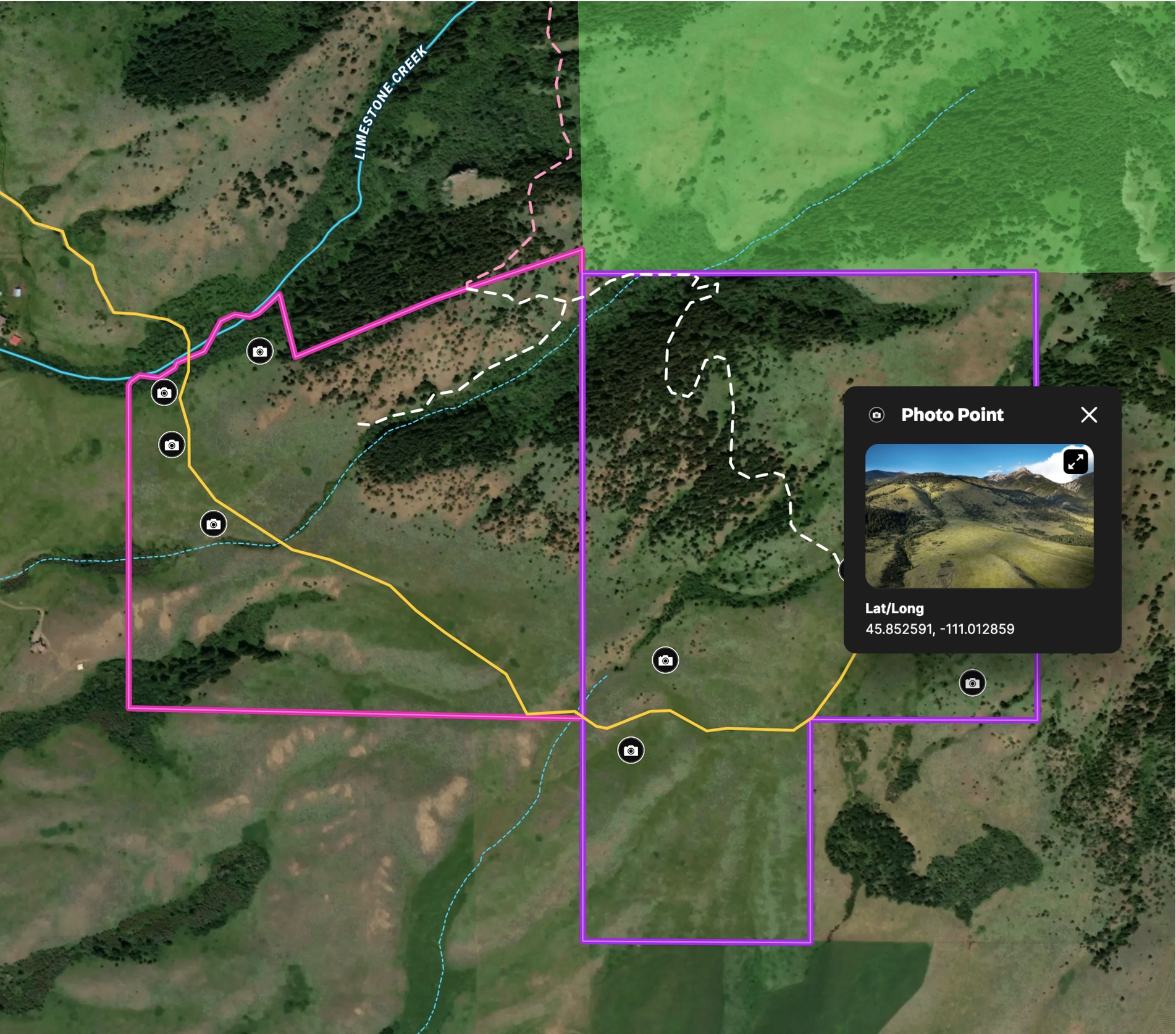
Ranch in Bridger Foothills
Land id® GIS mapping software creates a detailed property map of this 341-acre land parcel, showcasing trails, access, and views.
Listing
Rural
Hunt


Real Estate
Sandy Creek Ranch
Harlan Ray uses Land id®'s real estate mapping software every day to create detailed property maps, build relationships and showcase expertise.
Listing
Rural
Luxury
Hunt
Agricultural
Farm & Ranch
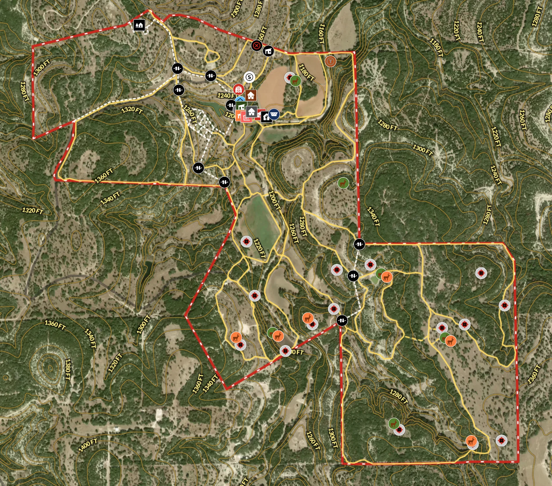
Recreational Ranch in Texas
Land id® transforms land ownership, enabling owners to craft detailed property maps of ranch amenities.
Hunt
Rural
Land owner
Land management