


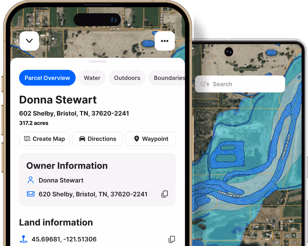


Extensive Parcel Data,
Property Lines, &
Map Creation
Parcel data and map layers are just a swipe away. Tab through detailed parcel info and rich map overlays to access the property data you need.

Get nationwide property boundaries and extensive private and pubic property data on your desktop and mobile devices.
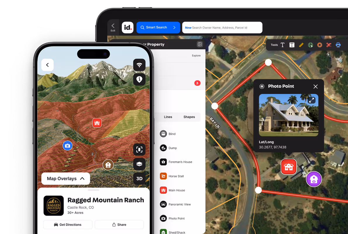
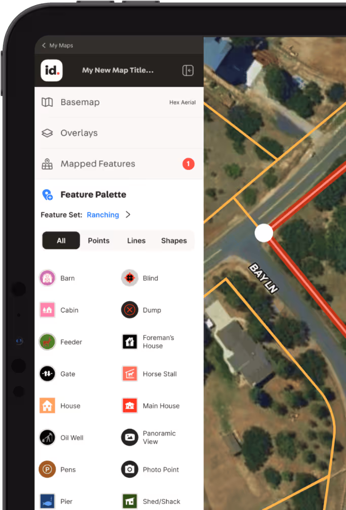
Create Property
Maps
Create and share maps that go beyond static visuals. Add property lines, boundaries, features, and data in an interactive format that brings your property to life.


Create, Embed, & Showcase Custom Branded Property Maps
Unleash the power of dynamic, interactive property maps that showcase every aspect of your land and listings.

Create personalized maps for your real estate listings, projects, and beyond with Land id on your desktop and mobile devices.
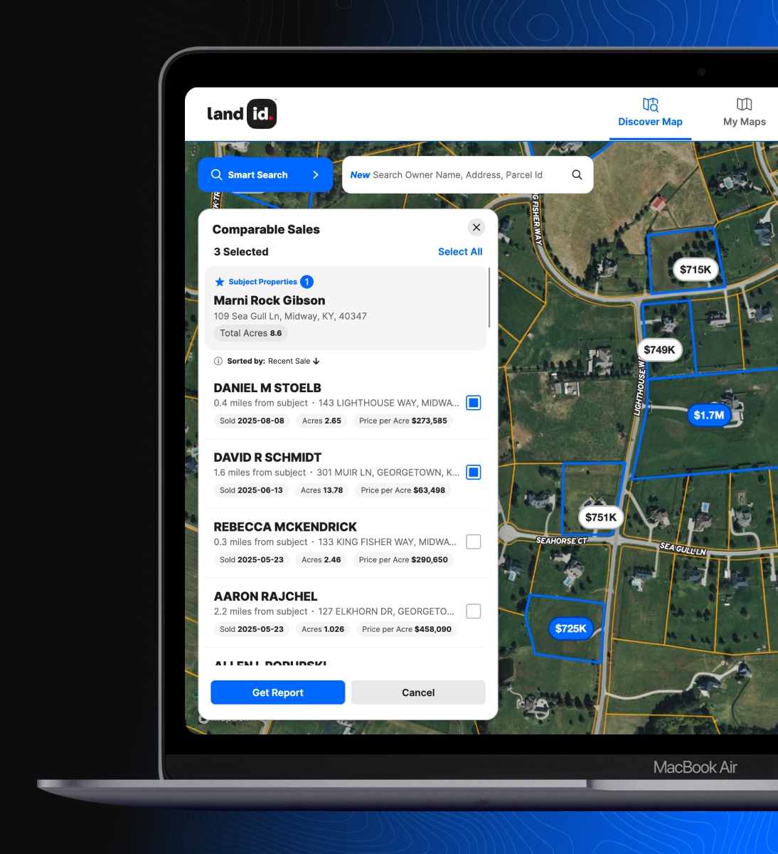
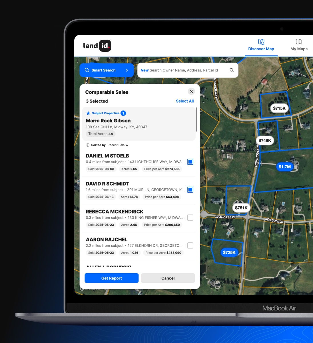
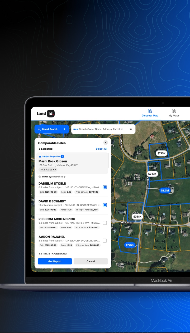
Comps Reports Made Easy
Generate professional, data-backed comparable sales reports in minutes. Defend the price, win more listings, and outsell competitors.

Embed Maps in Listings & More
Include your name, logo, and contact info. Seamlessly embed your interactive maps on any website or listing services.

Share Branded Maps with Anyone
Share the full potential of your property maps with colleagues, customers, and more via the web, email, and text.


Trusted by the Industry Pros Nationwide


Powerful Property Analysis & Tools, Tailored to You.
Enjoy the Land id® and Land id Pro plans on your phone and the web
Compare Plans


Map Creation

Core Features
Mapping & Pro Tools
All Plans Include Contextual Land Info, Basemaps, & Overlays
Enjoy the Land id and Land id Pro plans on your phone and the web.
Property Information
Owner Info
 Current Owner Name
 Owner’s Address
Land Info
 Total Acres
 Land Square Feet
 Assessed Value
 Land Value
 Land Use
 Property ID Number
Tax Info
 Sales Price & Date
 Mortgage Amount & Length
 Property Taxes
- Improvement Value
 Transaction Type
 Lender & Title Company
Building Info
 Building Type
 Number of Buildings
 Year Built
 Square Footage
 Bedrooms & Baths
 Energy Use Type
 Construction Type
 AC & Heating
7 Basemaps and Over 40 Map Overlays
Maps
 Satellite & aerial basemaps
- Modern & vintage USGS topo maps
- Contoured Explore Map & Street Map
Water Layers
- Surface Water
- FEMA Floodplain
- Wetlands
- Water Wells
- Aquifers: Principal, Major & Minor
- Water Districts
- CCN Water Utilities
- FEMA Panels & LOMRs
- 8-Digit Hydrologic Unit Codes (HUC)
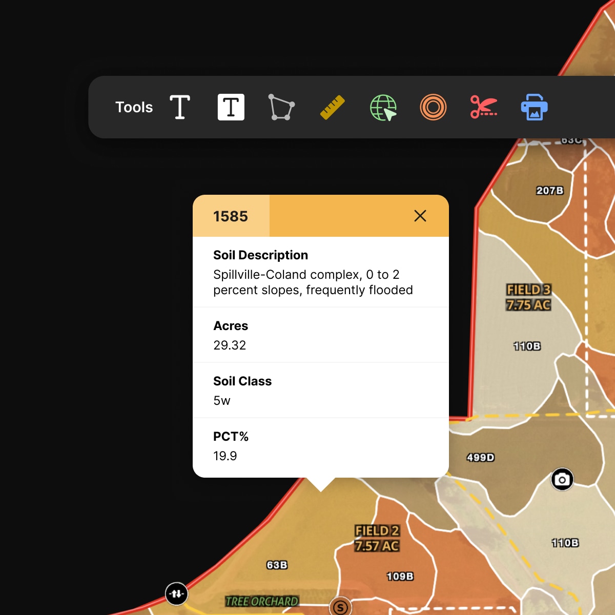
Soil Layer
- Soil Composition & Use
Infrastructure Layers
- Pipelines
- Oil Wells
- Transmission Lines
- Substations
- Fiber Optic Services
- Airports & Railroads
- Solar Farms, Wind Farms & Wind Turbines
- Ind. System Operators
- Power Plants
Property Layers
- Nationwide Public & Private Boundaries
- Property Owner Names
Outdoor Layers
- Contour Lines
- Fed/State Land
- Summits and Gaps
- Wilderness Areas
- Game Mgmt Areas
Boundary Layers
- Land Use
- City Limits
- Schools: Elementary, Secondary, Unified
- Opportunity Zones
- Zip Code Tabulation
- Townships
- PLSS
- Abstracts
- Conservation Easements
- County Lines
- FSA CLU
Nearby Layers
- Housing Developments
- Points of Interest
- Summits and Gaps
- Wilderness Areas
- Grazing Allotments