
Map Categories
Thank you! Your submission has been received!
Oops! Something went wrong while submitting the form.
000
,
000

Real Estate
Buyer Representation Map
Save time with our mapping tool for real estate, allowing buyers to filter potential properties interactively before visiting.
Rural
Agricultural


Recreation & Fun
RV Campsite Near Glacier National Park
Use our campground map maker to dynamically showcase campground amenities and site details.
Campgrounds
Rural
Real Estate
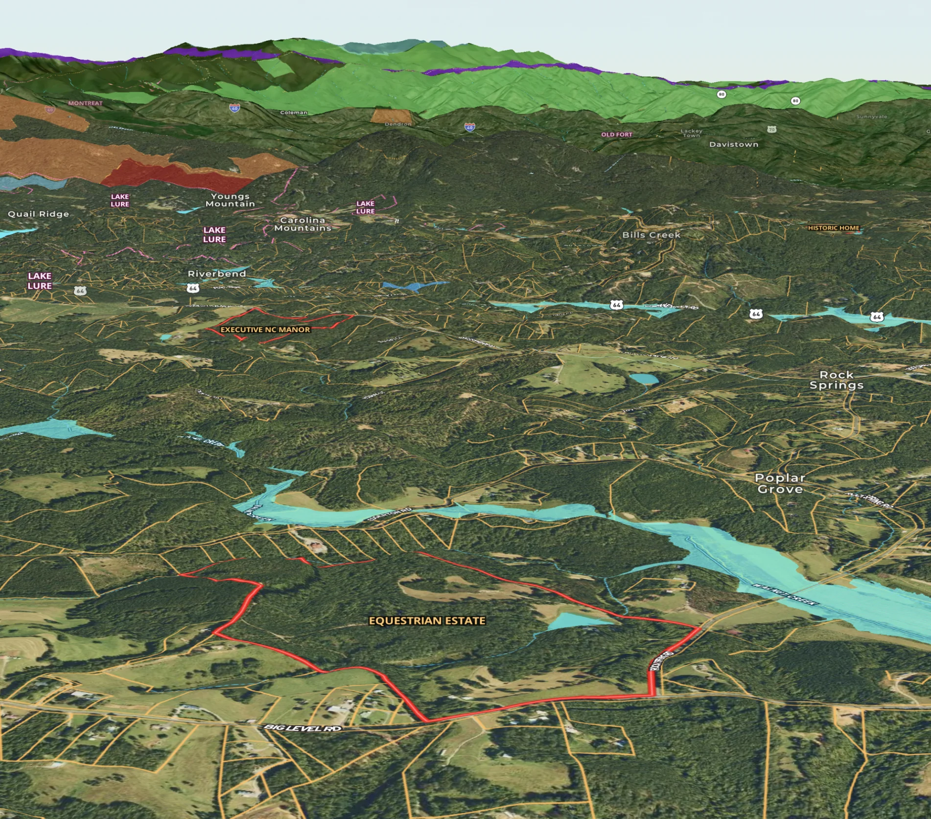
Neighborhood Development Project in Texas
Use Land id's real estate map maker to vividly present new developments, from trails to parks, enhancing buyer understanding.
Homebuilders
Property Development
Rural
Residential
Listing

Planning
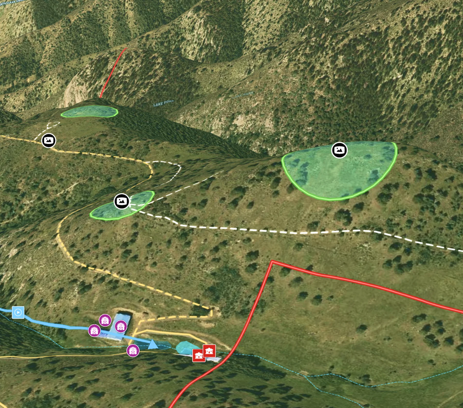
Potential Build Sites on Colorado Mountain Ranch
Enhance remote property planning with Land id®, integrating 360° views and drone paths for informed landowner choices.
Rural
Land owner
Land management
Panoramics

Real Estate
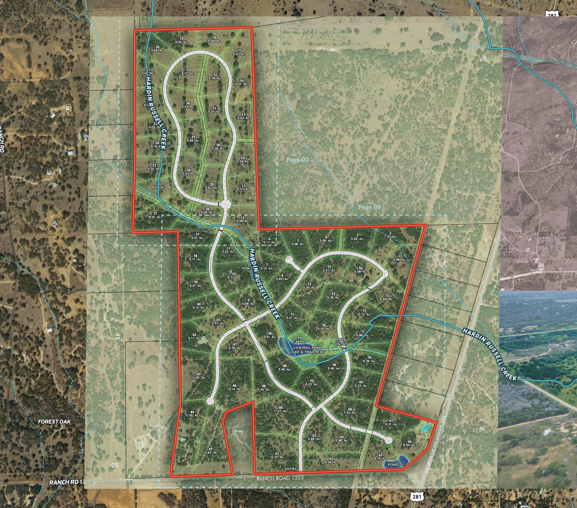
Subdivided Lots for Sale
Simplify how you subdivide a parcel of land with Land id's cut tool.
Property Development
Rural
Homebuilders
Listing

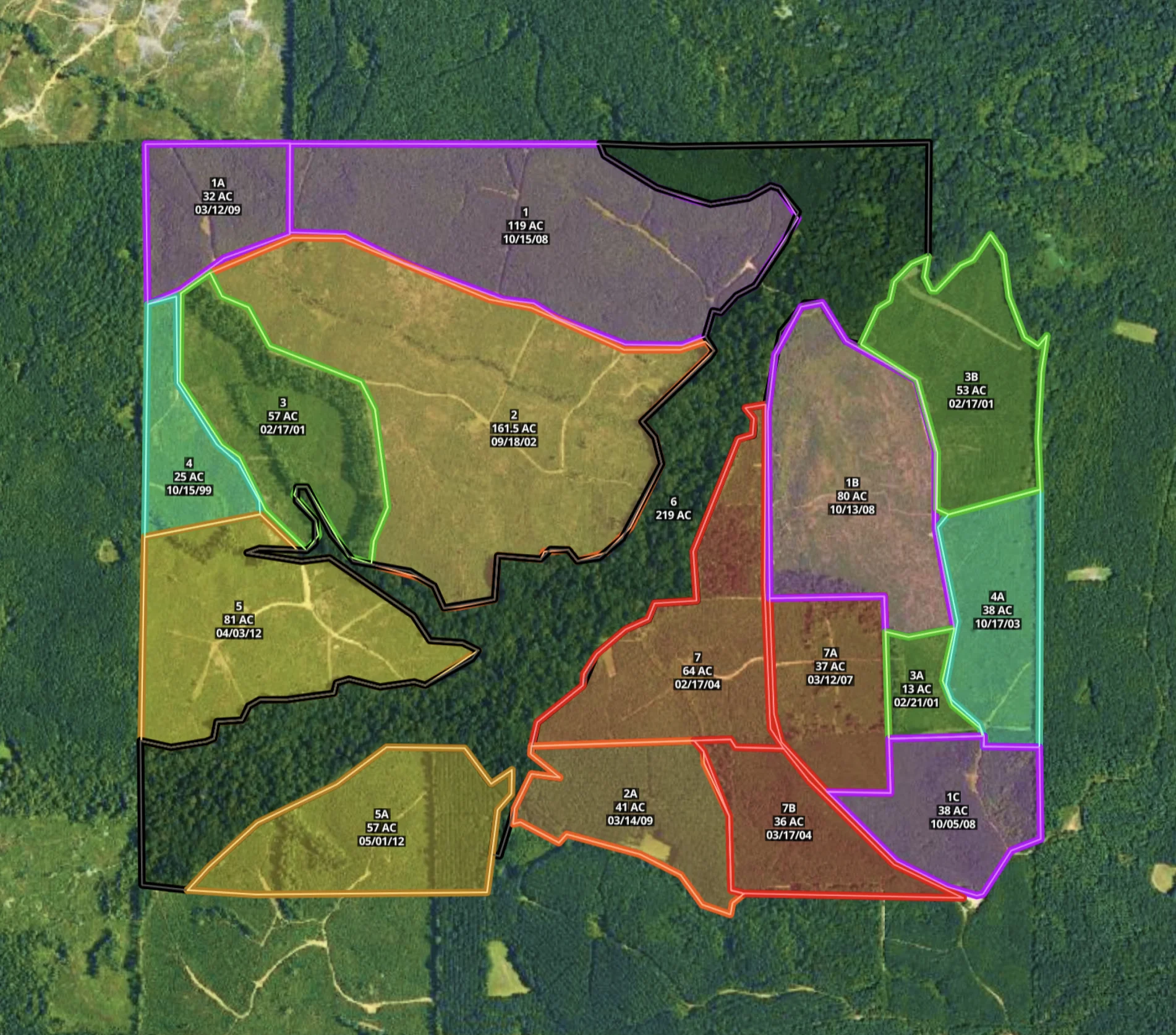
Farm & Ranch
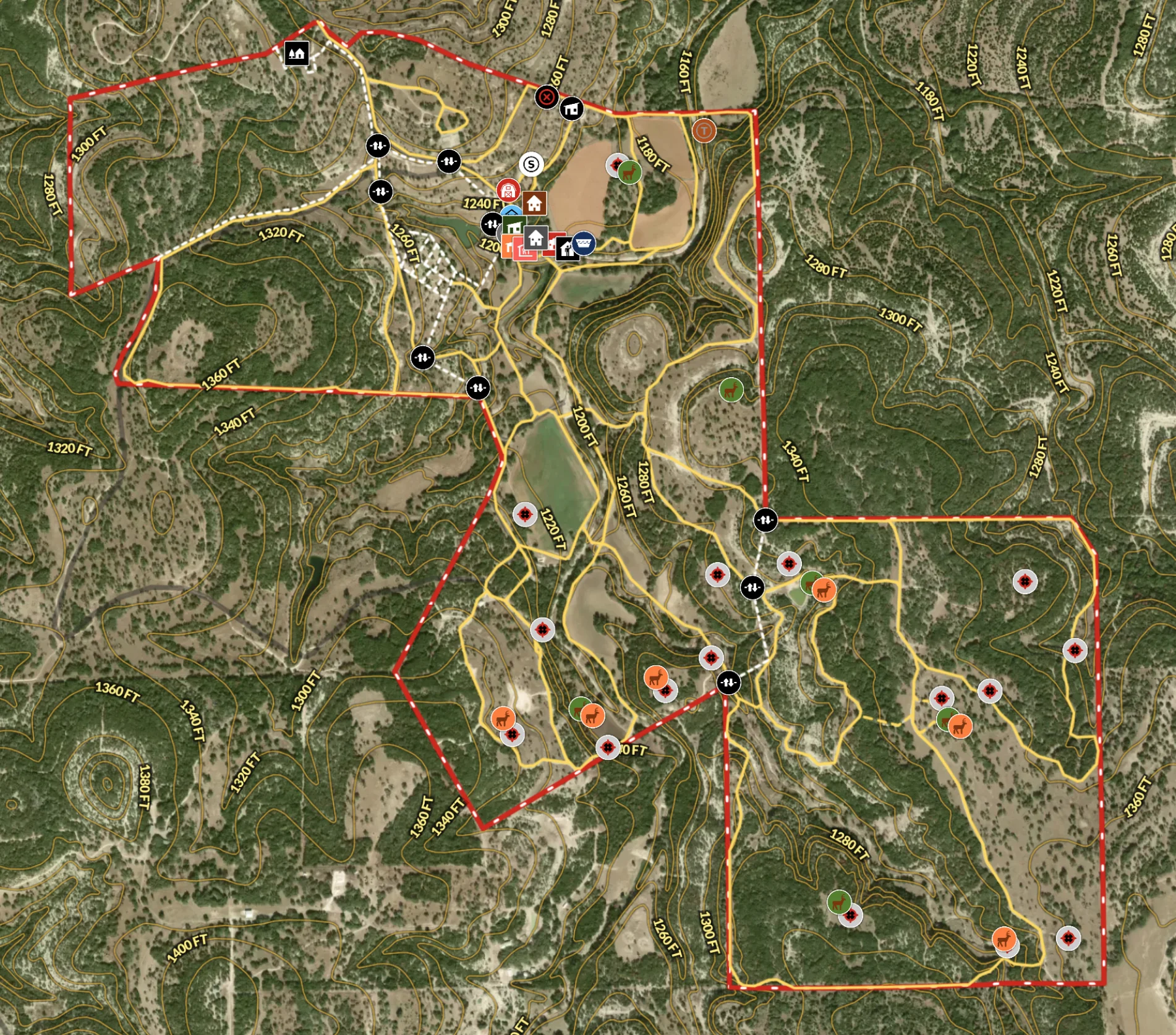
Recreational Ranch in Texas
Land id® transforms land ownership, enabling owners to craft detailed property maps of ranch amenities.
Hunt
Rural
Land owner
Land management

Real Estate
Wildflower Ranch in Colorado
Supercharge your listing strategy with our cutting-edge real estate mapping tools.
Campgrounds
Water
Rural
Luxury
Listing
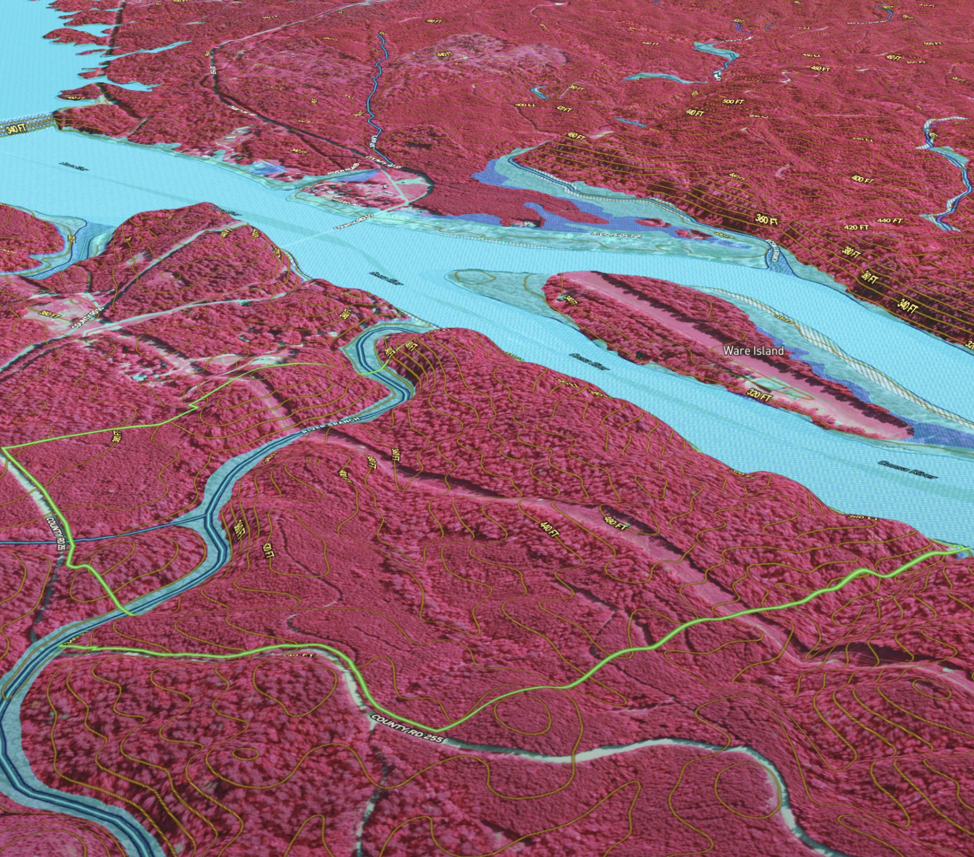

Natural Resources
Developing & Assessing Timberlands
Maximize timberland potential with Land id®, featuring Infrared Basemap, soil reports, and essential forestry GIS overlays.
Timber
Soil
Listing
Rural
Forestry
Real Estate
Comparable Sales
Optimize real estate pricing with Land id®. Create a visual real estate database to track and justify property values effectively.
Luxury
Residential
Agricultural
Commercial
Rural
%2520off%2520Blanco%2520River%2520-%2520Thumbnail.webp)
Real Estate
Residential Listing (7.5 Acres) Off Blanco River
Enhance your property listing strategy with Land id's real estate mapping software.
Luxury
Residential
Water
Rural
Listing
Natural Resources
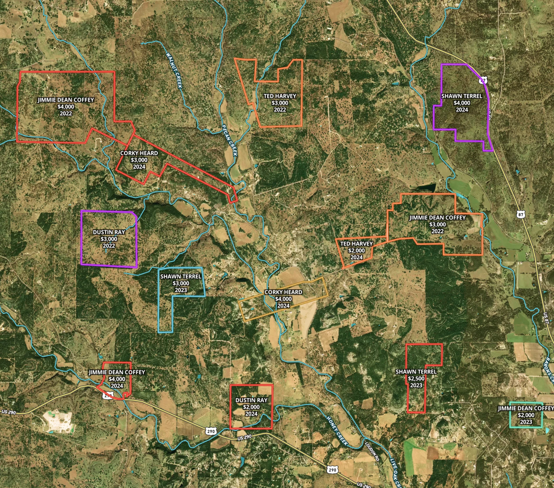
Mississippi Timber Stand Map
Boost your timber sales strategy with Land id®, creating interactive timber maps that highlight timber stand features and access.
Forestry
Timber
Soil
Listing
Rural
Farm & Ranch
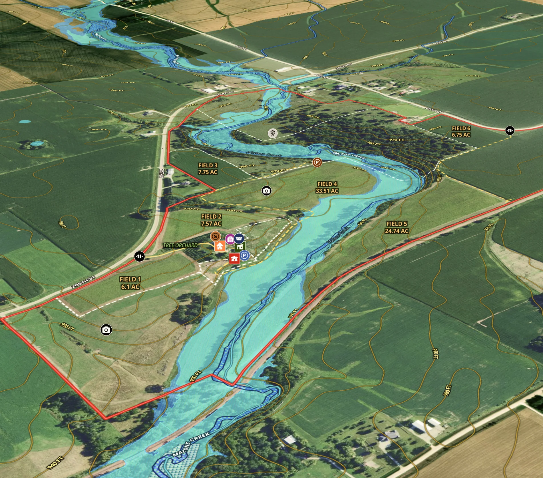
Agricultural Listing for Iowa Farm
Revolutionize farm listings with our real estate mapping software, integrating soil reports and multimedia for a standout presentation.
Agricultural
Listing
Rural
Water
Soil
Farm & Ranch
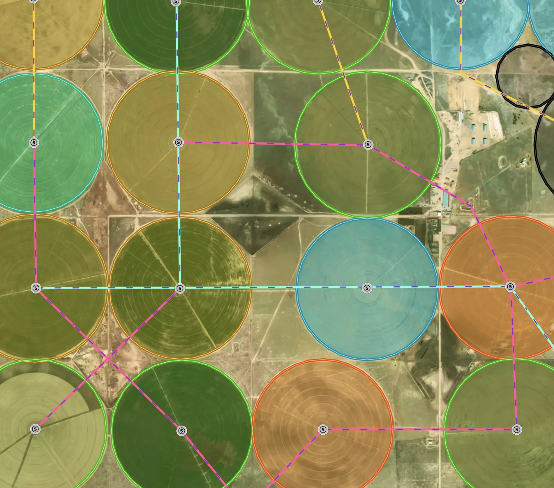
Managing a New Mexico Farm
Elevate farm efficiency with Land id®: Advanced agriculture GIS, field mapping software, and parcel maps for optimized crop and irrigation planning.
Agricultural
Soil
Water
Land owner
Land management
Farm & Ranch
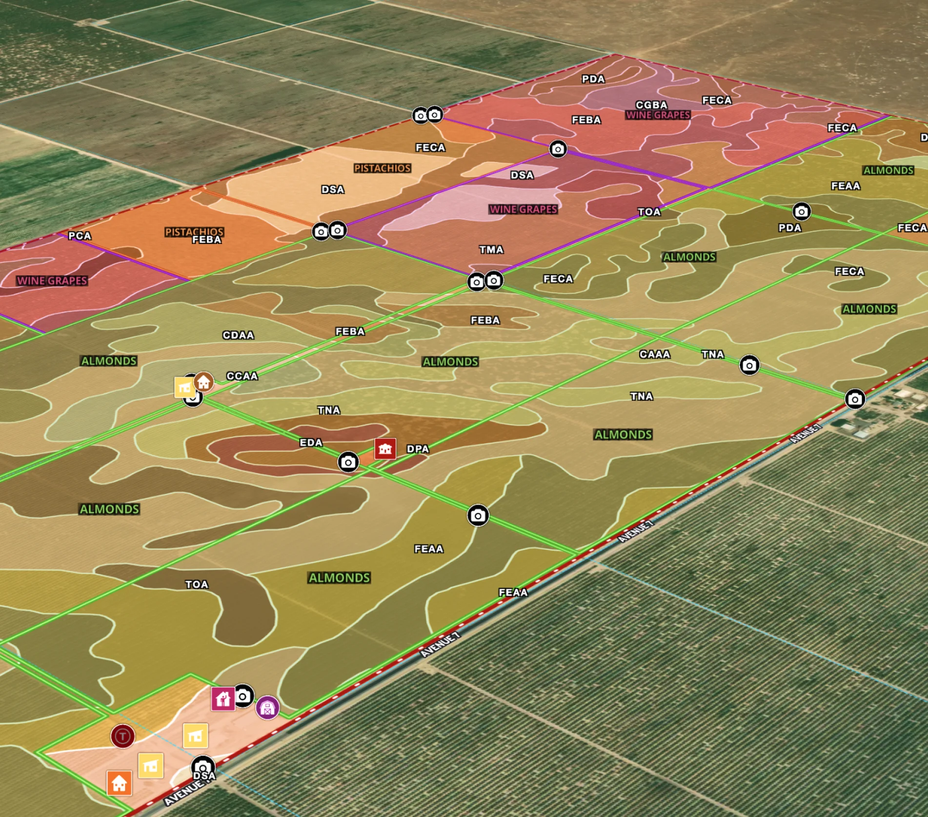
Agricultural Property Appraisal Report
Streamline your land appraisal process with Land id®, where every crop, building, and land feature is captured in an interactive map.
Appraisals
Rural