



This is Part Three in our prospecting series. Catch up with Part One, Prospecting for Seller Leads and Part Two, Finding Off-Market Properties.
Real estate developers and investors devote extensive energy and significant money to finding the right property for their next project. Rarely is the process cohesive or strategic.
They send mailers, contact agents and vendor partners, rack up endless road miles, and rely on data providers to reveal what “might” be a good fit.
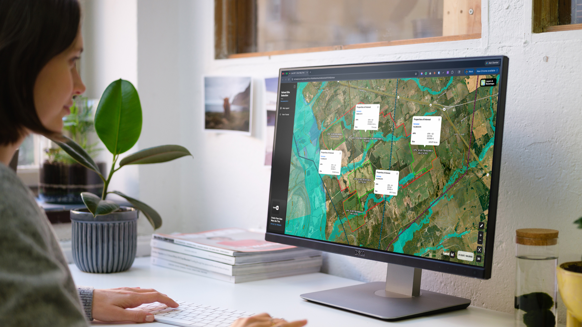
There are much better ways, however. A unified, single source of extensive land and parcel data accompanied by their ownership details. Land id can transform a scattershot approach to land due diligence and dial it into a strategic, intuitive advantage.
Land demands context to be valuable. Dynamic, data-enriched maps offer the most fundamentally transparent method for translating physical acreage into actionable business intelligence. Knowing what’s under, around, and above a potential parcel makes the prospecting effort much more fruitful. And when offered in a single solution, time is saved by the week, not the minute.
Off-Market Confidence
Investors and developers need a better method for understanding real estate data—a solution that produces results in less time and offers more confidence at the start of the transaction. And whenever possible, it helps to discover an opportunity before the competition.
Land id produces rich, verifiable reports on any parcel of land across the country. It doesn’t need to be active in an MLS or known only to local agents. Merely pick a parcel to learn owner information, size, boundaries, assessed value, mortgage holder, tax data, and whatever else is needed to know if a parcel is worth pursuing.
Off-market doesn’t mean you need to work harder in your due diligence. Flood plains, wetlands, and terrain challenges are all a tap away. Aerial tours, existing structures, and even soil makeup are at the ready. Land id often knows more about a parcel than its owner, giving any investor a powerful knowledge base to use when pitching a purchase.
How to Pull Parcel Data in Land id
- Open Land id and enter any basic search terms to the AI Smart Search field, such as a city of interest, APN, reference address, or owner name, or start by scrolling nationally to a region of interest.
- Click any parcel of interest to view its Property Details Card.
- Scroll the card for relevant property information, toggling between Water data overlays, Boundaries, Soil, Housing Development, Land Use, and more
- Consider quick calculations of frontage and acreage, insert pertinent waypoints, save, and share your map.
Watch these step-by-step videos for two common prospecting scenarios and how to do it in Land id.
One-Stop Mailing Lists
Land buyers can finally delete the browser bookmark for their local tax record website. Everything you need to know about land owners is on board, along with tools for simple database creation.
Land id offers three different location selection tools to generate mail-ready downloadable files that any user or mailhouse can use to execute regular mail campaigns. This alleviates the need to purchase data from third-party mailhouses, thus reducing costs and campaign delays.
That data can also be input into any third-party CRM or marketing tool to build long-term nurture campaigns and smarter, trackable, and more sophisticated outreach strategies. This is another compelling example of how Land id’s integrated data and outreach features eliminate the need to start fresh every time a land investment is in the pipeline.
How to Create a Prospecting Mailing List in Land id
Opportunity Comparison
Land id built a tool for creating map-based custom comparable sales libraries, an ideal way to always know what’s happening in the market and to narrow down the best opportunity among many.
Start with your own recent acquisition or base your survey on a targeted parcel. The database can use any number of parcel attributes as the centerpoint search, such as year sold, size, price-per-acre, or the brokerage that sold it. Comparative stats are color-coded when displayed and can be graphically visualized across all findings for easy juxtaposition of findings.
Any database you build is repeatable and accessible in the Land id Legend. Jump between any attribute and dive deeper into the market-specific value drivers.
See an Example
Shareable Maps
Land prospecting is a multi-step process. Finding the property is merely step one. After that, investors need to present their findings to financial and operational partners. Naturally, they want to know as much as they can about what’s next.
Land id’s custom map creation enables users to generate custom maps for intricately showcasing the most compelling characteristics of a subject property. This is one of our most-accessed features because of its visually engaging presentation and the variety of insights it displays.
Custom maps use labels and icons, data layers, text input, high-resolution images, measurements, 3D panoramas and even video embeds that coalesce into a comprehensive, single source of real estate due diligence. Imagine recording yourself on-site, explaining a property feature to partners that makes the deal uniquely valuable. That’s the power of custom mapping with Land id.
Any custom map can be presented at meetings or shared via email to stakeholders, once again helping alleviate the burden of your prospecting efforts.
How to Share Maps in Land id
The Land id Advantage
The four advantages to prospecting with Land id share a common thread: replacing fragmented, time-consuming workflows that have defined land investing for decades with a single, intelligent platform.
Off-market confidence means finding opportunities before they're widely known. One-stop marketing means building and executing outreach without stitching together outside vendors. Opportunity comparison means making sharper acquisition decisions backed by visual, data-rich context. And shareable maps mean partners and stakeholders get the full picture—quickly and compellingly.
Most land investors and developers are still operating with a patchwork of tools, legacy data, and manual processes. Land id users aren't. They're prospecting smarter, moving faster, and presenting more professionally than the competition at every stage of the deal cycle. In markets like this, the best opportunities are often won by whoever gets there first.
You don’t want to be the other person.
FAQs
See Land id In Action
Research, analyze, share, and showcase real estate, all in one place.
Continue Reading
Real Estate Storytelling: Turn Property Data Into a Story Buyers Can Follow

By Land id
Real estate storytelling turns property data into answers buyers can follow and sellers can trust. See how agents use Land id AI Insights at every showing.
.jpg)
Using Property Data Software to Improve Land Valuation
By Land id
Pricing raw land can be tricky. The right property data software can eliminate the guesswork, speed up the process, and help you defend pricing.


Explore Private Parcel Data & Property Boundaries
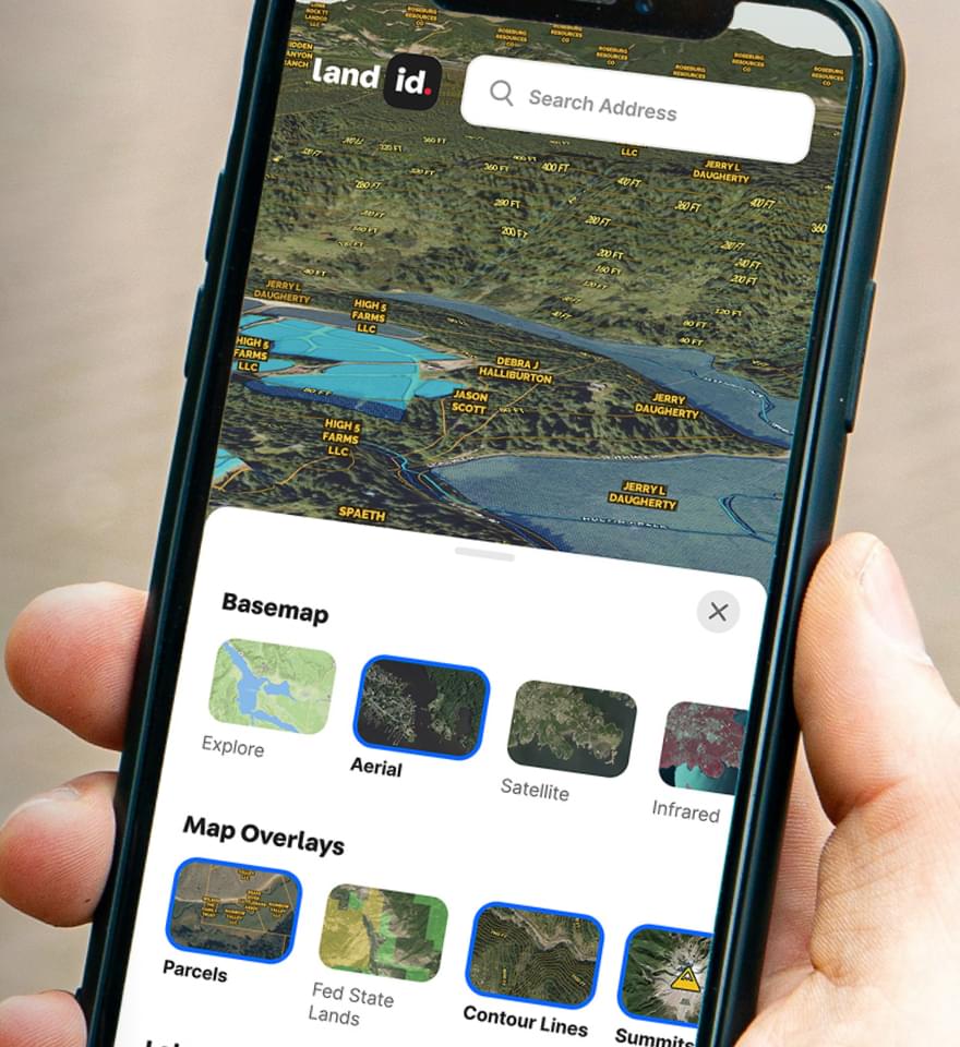
Download the Land id app and try for free.


