


A listing can tell you the bedrooms, acreage, price, and year built. Photos and video show you more. But understanding what a property is really like still takes a lot of digging, explaining, and back-and-forth.
Where does the water go when it floods? How much of the land is buildable? What does “walkable” really mean for this listing? What surrounds the property today, and what could change tomorrow?
The answers have always existed in Land id’s property data. The hard part has been interpreting the data, explaining it clearly, and taking action on it.
That is, until now. Introducing The Land id®—our flagship solution for delivering the right answers to any question about any property in the U.S. in a way you’ve never seen before.
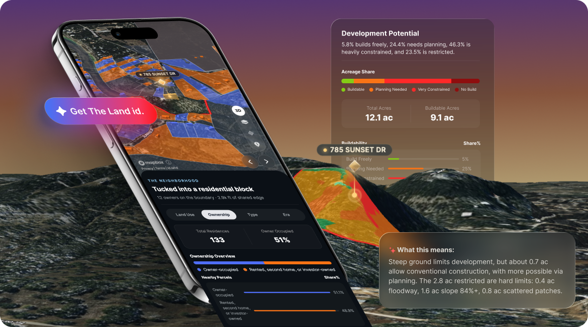
With the Land id, you can pull up any property and get an easy-to-understand summary of what the parcel and map data mean about that specific place. It answers every question in plain language, alongside the map and data behind it.
And now, you can send that understanding to someone else in one link.
Soon, when you want the complete picture of a property, you’ll simply say: “Send Me The Land id.”
What Is The Land id?
The Land id is a new way to get the right answers and share insights about a property.
Land id has always given people access to deep property information: boundaries, ownership, terrain, water, land use, environmental data, surrounding parcels, and dozens of map layers.
Now, Land id AI Insights helps make sense of it in an interactive, shareable output: The Land id.
Instead of opening layer after layer and figuring out what each one means on your own, the Land id connects the relevant information into a clear, property-specific story. It can help surface how the land lies, where water may affect it, what surrounds it, and which characteristics deserve a closer look.
And because the explanation stays connected to the map, you can see what the insight is referring to as you read it.
So when a buyer asks about the slope behind the house, you have more than a number. When a seller wants to know what makes their acreage stand out, you have more than a set of parcel facts.
You have a clearer picture of the property—and something you can share.
Property Data & Insights Are Now Shareable
Knowing something is useful. Being able to hand that understanding to someone else—like a prospective buyer or seller—is a game-changer.
From any parcel card, you can now tap to send the Land id with a link, and your recipient can explore it on their phone or desktop.
A buyer can look through the property before deciding whether to make the drive. A seller can revisit what you showed them after a listing appointment. A client who wants to understand the terrain or water can see it instead of trying to picture what you described over the phone.
One property. One link. The context stays with it.
Powered by Land id Intelligence
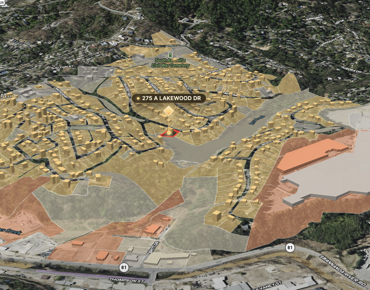
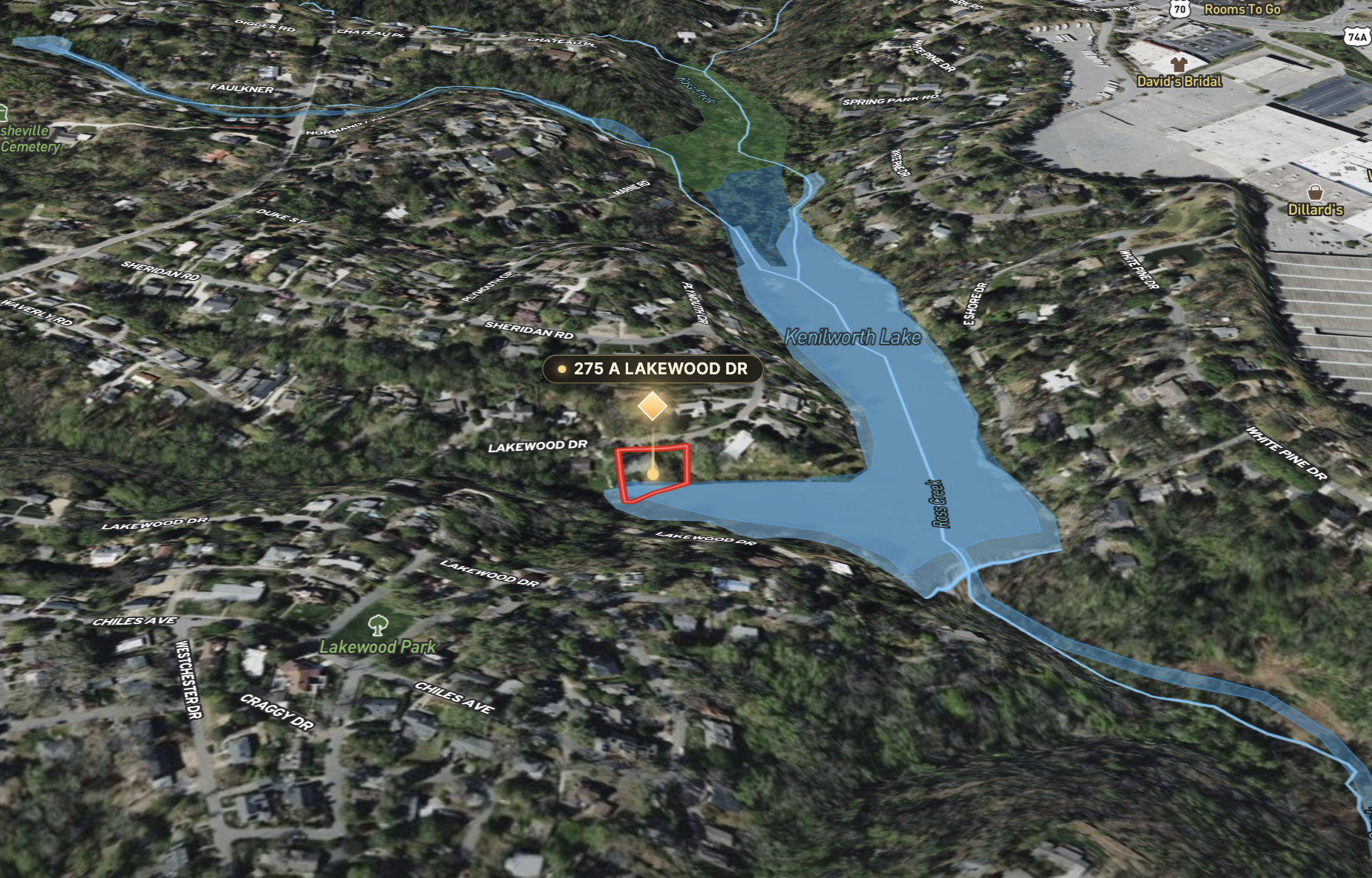
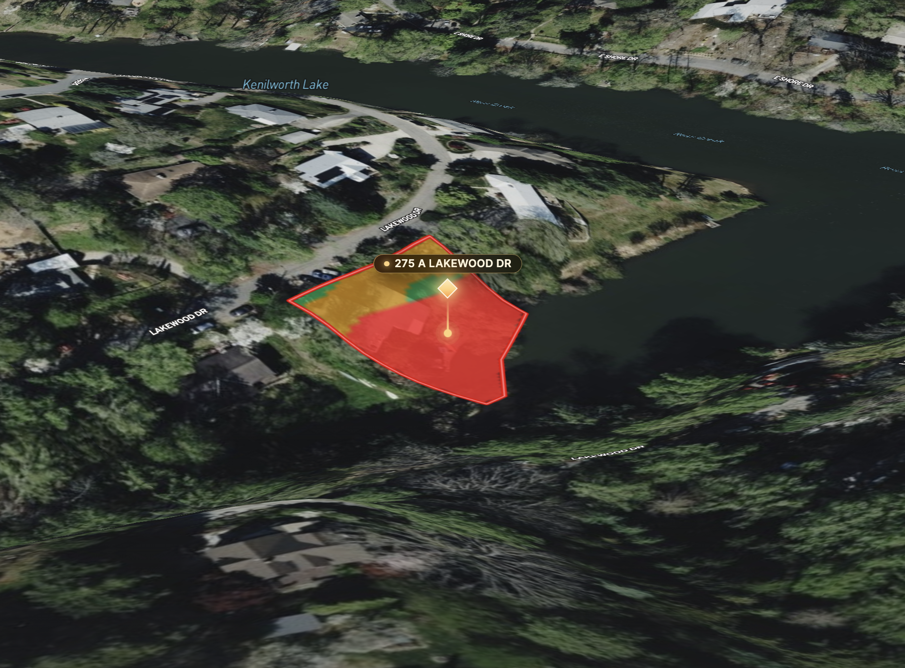
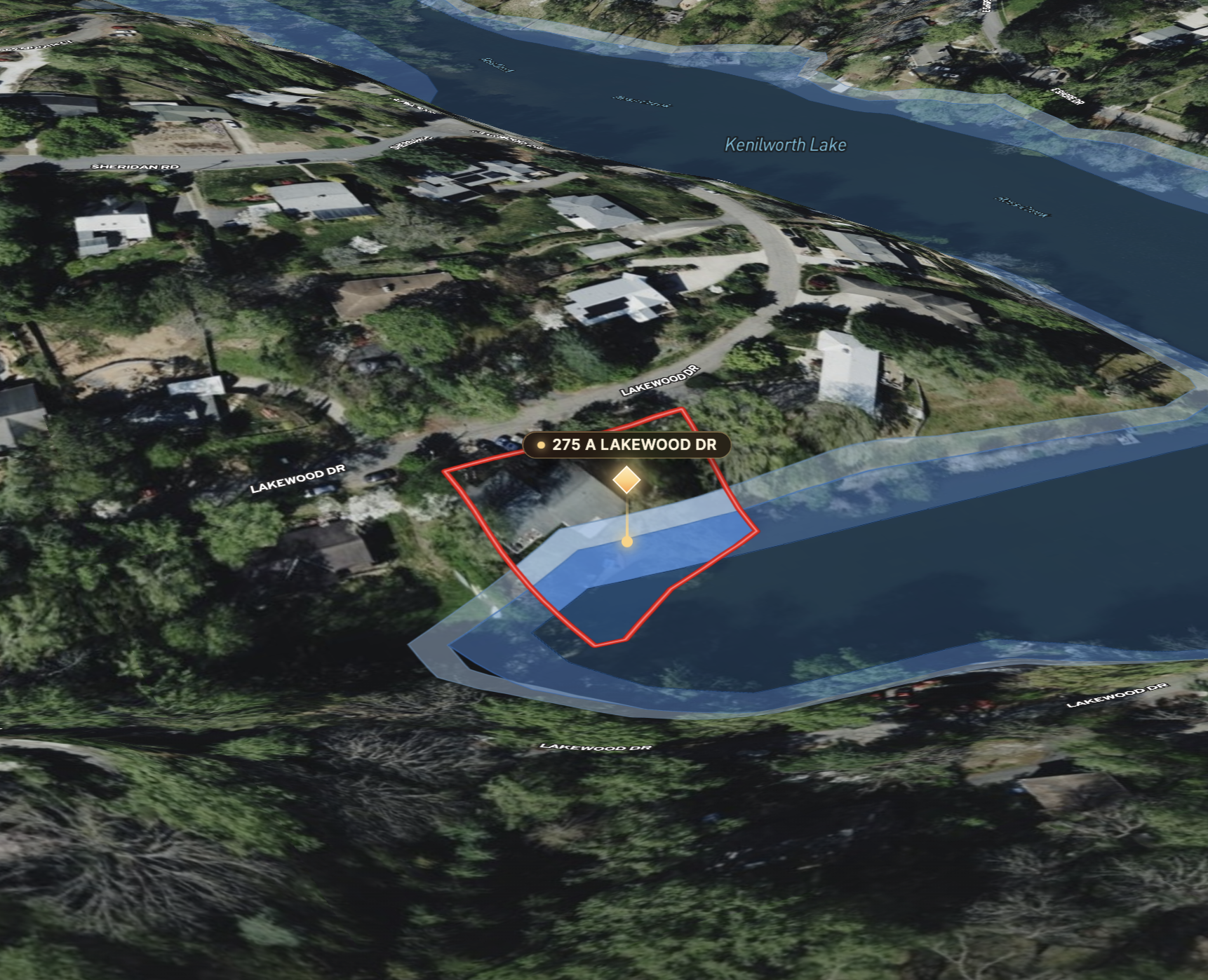
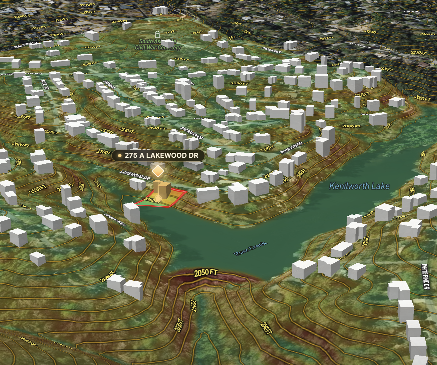
15 owners on the boundary, 367 ft of shared edge.
Land id AI insights is powered by Land id Intelligence, the AI “brain” that connects all the dots and interprets data in a way that’s fast and easy to understand.
And data you can easily understand makes it easier to act.
Land id Intelligence brings together the Land id property data and geospatial information you already know and trust, then uses AI to interpret what those signals mean for the property you’re looking at.
The experience combines the power of visualized data with the simplicity of plain-language text.
- If terrain is too steep to work with, you’ll see it on the map and read it in the summary.
- If only a small portion of the parcel is buildable, the Land id tells you so in plain English.
- If your vision is of a suburban oasis but the next-door parcel is for commercial land use, you’ll know and see it right away.
- If a floodplain crosses the property, see exactly where and know if it will impact your plans.
You can move through the Land id section by section, going deeper where you want to and getting the quick version where you don’t.
It feels less like researching a property and more like getting to know one.
Get The Land id, Then Put It to Work
The Land id starts with understanding a place. What you do with that understanding depends on why you came to Land id in the first place.
Know & Close
Know more before you recommend, pitch, or pursue a property.
- Buyer agents can use the Land id to pre-qualify properties with clients before committing time to a showing. Check the things that matter to that buyer, answer questions earlier, and save the drive for properties that actually warrant it.
- For seller agents, that knowledge becomes proof of preparation. Walk into the listing appointment knowing more than the basic facts and ready to explain what makes the property special. Your expertise lands you the listing.
Learn more about Knowing & Closing with The Land id.
Market & Sell
Turn what you know into a property experience that sells.
Once you know the property, turn that understanding into a branded virtual Property Tour. Add your photos, video, maps, documents, and branding to guide buyers through what makes the listing special.
Share the virtual Tour directly. Embed it with the listing. Pull up your maps while you drive the property with Land id for CarPlay.
The property gets a better presentation. Your brand travels with it everywhere it’s shared.
Learn more about using Land id to Market & Sell real estate.
Manage & Own
Keep everything about a property project in one place.
Create custom maps and plan for improvements. Overlay a survey or site plan. Measure areas to estimate project costs. Cut up parcels for subdivision. Document what has been completed and share it with clients and colleagues to keep property projects moving forward.
For landowners, developers, conservation and government, and other teams working across large or multiple properties, Land id becomes the source of truth you keep coming back to as plans turn into work.
Learn more about Managing & Owning property projects in Land id.
Try it Now on a Property You Know
The easiest way to understand it is to get the Land id for a property you’re already familiar with.
Choose a property you know well—your house, a current listing, a property you’ve sold, or one you’ve been researching.
- Open the parcel card and tap Get The Land id.
- See what AI Insights finds. Tap through the data visualizations on the map. Read the summaries.
- Then text or email it to someone without leaving the screen.
Or check out an example Land id.
The Land id with AI Insights is available on Land id Premium and Pro, with limited-time access for Land id users on our base plan.
Pretty soon, when someone talks about real estate, the next step will be obvious: “Send Me The Land id.”
Get the Land id for any property today. Sign up for a FREE 7-day trial.
FAQs
See Land id In Action
Research, analyze, share, and showcase real estate, all in one place.
Continue Reading
Craig Rowe
How to Work With Out-Of-State Buyers: Tips for Real Estate Agents


By Land id
Agents in emerging markets will benefit from an influx of aspiring buyers. Get tips on how to make the most of these potentially lucrative leads.
Absentee Owner Lists: What They Are, Why They Convert & How to Get Them
By Land id
Absentee owner lists are one of the most reliable ways to find off-market opportunities before your competition does. Here's how to do it in Land id.

Explore Private Parcel Data & Property Boundaries
Download the Land id app and try for free.


