There's a lot riding on the finding the right location for a new venture.
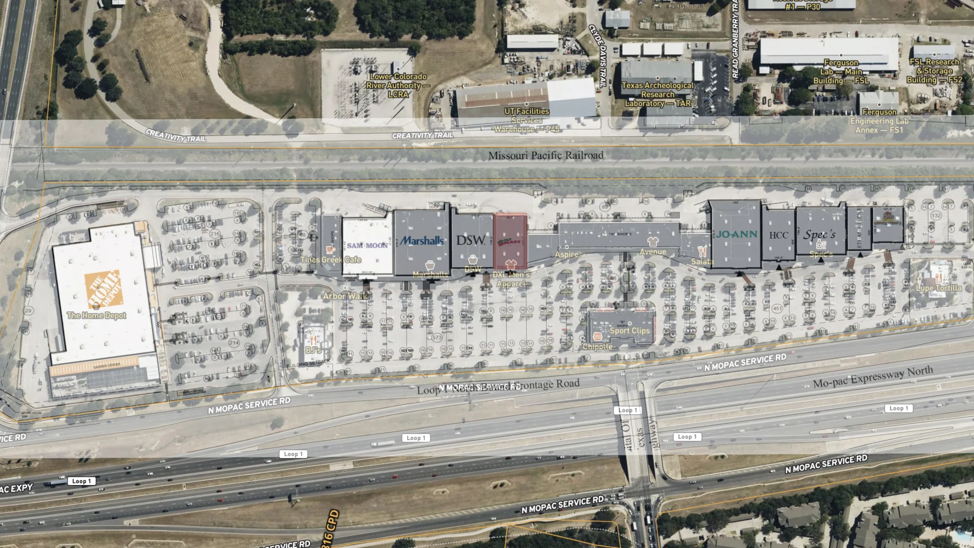
With Land id®, you can assess properties to find the right location for your tenant with our extensive overlays. Once a possible location is identified, create a map of the location and highlight existing tenants, anchor stores, and traffic counts.
Land id® GIS mapping software creates immersive real estate maps that showcase property features, land parcels, and lifestyle highlights for this Bozeman riverside retreat.
Boost your sales pipeline with Land id®'s real estate mapping software. Create property maps to track land parcels, market trends, and off-market opportunities with ease.
Use Land id® GIS mapping software to evaluate land parcels for data centers. Create a property map with overlays for utilities, floodplains, and more using real estate maps.
Take Your Mapping to the Next Level
Mapping is just the beginning. Land id is the #1 tool for researching, discovering, and showcasing land, and we're here to help you make the most of it, every step of the way.
Get a live demo
Need to see a bit more? Sign up for a live demo today.
Intrigued with Land id but want to see a bit more? Sign up for a live demo of our land mapping software with our experts today.
By clicking “Accept All Cookies”, you agree to the storing of cookies on your device to enhance site navigation, analyze site usage, and assist in our marketing efforts. View our Privacy Policy for more information.