

Map Categories
Thank you! Your submission has been received!
Oops! Something went wrong while submitting the form.
000
,
000


Planning
Data Center Development Site Analysis
Use Land id® GIS mapping software to evaluate land parcels for data centers. Create a property map with overlays for utilities, floodplains, and more using real estate maps.
Commercial
Property Development
Research

Real Estate
Commercial + Development Listing in NC
Mossy Oak uses Land id® GIS mapping software to showcase this ±11.90-acre land parcel with a real estate map highlighting utility availability, highway access, floodplain, and development potential.
Listing
Commercial
Panoramics
Property Development

Real Estate
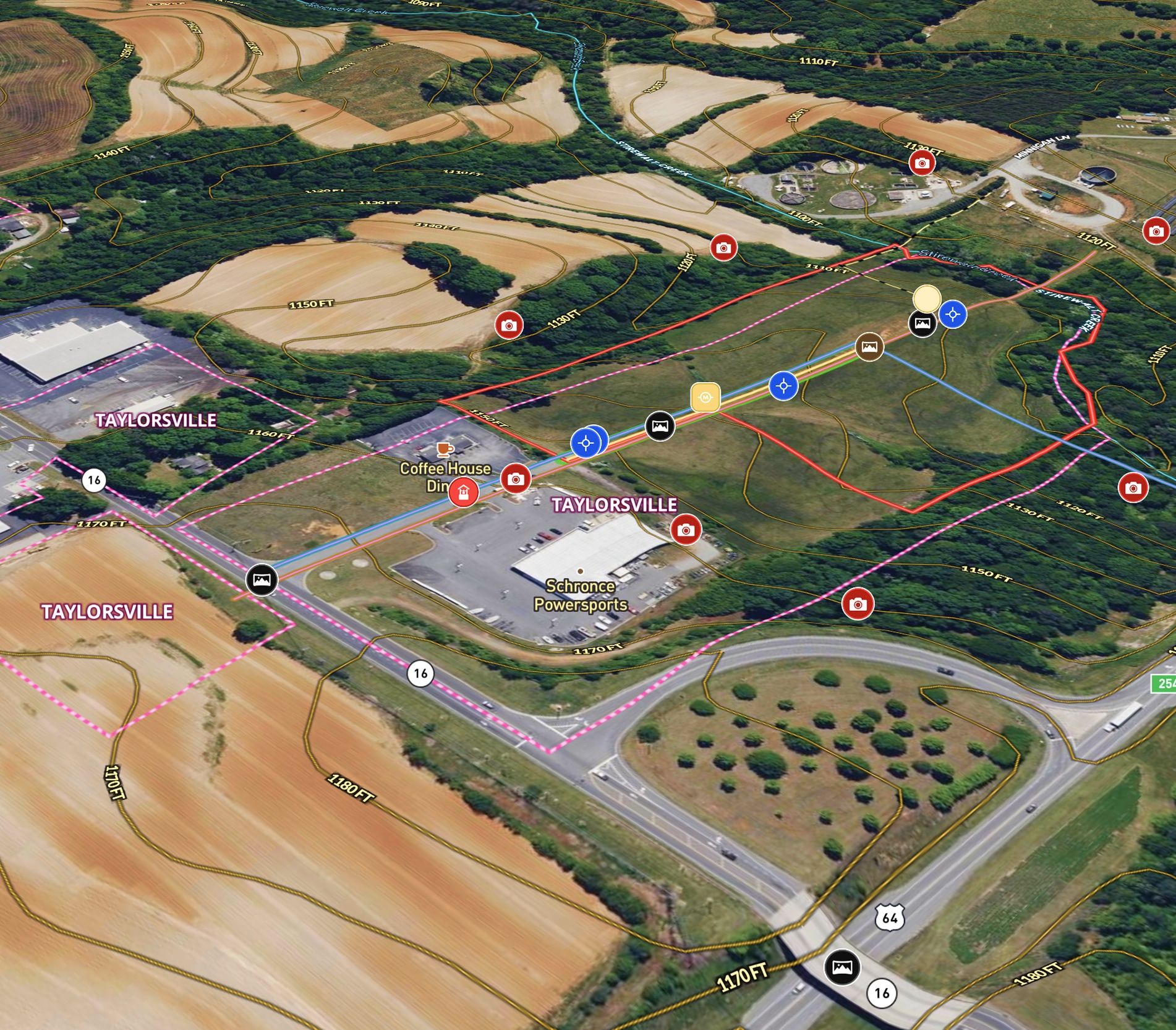
RV Commercial Listing
Tyree Real Estate uses Land id® GIS mapping software to create a commercial property map showcasing land parcels, access points, and development potential.
Listing
Commercial
Property Development
Real Estate
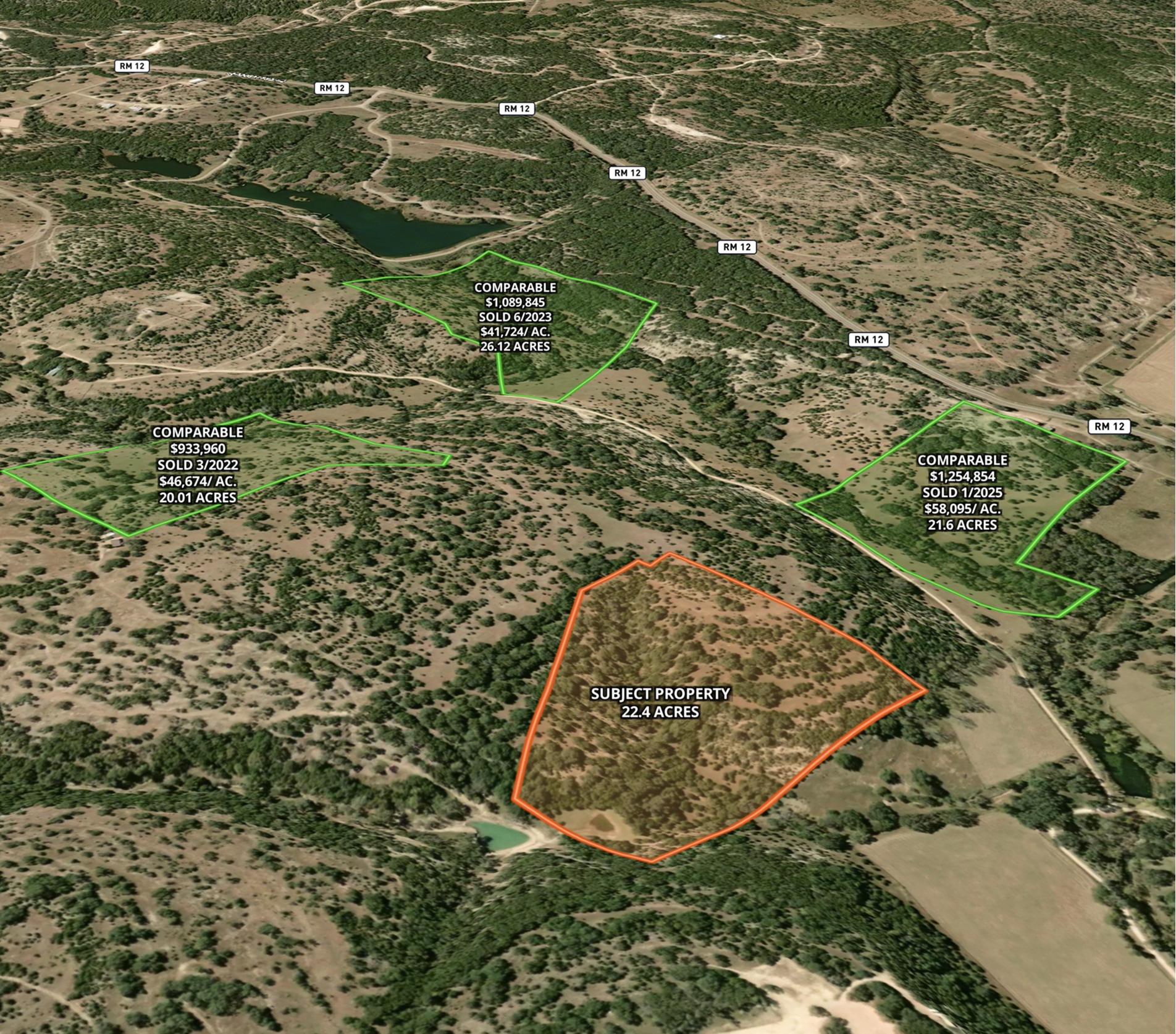
Market Trends Overview – Interactive Comps
Use Land id® GIS mapping software to visualize property comps on a map. Simplify how you present similar land parcels and sales data.
Listing
Agricultural
Rural
Comps
Residential
Real Estate
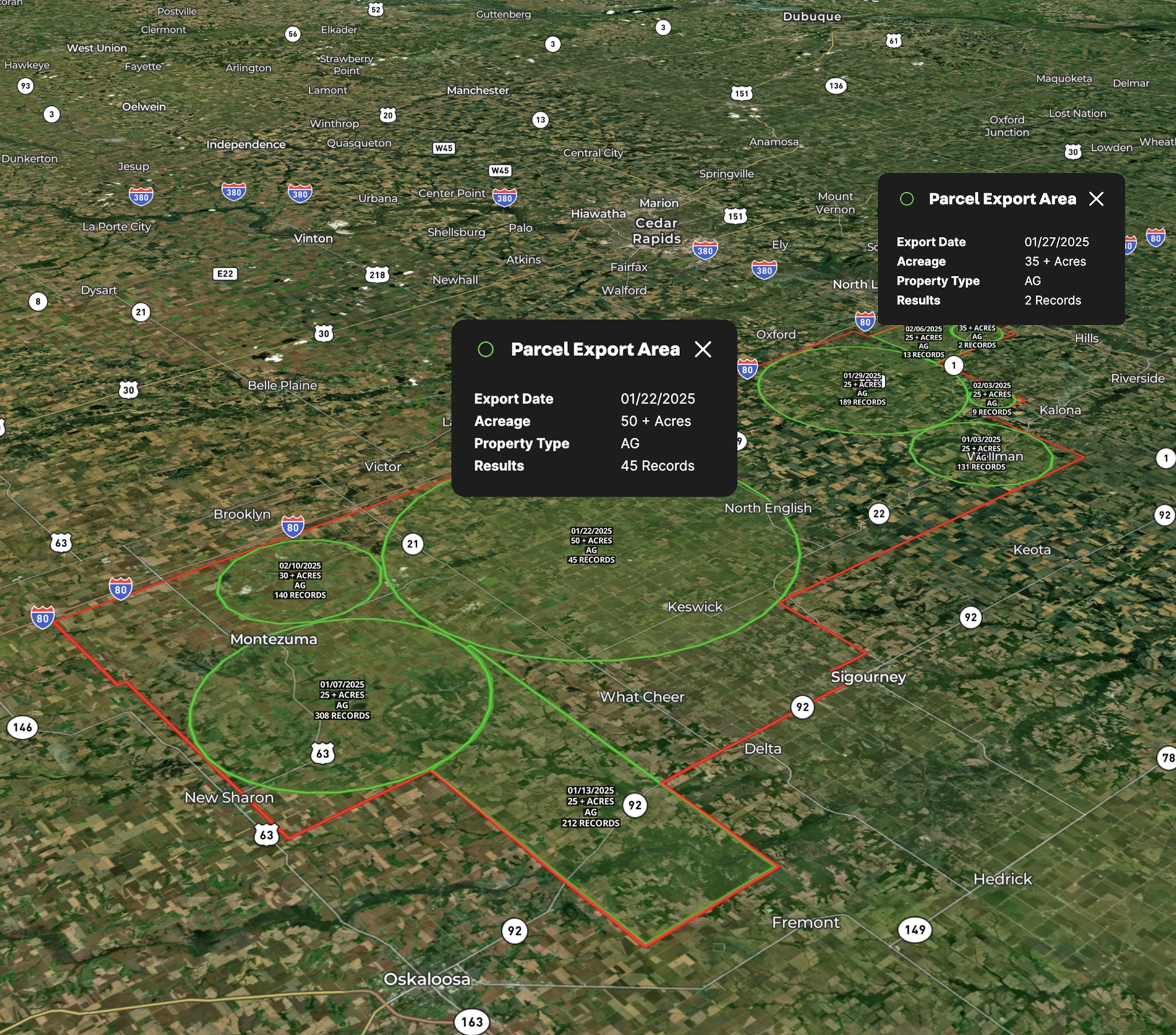
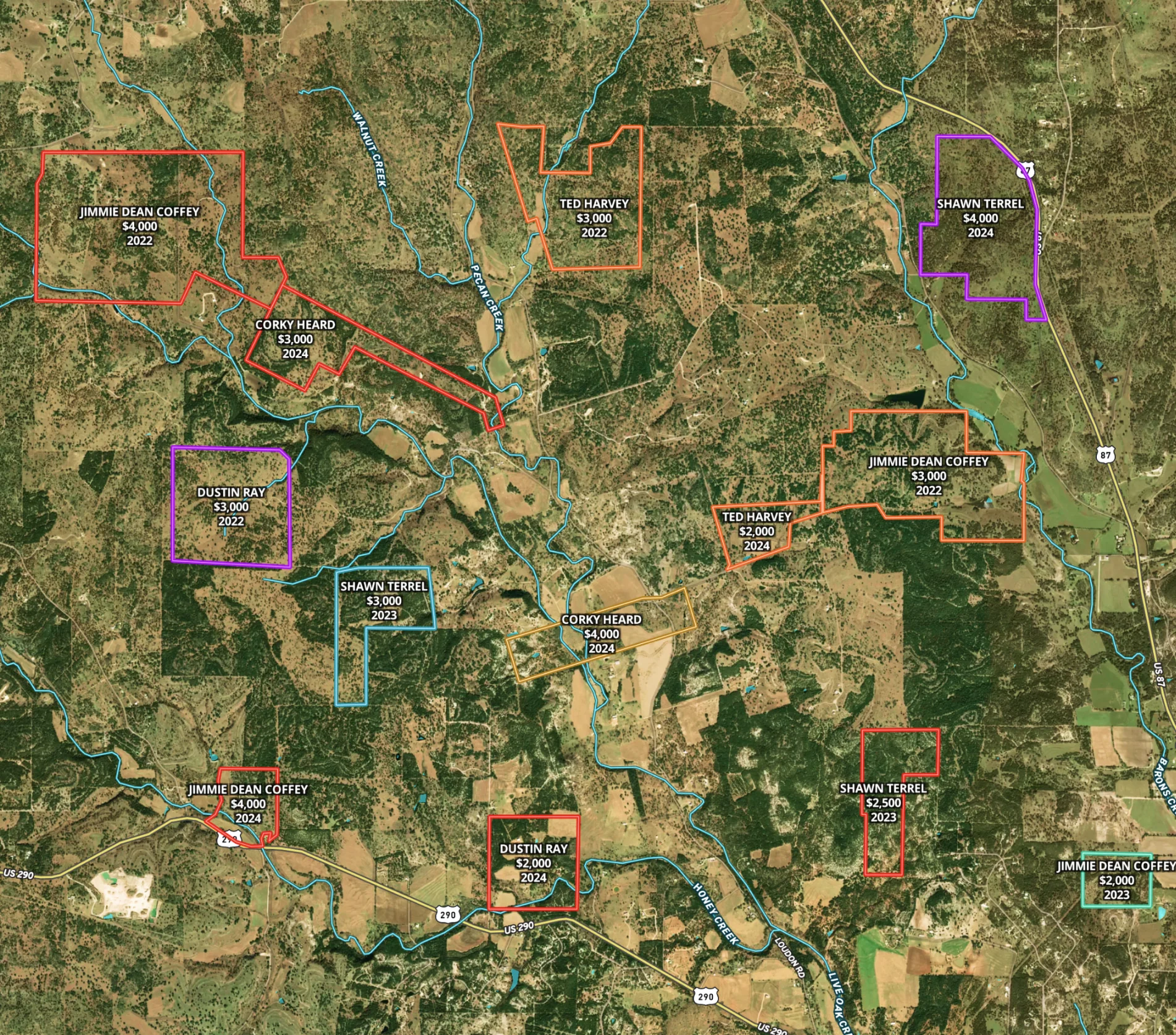
Lead Farming
Land id® GIS mapping software helps you visualize lead areas with a map and track your targeted outreach efforts.
Agricultural
Rural
Commercial
Luxury
Residential

Real Estate
Commercial Real Estate Off-Market Prospecting
Boost your sales pipeline with Land id®'s real estate mapping software. Create property maps to track land parcels, market trends, and off-market opportunities with ease.
Commercial
Comps
Research
Real Estate
Marketing a Commercial Lease
Enhance tenant site selection with our property mapping tool.
Commercial
Listing
Urban
Real Estate
Comparable Sales
Optimize real estate pricing with Land id®. Create a visual real estate database to track and justify property values effectively.
Luxury
Residential
Agricultural
Commercial
Rural
Real Estate
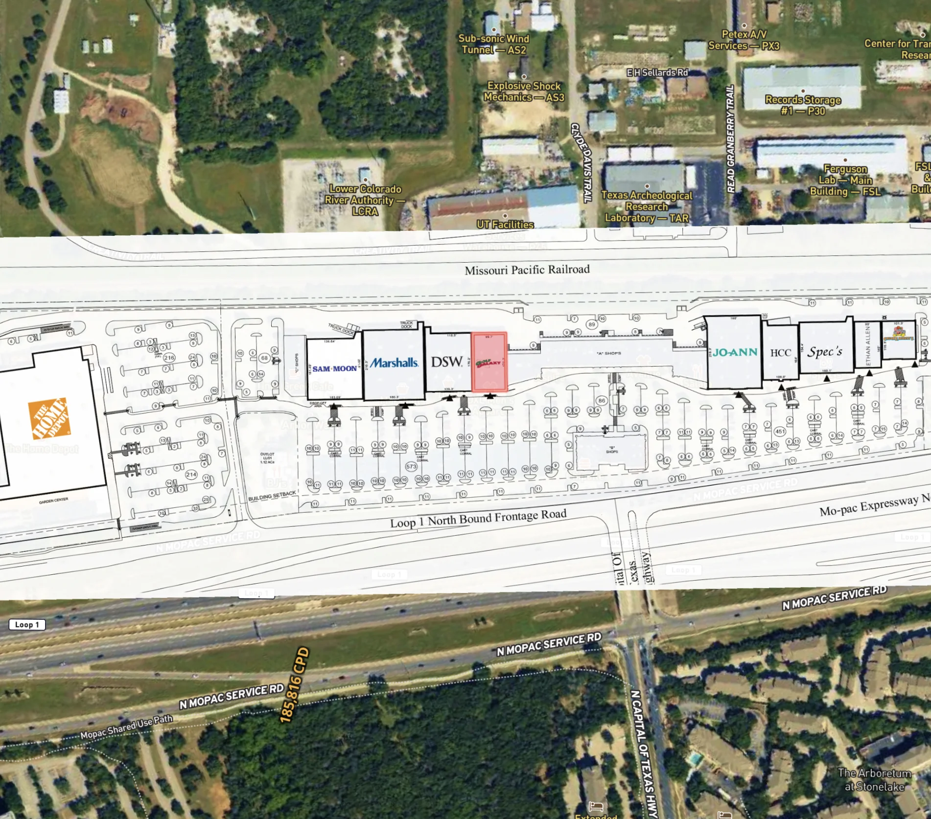
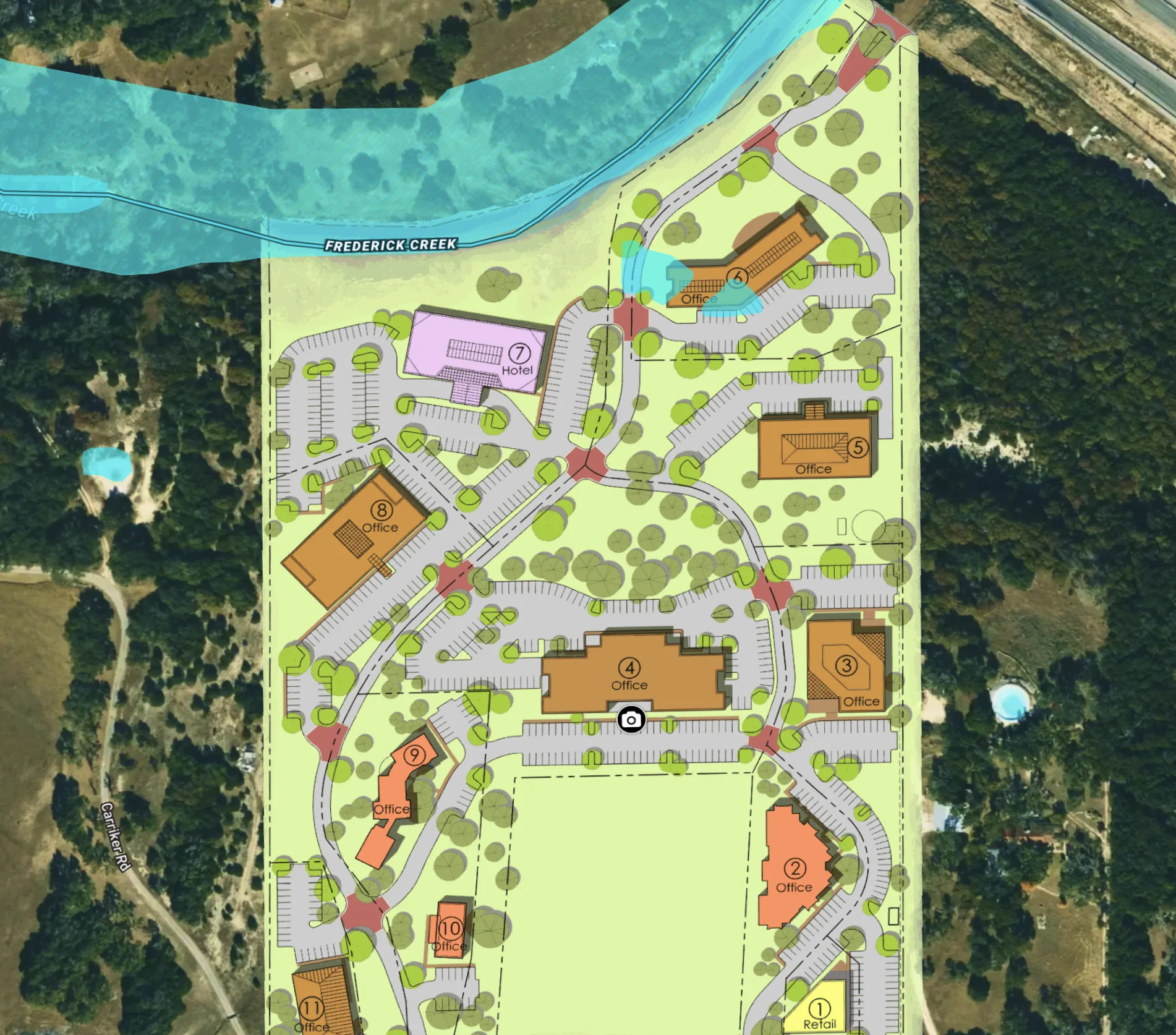
Office Park Development in Texas
Embed site plans and surveys in a map to elevate your commercial real estate project.
Commercial
Property Development