

Map Categories
Thank you! Your submission has been received!
Oops! Something went wrong while submitting the form.
000
,
000

Farm & Ranch
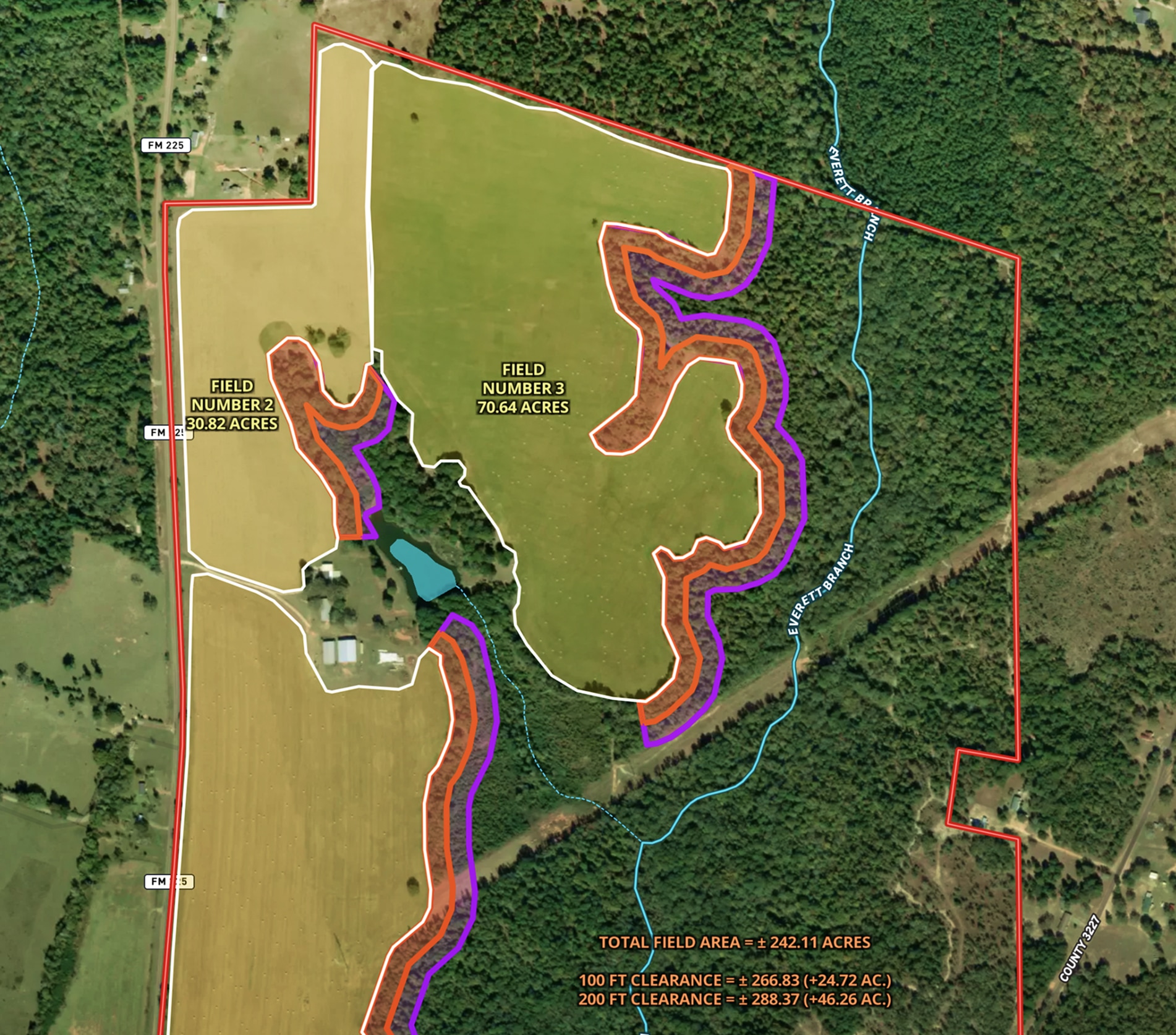
Land Clearing Analysis Map
Land id® GIS mapping software helps landowners visualize field expansion with property maps, buffer zones, and acreage gains—making land clearing plans easy and clear.
Land owner
Land management
Timber
Renewable Resources

Natural Resources
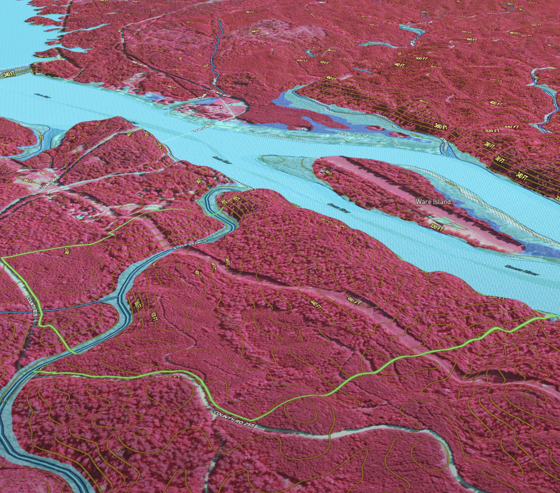
Developing & Assessing Timberlands
Maximize timberland potential with Land id®, featuring Infrared Basemap, soil reports, and essential forestry GIS overlays.
Timber
Soil
Listing
Rural
Forestry
Natural Resources
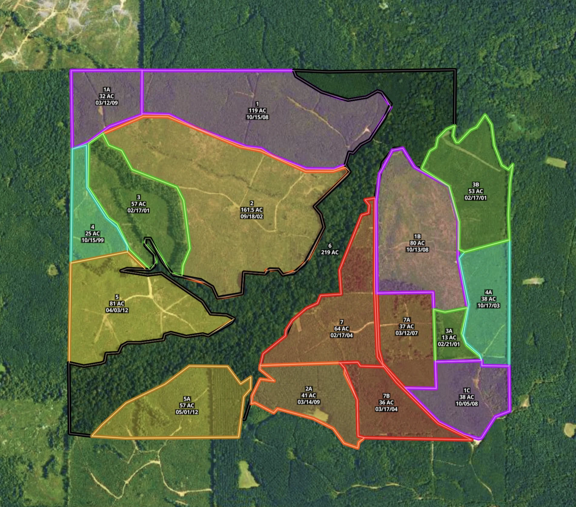
Mississippi Timber Stand Map
Boost your timber sales strategy with Land id®, creating interactive timber maps that highlight timber stand features and access.
Forestry
Timber
Soil
Listing
Rural