


In the world of real estate, accurate and detailed information about properties is crucial for making informed decisions. One of the fundamental tools used to gather and verify this information is a property survey.
But what exactly is a survey in real estate? This article will break down the concept of real estate surveys, detailing what they are, why they are necessary, and how they are conducted.
We'll also explore how advanced tools like Land id’s deed plotting and boundary features can enhance the surveying process, offering high precision and efficiency for surveyors and real estate professionals.
Main Takeaways From This Article:
- Property surveys are essential for accurately defining property boundaries, identifying easements, and detailing topographical features.
- There are various types of real estate surveys, such as boundary, topographic, ALTA/NSPS, and construction surveys, each serving a specific purpose.
- Surveys are conducted using precise measurement tools and technologies like GNSS and drones to ensure high accuracy.
- Key components of a land survey include property lines, identification of easements, location of structures, and legal property descriptions.
- Land id® offers advanced deed plotting and boundary features that enhance surveying accuracy and streamline the process for professionals.
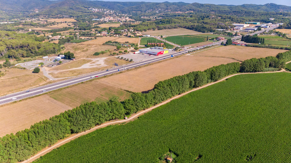
What Is a Property Survey?
A property survey is a detailed inspection and mapping of a piece of land, including its boundaries, structures, and other significant features. Conducted by professional surveyors, property surveys provide precise measurements and valuable information about the land's physical characteristics.
Importance of Land Surveys

Land surveys are a cornerstone of the real estate industry, providing critical information that underpins a wide range of property-related activities. Here are some key reasons why land surveys are so important:
- Verifying Property Boundaries: One of the primary purposes of a land survey is to accurately determine and document the boundaries of a property. This is crucial for preventing and resolving disputes between neighbors over property lines, ensuring that each party knows exactly where their property begins and ends.
- Facilitating Property Transactions: During real estate transactions, accurate property surveys provide essential information for buyers, sellers, and lenders. They ensure that everyone involved has a clear understanding of what is being bought or sold, including the exact size and location of the property. This reduces the risk of legal issues arising from misunderstandings or inaccuracies in property descriptions.
- Supporting Development and Construction: For developers and builders, land surveys are vital for planning and executing construction projects. Surveys provide detailed information about the topography, existing structures, and any potential obstacles or restrictions. This helps in designing buildings, planning infrastructure, and ensuring that new developments comply with zoning laws and building codes.
- Ensuring Regulatory Compliance: Land surveys help property owners and developers comply with local, state, and federal regulations. Whether it’s adhering to zoning laws, environmental regulations, or building codes, accurate surveys provide the necessary data to ensure that all legal requirements are met, avoiding potential fines and legal complications.
- Identifying Easements and Encroachments: Surveys reveal any easements, encroachments, or rights of way that affect the property. This information is crucial for property owners and prospective buyers to understand any limitations or rights others may have regarding the use of the property. Knowing about these issues upfront can prevent future disputes and legal challenges.
- Protecting Property Value: Accurate land surveys protect the value of a property by ensuring that all legal and physical aspects of the land are clearly documented. This can be especially important when selling a property, as a current and precise survey can reassure potential buyers about the legitimacy and value of their investment.
Types of Surveys in Real Estate
Just like there's a specific wrench for every bolt, there's a specific type of property survey designed for each unique need. Let's explore the different types available to ensure you choose the right one for your needs:
Boundary Survey
This is the most common type of survey. A boundary survey precisely defines the legal borders of your property. It determines the exact location of property lines, often using a combination of physical markers, historical records, and modern surveying tools. This information is crucial for:
- Preventing boundary disputes with neighbors.
- Knowing the extent of your property ownership.
- Planning any construction projects that might come close to property lines.
Topographic Survey
A topographic survey goes beyond boundaries, capturing the physical features of your land. It typically includes details like:
- Elevation changes and slopes.
- Locations of bodies of water (streams, ponds, etc.).
- Existing vegetation.
This information is valuable for planning landscaping projects, determining the feasibility of construction based on the terrain, and understanding potential drainage issues.
ALTA/NSPS Land Title Survey
This is like the "deluxe" version of a boundary survey. An ALTA/NSPS Land Title Survey meets the rigorous standards set by the American Land Title Association (ALTA) and the National Society of Professional Surveyors (NSPS). It provides a comprehensive overview of your property, including boundary details, potential encroachments, and easement information. This level of detail is often required by lenders for:
- Commercial property transactions.
- High-value property purchases.
- Situations with complex ownership history.
Site Planning Survey
A site planning survey is your essential first step. It maps the existing features on your land and considers factors like:
- Topography (using data from a potential topographic survey).
- Location of utilities (underground pipes, electrical lines).
- Zoning regulations.
This information helps architects and engineers determine the feasibility of your project and plan its layout effectively.
Subdivision Survey

A subdivision survey serves as a blueprint for development. This survey meticulously defines the boundaries of individual lots within a larger parcel of land. Here's what it entails:
- Precise lot measurements
- Adherence to development plans
- Preparation for construction
This survey is crucial for developers to ensure a smooth and legal subdivision process, which will lead to successful lot sales or construction projects.
Construction Survey
A construction survey acts as your on-site guide throughout the building process. It translates plans on paper into precise on-site locations for all your planned structures. Here's how it ensures your project stays on track:
- Staking out building locations to ensure they align with construction plans
- Verifying elevation points to ensure proper drainage and foundation stability.
- Tracking progress to identify any potential deviations that need correction
- Maintaining compliance with building codes and zoning regulations
A construction survey provides a clear on-site roadmap, minimizes errors, prevents costly delays, and ensures your project adheres to the approved plans.
Location Survey
Not every property survey needs to encompass the entire land parcel. A location survey focuses on a specific area of your property, pinpointing the precise location of a particular feature. This is helpful for situations like:
- Installing fences or driveways
- Placing septic systems
- Adding decks or patios
This targeted survey helps you avoid potential encroachment issues and ensures your planned features are placed correctly within your property lines.
As-built Survey
Once the construction dust settles and your project is complete, an as-built survey captures the built structures' final "as is" state. This survey typically includes:
- Documented location of structures
- Verification of building plans
- Record for future reference
By understanding these specific survey types, you can ensure your construction project progresses smoothly, avoids potential setbacks, and has a clear record of the final built structures.
Floodplain Survey
Thinking about buying property in a flood-prone area? Floodplain surveys help determine whether your land falls within a designated floodplain. This information is crucial for:
- Understanding potential flood risks.
- Obtaining flood insurance (often mandatory in flood zones).
Land id® is a fantastic resource for determining if a property falls within a floodplain, with our FEMA floodplain overlay, now a standard tab on our Property Info Cards.
Right-of-Way Survey
Not all property ownership is absolute. Sometimes, an easement might be granted to a public entity or even a neighbor, allowing them access across your land for specific purposes. A right-of-way survey clarifies the boundaries and limitations of such easements. Here's what it typically entails:
- Mapping the easement area
- Identifying easement type
- Restrictions and limitations
By clearly understanding the right-of-way through a survey, you can ensure that access across your land is maintained within the designated boundaries and according to the established limitations.
Mortgage Survey
Securing a mortgage for your property typically involves a property survey. But unlike some of the more comprehensive surveys we've discussed, a mortgage survey is usually a basic verification tool for lenders. Here's what it typically covers:
- Verification of property boundaries
- Confirmation of size and location
- Checking minimal details
- Checking suitability for loan purposes
In most cases, a lender may accept a recent boundary survey or a simplified version of it to fulfill the mortgage survey requirement.
How Property Surveys Are Conducted
Here's a step-by-step process of how a typical property survey is conducted:
- Research and Preparation: The property surveyor starts by researching property records, including past surveys, deeds, and maps. This helps them understand the property's history and legal boundaries.
- Fieldwork: Using specialized tools, the surveyor visits the site to measure and map the property. Modern surveyors often use a combination of traditional tools and advanced technologies, including:some text
- Total Stations: These instruments measure angles and distances with high precision.
- GPS (Global Positioning System): GPS units help pinpoint the exact location of land boundaries and features.
- Drones: Aerial surveys using drones provide a bird's-eye view and detailed photos of the property.
- Data Analysis: After collecting data in the field, the surveyor analyzes it to create accurate maps and reports. This involves using software to process the measurements and data captured.
- Report Preparation: Finally, the surveyor compiles the findings into a detailed report, including maps, descriptions, and any notable features or legal considerations.
- Final Review and Approval: The surveyor carefully reviews the draft report to ensure that all information is accurate and meets professional standards. After that, the report is shared with the client for their approval.
Key Components of a Land Survey
Now that we've explored various survey types, let's understand what a typical land survey report might contain. These key components provide a comprehensive picture of your property:
1. Property Lines and Measurements
This is the cornerstone of any survey. The report will detail your property's precise measurements and dimensions, typically using a legal unit of measurement like feet or meters. It will also clearly define the property lines, often referencing property markers, stakes, or monuments placed on the land to mark the boundaries.
2. Identification of Easements and Rights-of-Way
Not all land ownership is absolute. Some properties might have designated easements or rights-of-way that allow access for specific purposes. The survey report will identify any such easements and clearly outline their location, extent, and type (public or private). This information is crucial for understanding any limitations on how you can use your property and respecting the rights of those granted access through easements.
3. Location of Structures and Improvements
The survey report will map the location of any existing buildings, fences, pools, driveways, or other permanent improvements constructed on your land. This ensures a clear picture of what exists on your property and verifies that these structures fall within your designated boundaries.
4. Topographical Features and Natural Landmarks
Depending on the type of survey, the report might include details about the physical characteristics of your land. This could encompass:
- Elevation changes and slopes.
- Location of bodies of water (streams, ponds, etc.).
- Existing vegetation.
This information is valuable for planning landscaping projects, understanding drainage patterns, or determining the feasibility of construction based on the terrain.
5. Legal Description and Property Title
The survey report will often include a legal description of your property based on the information in your property title. This legal description uses specific language and reference points to uniquely identify your land parcel within the official land records system.
How To Get a Property Survey

If you are planning to get a survey done, it's wise to see if an existing one already exists for your property. Here's where you can look:
- Check With the Previous Owner: If you recently purchased the property, check with the seller or their realtor. They might have a copy of a recent survey conducted during the selling process.
- Contact the Title Company or Lender: The title company or lender involved in your property transaction might have a copy of the survey on file, especially if it was a requirement for the mortgage.
- Search Local Government Records: Your city or county offices might have copies of older surveys on file, particularly if the survey was conducted for property tax purposes or public works projects. There might be associated fees for obtaining a copy.
If you can't locate an existing survey, here's how to get a new one:
- Hire a Licensed Land Surveyor: The most crucial step is to hire a qualified land surveyor. Look for a surveyor licensed in your state with a good reputation and experience in the type of survey you need.
- Provide Property Details: Once you've chosen a surveyor, provide them with all the relevant information about your property, including your address, legal description (if available), and the specific purpose of the survey.
- Get Quotes and Understand the Project Scope: The surveyor will provide a quote based on the complexity of the survey and the size of your property. Discuss the project scope clearly, including the type of survey needed and the deliverables you expect (report, maps, etc.).
- Schedule the Survey: Once you agree on the terms, the surveyor will schedule a time to visit your property and conduct the fieldwork.
Enhance Your Surveying Accuracy With Land id®
Land id® offers powerful deed plotting and boundary features that are essential tools for surveyors and real estate professionals alike. These advanced capabilities provide high precision and efficiency in the surveying process, ensuring accurate and reliable results.
- Deed Plotting: Land id® allows users to overlay surveys or site plans on top of aerial maps, providing a clear visual representation of deed information. This feature helps surveyors and real estate professionals accurately align and visualize property boundaries, ensuring that all legal descriptions match the physical reality on the ground. With opacity controls and custom control points, users can fine-tune the alignment, making it easier to understand and present property details.
- Boundary Features: Understanding and defining property boundaries accurately is crucial for a wide range of land-related activities. Land id® provides precise information on property boundaries, helping to clarify the extent and limits of land parcels. This feature is invaluable for real estate professionals, landowners, and surveyors who require accurate boundary data to avoid disputes, plan developments, or conduct appraisals.
By leveraging Land id's deed plotting and boundary features, surveyors and real estate professionals can streamline the surveying process with high precision. These tools not only enhance the accuracy of property surveys but also save time and reduce the complexity of mapping and analyzing land data.
Ready to streamline your property survey process and ensure absolute precision? Sign up for a free 7-day trial and see how it makes a difference to each project.
FAQs
Continue Reading
Craig Rowe
How Factory-Built Housing Can Reshape America’s Housing Market
.png)
By Land id
The U.S. housing industry’s decade-plus-long inventory challenge could see its first true sign of resolution should the 21st Century Road to Housing Act become law.

Craig Rowe
Can Refurbishing Schools Help Solve Housing Issues?
By Land id
Old public schools are becoming apartments as enrollment drops. See why school-to-apartment conversion is adaptive reuse's fastest-growing niche.


Explore Private Parcel Data & Property Boundaries
Download the Land id app and try for free.
