

Adding 360experiences into your interactive maps is a great way to get as close as we can for somebody to feel like they’re out on the property.
There’s a couple of ways we can do that. Now, we have panoramic views. This allows you to upload any of the 360 pano points that you might take out in the field.
Now, we’ve added the ability to integrate Matterport links into your interactive maps, and you can add Matterport links to any of these points that you place on the map.
I’ve got a little camera and a house here – I’ve added Matterport links to both of these. It’s effortless for us to add Matterport links to any of these points we have on our map.
We’re going to first place the point that we want to add the Matterport link to on our map, then we’re going to click on that point.
There are a series of options at the bottom; a little pencil, a camera and all of that, and a 360 button.
To add Matterport links to my point, I’m going to click on that 360 button. Then, you just need to paste the Matterport link in right here, hit save, and then save your map.
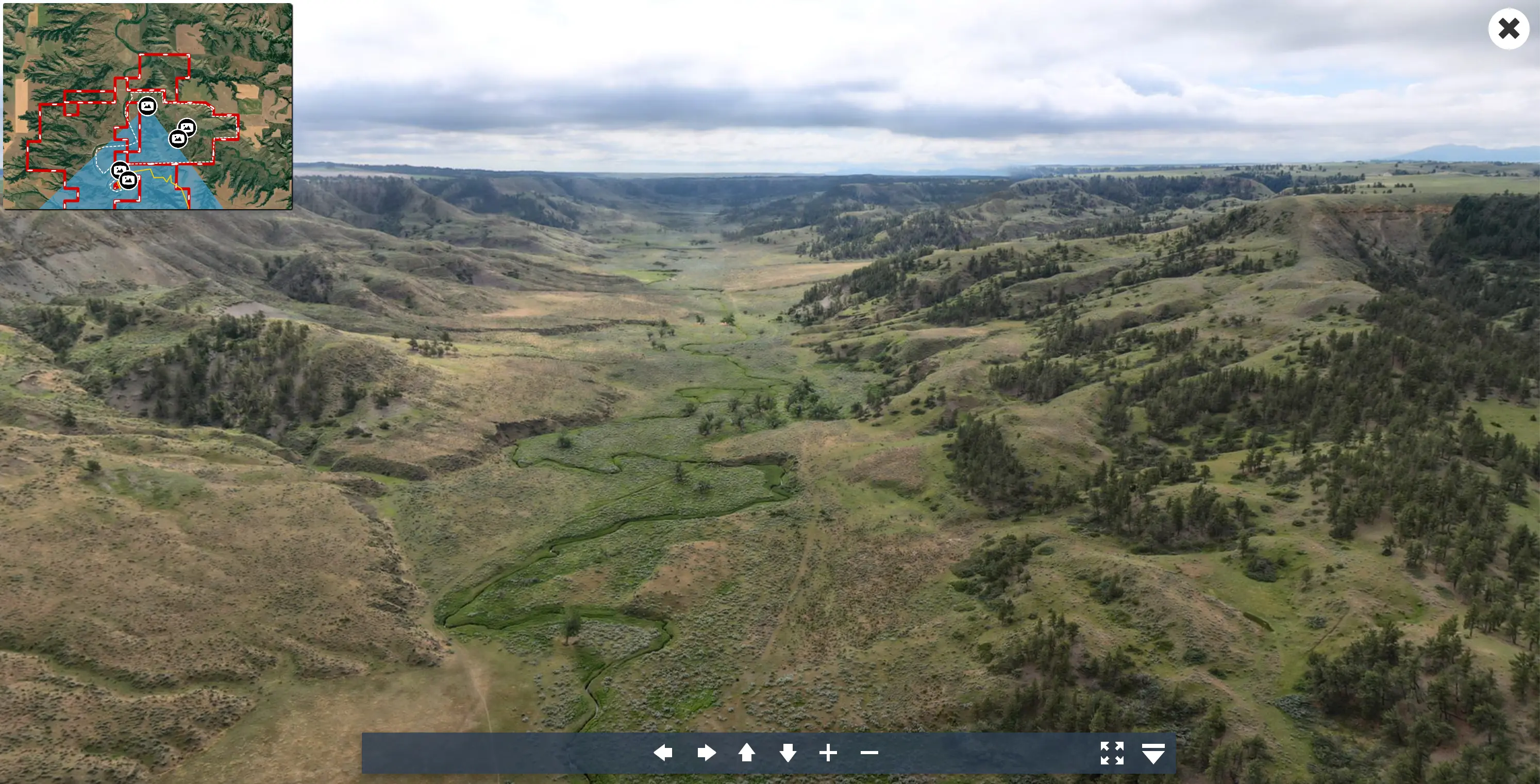
Here’s the experience somebody will have when they come to your website and view this map. It embedded into your website, or you send this off as an interactive map for them to view.
When they open it, they can click on the pano points if you have those, so that will give you an excellent 360 immersive experience of any of the outside of the property just like this. I can cruise around, zoom in, zoom out with the panos. And then I’ve also got an immersive experience now for any of the buildings on the property with my Matterport links.
So, you can click on this house and then click on the Matterport option, and you are taken into a full 360 immersive experience for this structured property.
By integrating your Matterport links and taking advantage of our pano points, which you can create with these new options, is a really a full 360 immersive experience, all within your interactive map and really just takes it to the next level.
This is really easy for your prospective buyers, clients, to find the 360 photos on your interactive maps. And it has a real wow impact on helping them understand the property, both inside and outside.
FAQs
Continue Reading
Craig Rowe
5 Real-World Land id Workflows Worth Borrowing
.png)
By Land id
See helpful examples of how real estate pros use Land id to win listings, market properties, plan developments, and make smarter data-driven decisions.
Alyssa Toohey
Off the Map & In Person: The Land id Team Gets Together

By Land id
The Land id team came together in Montana for collaboration, connection, Big Sky views, PBR, Yellowstone, and plenty of memorable moments.


Explore Private Parcel Data & Property Boundaries
Download the Land id app and try for free.
