


The Challenge: Making Sense of 1,165 Acres
Picture this: You're standing on property that dates back to the 1860s gold rush. The Brassie family owned it for over 100 years. Now your clients want to unlock this "piece of private Idaho" for families who've admired it from a distance.
But here's the thing—you're not just selling one property. You're selling:
- Trail Creek Meadows: 31 lots ranging from 3-5 acres with year-round creek access
- Harris Creek Heights: 5-7 acre lots with dramatic 500-foot elevation views
- North and South Ranch: 300 total acres of pristine pasture land
- Ridge View Subdivision: Future 20-30 acre lots (still in development)
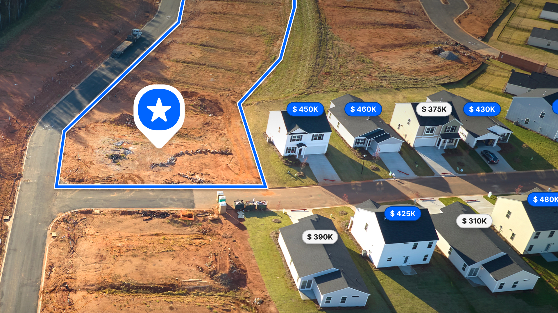
How do you help buyers visualize all these options? How do you show the relationship between subdivisions? How do you create professional materials that match the caliber of this incredible property?

The Solution: Professional Mapping Made Personal
Lance and Jed discovered something powerful: Land id transforms raw property data into compelling visual stories.
Instead of handing prospects basic flat maps or sketchy property lines, they create custom maps that showcase:
- Creek systems running through Trail Creek Meadows
- Elevation changes that make Harris Creek Heights so special
- Proximity to National Forest (760,000 contiguous acres of public land)
- Development phases so buyers understand the full vision
- Access points and common areas throughout the community
"We're not just selling lots," Lance explains in our video. "We're selling a lifestyle. And these maps help people see themselves living here."
Why This Matters for You
Whether you're a selling agent, developer, or investor, Triple Creek Reserve shows what's possible when you stop thinking about properties as data points and start thinking about them as stories.
For Selling Agents: Professional maps set you apart from competitors still using basic MLS photos. Your listings become experiences, not just square footage.
For Developers: Visual storytelling helps buyers understand your vision before construction begins. No more explaining complex subdivision plans—just show them.
For Investors: Custom maps help you evaluate opportunities faster and present deals to partners with confidence.
For Buyers: See exactly what you're getting, from creek access to mountain views, before you ever set foot on the property.

The Best Part? No Technical Skills Required
Here's what impressed us most about Lance and Jed's approach: They're not tech experts. They're real estate professionals who needed better tools to showcase incredible properties.
Land id's Pro plan gives them everything they need:
- High-resolution aerial imagery that shows every detail
- Custom markers to highlight selling points
- Professional sharing that works on any device
- Offline access for property visits
- Unlimited photo uploads to document improvements
Starting at $33/month. No learning curve. No complicated software. Just professional results in minutes.
Ready to Transform Your Property Marketing?
Triple Creek Reserve proves that great properties deserve great presentation. Whether you're working with 5 acres or 1,165 acres, your prospects deserve to see the full picture.
Try Land id Pro free for 7 days →
See how custom mapping can transform your next listing, development project, or investment opportunity. Because when you can show people exactly what they're getting, everyone wins.
Want to know more about Triple Creek Reserve? Click Here
FAQs
Continue Reading
How to Price Land for Sale Using Comparable Sales Data
By Land id
Learn how to price land using comparable sales. Find, analyze, and adjust vacant land comps to price listings accurately and sell with confidence.
Craig Rowe
Can Refurbishing Schools Help Solve Housing Issues?
.png)
By Land id
Old public schools are becoming apartments as enrollment drops. See why school-to-apartment conversion is adaptive reuse's fastest-growing niche.


Explore Private Parcel Data & Property Boundaries
Download the Land id app and try for free.
