


From drawings on the ground to representations on stone tablets all the way to the invention of GIS software, humans have been using maps to help understand the world around us since the dawn of our existence. While map making software has made map creation more accurate, it's important to remember that maps are still only a symbolic representation of reality. However, that means you have a greater ability to influence how a viewer sees the land and its qualities.
What Are Maps?
A map is a symbolic representation of certain characteristics of a specific area, and typically, they’re displayed on a flat surface. They teach us about the world in an easily digestible, visual manner by showing the size and shape of regions, the location of important features, distances between places, and even how things (houses, pollution, trees, grocery stores…) are distributed. Because of this, they have the unique ability to stimulate both hemispheres of our brains: the creative, visual right side, and the analytical, rational left side.
Types of Maps
General Reference Maps
General reference maps summarize the landscape and depict the locations of important natural and human-made features in an area, including the location of mountains, rivers, roads, city boundaries, and more. One popular type of general reference map is a topographic map, which shows changes in elevation as well.
Thematic Maps
As the name implies, thematic maps display information about a particular topic or theme in relation to the location on the Earth’s surface. They could track trade patterns, the spread of disease, average income, annual rainfall, or virtually any other piece of data tied to a theme. In recent years, GIS map making software has revolutionized the way these maps are made, as you can now display multiple datasets on the same map.
Building a Better Map With Map-Making Software
Layer Spatial Data
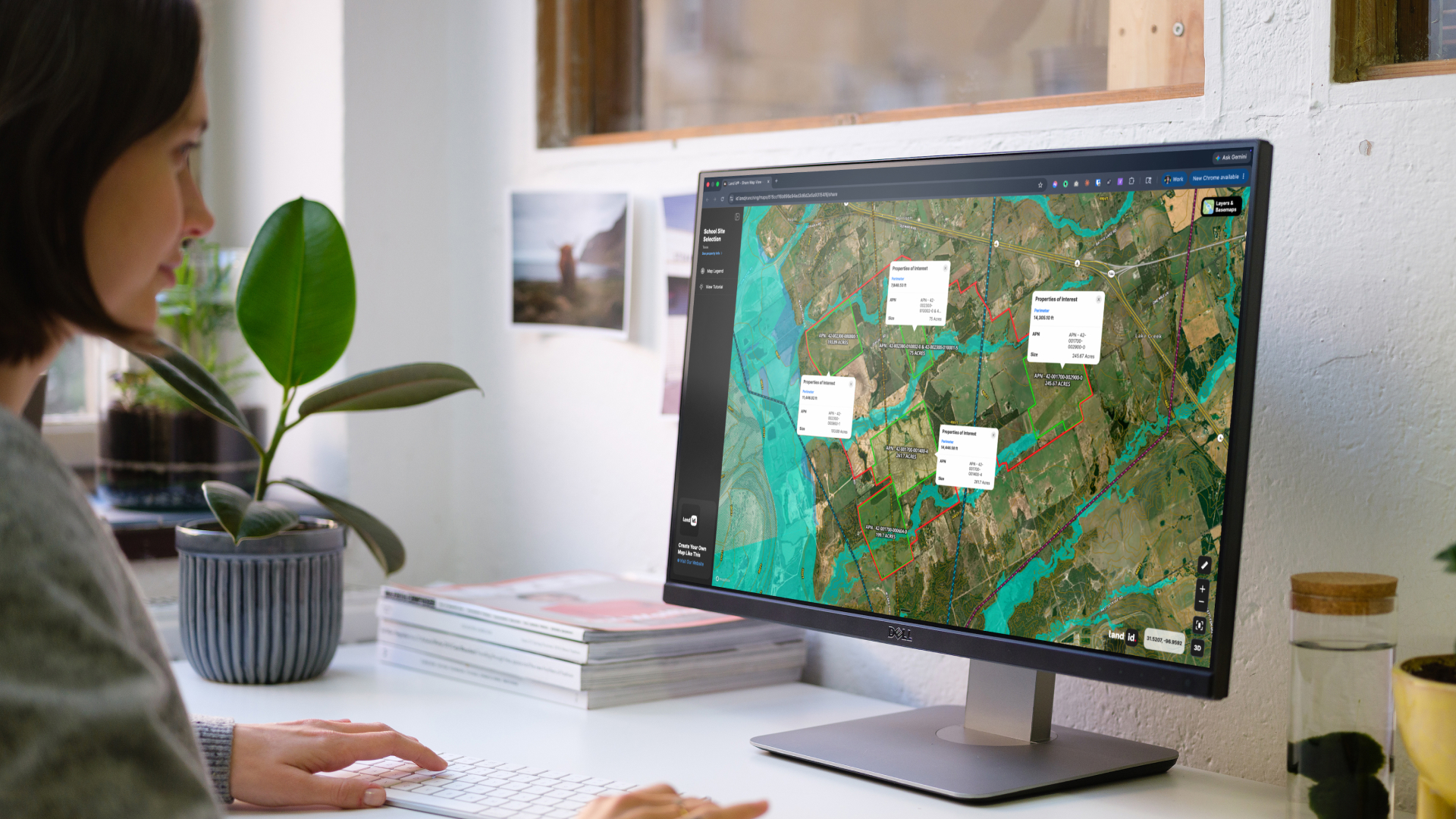
Each layer on a map made with GIS-based map making software represents a unique spatial data set. Separating out all of the data you choose to include not only keeps your map organized, but allows you to analyze each piece individually. By toggling off every layer but one, you can analyze a single aspect of an area, and by toggling on multiple layers, you can see how the data interact with each other.
You could use GIS layers to check if school districts are located on flood plains, if counties have access to important infrastructures such as highways or transmission lines, or even if land use correlates with access to natural water sources.
Establish a Visual Hierarchy
Once you’ve determined what data to include in your map, you’ll want to make sure and organize it in a way that readily makes sense to the viewer. It’s generally best to place the most important elements such as the title and the legend at the top of the page, and the least important at the bottom.
However, what makes the most sense to viewers will depend on context. For instance, if you’re offering a print map as a closing gift after landing your client a new property, it may be better to put the title and other elements like that in a less visible location.
Create & Use Design Elements
When creating a map with map-making software, it’s crucial that you design it in a way that is clear, legible, and easy to digest. A great way to do that? Incorporate design elements such as labels, icons, and color. Not only do labels and icons add a personalized touch to your maps, they can also help viewers instantly identify where features are in relation to each other (and what they’re looking at in general). In short, they help viewers spatially understand the land.
Similarly, color can also be used to add clarity to your map. When you choose a color for your icons, make sure and opt for one that makes sense with what it is representing; blue icons depicting soil and brown icons depicting waterways will likely confuse the viewer, as they’d expect the colors to be the other way around.
Incorporate Media
Perhaps the most important step in making a truly beautiful map is to incorporate media such as 360° panoramas, aerial photography, and videos. Adding these elements allows you to create a fully immersive experience for viewers. Instead of telling prospects about the incredible views from the property, you can show them, and instead of just looking at the image of a house on a map, they’re able to click on it and take a walkthrough tour, view photos of the interior, and more. By adding these elements, you help viewers get a feel for the land in a way that wouldn't otherwise be possible without visiting it themselves.
Start Building Better Maps Today With Land id®
Land id has all of the tools you need to begin building beautiful, interactive maps. You can add as many layers as you choose, toggle them on and off to view important patterns and trends, and even import your own datasets from elsewhere.
Once you’ve decided on what data to include, you can customize your maps by tying 360° panoramics, photographs, and videos to the exact pace on the map where they were taken, giving viewers the full picture of the property.
And finally, with automatic labeling options and countless icons to choose from, what you decide to highlight will be apparent to viewers.
The best part is that you don’t have to be a GIS expert to utilize our map making software. We took the technical aspects out so novices and professionals alike can create impressive maps.
Ready to get started? Sign up for your 7-day free trial today!
FAQs
Continue Reading
Alyssa Toohey
Off the Map & In Person: The Land id Team Gets Together

By Land id
The Land id team came together in Montana for collaboration, connection, Big Sky views, PBR, Yellowstone, and plenty of memorable moments.

Craig Rowe
Prospecting, Part 3: Find Land Faster
.png)
By Land id
How real estate investors and developers can use Land id to discover and analyze land-buying opportunities in less time.

Explore Private Parcel Data & Property Boundaries
Download the Land id app and try for free.
