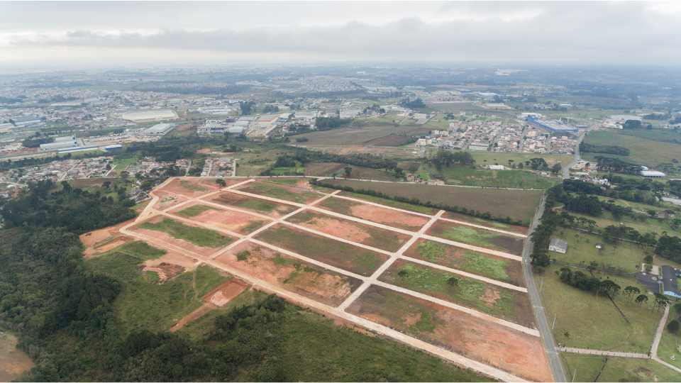
Ever feel like your land’s appraisal just doesn't quite capture your property's true value? Fluctuating market conditions and unique property features can make it tough to get a valuation that reflects your land's true potential.
This post sheds light on the land appraisal process, helping you understand how appraisers reach their conclusions and how you can ensure a more accurate outcome.
We'll also explore how Land id® can significantly improve the accuracy of your land appraisals.
Main Takeaways From This Article:
- Land appraisals determine a property's fair market value by considering factors such as location, size, and market conditions. These appraisals are crucial for securing financing, estate settlements, and understanding property valuation.
- The vacant land appraisal process involves multiple stakeholders, including the appraiser, the property owner, and potentially a lender. The property owner must provide necessary documents and access while the appraiser conducts a thorough analysis using various valuation methods.
- Appraisers use several methods to estimate the raw land value. Comparative Market Analysis (CMA) involves comparing properties to similar ones. The income approach looks at potential income generation, and the cost approach estimates the cost of replicating property improvements.
- Data inaccuracies, market volatility, and regulatory changes can all impact the accuracy of land appraisals. These challenges highlight the importance of using current and comprehensive data during the appraisal process.
- Land id® enhances the accuracy of the land appraisal process by providing detailed, real-time data on zoning regulations and land use, allowing for a more reliable and informed appraisal process.
Understanding the Land Appraisal Process

Entering the real estate world can be both exciting and daunting, especially when it involves determining the value of your property. A key element in this process is understanding how land appraisals work. Appraising land provides an estimated value for a property and plays a crucial role in transactions, planning, and legal procedures.
To make this journey easier for you, we break down the complexities of the land appraisal process to give you a straightforward and detailed understanding of what it is, why it is done, and the factors influencing it.
What Is a Land Appraisal?
A land appraisal is a professional assessment of your land's market value. An appraiser considers various factors to create a report with their expert opinion on what a willing buyer would pay a willing seller in today's market. This report is crucial for securing financing, settling estate matters, or simply understanding your property's worth.
Land appraisals are often required when buying or selling land, especially if you need a loan. They can also be helpful for tax purposes, estate planning, or resolving disputes with neighbors.
How Is Land Appraised?
A land appraisal isn't a one-man show. Several key stakeholders work together to reach a fair and accurate valuation.
Here's how each player contributes to the process:
- The Appraiser: As the central figure, the appraiser is a licensed professional responsible for analyzing the land, considering relevant factors, and ultimately estimating its market value. They'll conduct a site visit, research comparable properties, and utilize various valuation methods to arrive at the appraised value of your land. The appraiser is expected to be objective and unbiased in their assessment.
- The Property Owner: You, the landowner, play a crucial role in facilitating the appraisal process. You'll be responsible for:some text
- Selecting a qualified appraiser.
- Granting the appraiser access to the property for inspection.
- Providing any relevant documents requested by the appraiser, such as property deeds, surveys, or zoning information.
- The Potential Lender (if applicable): If you're seeking financing to purchase land, the lender will likely require an appraisal before approving your loan. The lender relies on the appraisal report to determine the property's value and assess the risk associated with the loan. They may have specific requirements for the appraiser's qualifications and the format of the appraisal report.
What Factors Affect the Value of Land?

Many factors contribute to a land's value. Here are some of the biggest influences on a property appraisal:
- Location: Proximity to desirable amenities, infrastructure, and population centers significantly impact value.
- Size and Usability: The overall size, topography, and usable acreage of the land play a major role.
- Zoning Laws: Zoning regulations dictate how the land can be developed, affecting its value for specific uses.
- Market Conditions: Current market trends for similar properties in the area can significantly influence the valuation.
- Access to Infrastructure: The availability of utilities, roads, and other essential services can impact development costs and overall value.
- Environmental Factors: Factors like soil quality, natural resources, and environmental restrictions can play a role.
- Future Development Potential: The potential for future development based on the area's growth plans can significantly increase value.
Top Four Land Valuation Methods

Appraisers often combine methods to arrive at a well-rounded estimate of your land's market value. Let's explore four of the most common land valuation methods.
1. Comparative Market Analysis (CMA)
One of the most common property valuation methods for land appraisal is doing a sales comparison using the CMA approach.
In this approach, an appraiser examines the sale prices of nearby, similar properties to determine the most profitable and feasible way to develop a given property and calculate its value.
Finding comps can be a challenge—there are many different factors to consider, and then you need to decide how much weight you should give each factor. You could have two waterfront properties of similar size, for instance, but if one has more usable acreage than the other, it should be valued higher.
To speed up the process, many appraisers create proprietary sales comps databases, which allows them to track the many unique factors that help determine value. For land appraisals:
- Having current and comprehensive data is crucial to make accurate comparisons.
- As land values fluctuate over time, it's essential to use current market data to avoid outdated assumptions.
On Land id®, you can use our datasets to collect valuable comps data, such as year sold, square footage, sale price, and more. There is no limit to the number of notes and waypoints of saved properties you can add as you do your analysis.
2. Income Approach
The income approach is a valuable tool for appraising vacant land that generates income, such as properties leased for agriculture or rental properties with structures.
Here's how it works:
- Projecting Future Income: The appraiser estimates the potential gross income the land can generate over a specific period. This might involve factors like current lease rates, rental market trends, or potential development for income-producing purposes.
- Factoring in Expenses: Operating expenses associated with the property, such as taxes, maintenance, and vacancy rates, are deducted from the gross income to arrive at a net operating income (NOI).
- Capitalization Rate: The NOI is then divided by a capitalization rate, which reflects the market's risk and return expectations for this type of property. This calculation results in the estimated market value of the land based on its income-generating potential.
Land with income potential can be more valuable than land without it. The income approach helps quantify this value by considering the future income stream the property can provide.
3. Cost Approach
The cost approach takes a different perspective. Here, the licensed appraiser estimates the value of your land by considering the cost of replicating the existing improvements on the property minus depreciation.
- Replacement Cost Breakdown: The appraiser considers the cost of land acquisition, construction materials, labor, and permits to rebuild the existing structures on the property.
- Depreciation Deduction: Since most improvements depreciate over time due to wear and tear, obsolescence, or economic factors, the replacement cost is then adjusted by subtracting depreciation to arrive at an estimated market value.
The cost approach is most relevant for new properties or unique structures with limited comparable sales data. While it doesn't directly reflect market value, it provides a valuable benchmark for appraisers, especially when used in conjunction with other methods.
4. Using Land id® for Enhanced Data Access
Land id® emerges as an invaluable tool for anyone seeking accurate land appraisals. By consolidating essential property details in a single interface, the platform revolutionizes the way land valuations are conducted, delivering consistently reliable results.
To put Land id® to work, start by entering the address or unique identifier of your property into the search bar. A wealth of data, including land use and value, will be instantly displayed in our unique property info cards. These details provide a nuanced perspective of your property, revealing valuable insights in one place that are difficult for conventional appraisal methods to deliver.
Land id®'s detailed parcel data feature provides all of this information in a comprehensive, updated, and concise manner. This level of detail ensures a robust and reliable valuation that reflects the property's true worth in the current market conditions, removing uncertainty and doubt from the calculation process.
Common Challenges in Land Appraisal

Even with the best intentions, land appraisals can face hurdles that can impact their accuracy.
Here are some of the most common challenges:
- Data Inaccuracy: Outdated or inaccurate data on comparable properties, zoning regulations, or land use patterns can lead to flawed valuations. Appraisers rely heavily on the information they receive, and any inconsistencies can skew the results.
- Market Volatility: Rapid fluctuations in the real estate market can make it difficult to pinpoint a property's true value. Comparable sales data from just a few months ago might not accurately reflect current market conditions.
- Regulatory Changes: Shifts in zoning codes or environmental regulations can significantly impact the development potential and value of your land. An appraiser might not be aware of the latest changes, leading to an underestimation of your property's value.
These challenges can leave landowners feeling frustrated and unsure about the accuracy of their appraisal. Here's where Land id® comes to the rescue:
- Combating Inaccuracy: Land id® offers comprehensive data sets that are constantly being updated and verified. This ensures you and the appraiser have access to the most accurate information possible.
By offering a single source of reliable and current data, Land id® helps to mitigate the risks associated with inaccurate information and ensures a faster, more transparent, and accurate appraisal process.
Maximize Your Land Appraisal With Land id®
Land appraisals are an essential part of any real estate transaction. With the evolution of GIS technology, this process can now be done more accurately, potentially resulting in higher revenues for everyone involved. If you are involved in land appraisals day in and day out, Land id® is the solution for you.
Land id® helps you at every stage of the process, allowing you to:
- Layer all of your findings onto one organized, interactive map.
- Visualize all of your property and land data in one place and gain a fuller picture of each parcel, which will help you make better comparisons down the road.
The platform provides a wide range of data, the ability to upload your own information, an array of customizations, and even the ability to instantly turn parcel data into a comparable sales feature group. With all of this at your fingertips, you’ll be well-equipped to make accurate appraisal valuations. To learn what you’ve been missing, sign up for a free 7-day trial of Land id® today!
FAQs

Continue Reading


