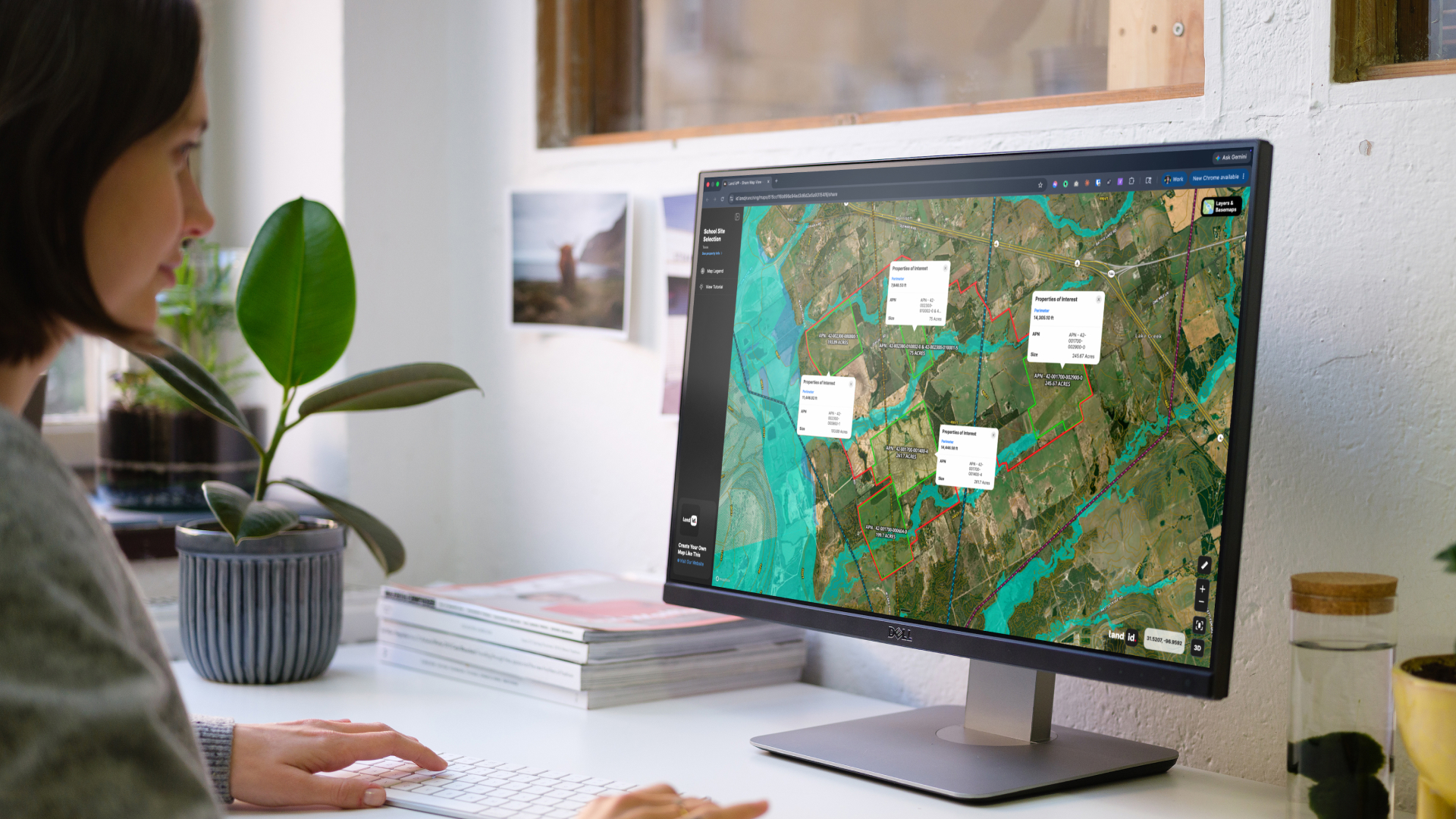
All
Thank you! Your submission has been received!
Oops! Something went wrong while submitting the form.

Latest

Mapping the Future: Triple Creek Reserve's Journey from Wilderness to Community

Land IdMapping the Future: Triple Creek Reserve's Journey from Wilderness to Community

By

By Land id

Map creation
/
Sep 18, 2025

Ever wondered what it takes to turn raw wilderness into the ultimate outdoor recreation community? We just spent a day with Lance and Jed from Anthology Real Estate, watching them showcase Triple Creek Reserve—a stunning 1,165-acre development just outside Boise, Idaho. What caught our attention wasn't just the breathtaking property. It was how they're using Land ID to map, organize, and sell multiple subdivisions across this massive piece of land.

No results

Sorry, we don't have any articles that match your search. Try resetting your filters.

Your Land Plotting App: Showing the Past, Present and Future

Land IdYour Land Plotting App: Showing the Past, Present and Future

By

By Land id

Feb 11, 2021

In real estate, it’s all about the land.

Animals in an open field

Redistricting: A Very Real World Application of Data in Map Making

Land IdRedistricting: A Very Real World Application of Data in Map Making

By

By Land id

Jan 25, 2021

Maps are used in many scenarios to help us visualize the relationship between geography and other variables such as average temperatures, bird migration patterns or relative elevation.

Open view of a city

The Major Components of GIS

Land IdThe Major Components of GIS

By

By Land id

Jan 25, 2021

GIS is hailed as one of the most effective tools for understanding the world around us. The popularity of GIS stems from its versatility; farmers can use GIS to plan their crops, realtors can use GIS to analyze market trends, government entities can use GIS in city planning - and its applications don’t end there. By providing a complete view of an area, GIS helps people in virtually any industry make smarter business decisions. While Land id® (formerly MapRight) makes GIS technology accessible to everyone, you need to know how it works to get the most out of this tool.

Open sea and land

The Best Real Estate Mapping Software for Marketing Properties

Land IdThe Best Real Estate Mapping Software for Marketing Properties

By

By Land id

Jan 13, 2021

There’s nothing like the art of buying and selling properties, but with over two million licensed real estate agents in the United States, you have to go above and beyond to stand out.

An aerial open field with trees and a property

The Hidden Benefits of an Interactive Map for Land Projects

Land IdThe Hidden Benefits of an Interactive Map for Land Projects

By

By Land id

Dec 16, 2020

If you’re involved in the development of land in any way - whether it be as a planner, a developer or an engineer - you understand the necessity of looking at a project from every conceivable angle to ensure you’ve developed a comprehensive master plan.

Construction Site

Selling Land? For Best Results, Just Add Water

Land IdSelling Land? For Best Results, Just Add Water

By

By Land id

Dec 7, 2020

Nothing increases the value of a piece of property like a water feature such as a river, stream, pond, lake or stock tank.

A goose in a pond

Explore Private Parcel Data & Property Boundaries

Download the Land id app & try for free

Download on the Apple App StoreGet it on Google Play